Hiking in a Mother City
A “mother city”, you ask? The English word “metropolitan” is derived from two Greek words, “meter” meaning “mother” and “polis” meaning “city”, a “metropolis”. It also indicates a city from which others have been colonized, a parent state of a colony, or a capital city. So the “mother city” in the title is really referring to a capital city, a city pre-emminent above others in it’s realm. In this case, that city was Sydney, the capital city of New South Wales, Australia.
It might seem a bit strange to engage in hiking, an activity that would normally be associated with more natural locations, in a major metropolitan area. But Sydney has a large number of hiking trails in natural settings, some of them cutting a path right through the suburbs. There is Lane Cove National Park, a longish linear national park that cuts through the northern suburbs which hosts a portion of the Great North Walk and more or less follows the Lane Cove River. There are a number of national parks in the Sydney metropolitan area, which have good walking tracks and plenty of interesting things to see. The reason I went to Sydney between 8th and 12th of October was to explore the walks Sydney had to offer.
Before I describe the walks I did, a quick word on how I got to the various walking trails. I went to Sydney on the overnight train from Wangaratta, as I avoid driving because of problems with my eyesight. So public transport was the only way I could get to the start of a walk and get back to my accommodation after finishing a walk. This holiday was the first time I’d used Sydney’s buses and ferries to get around – overall using the various forms of public transport was fairly painless especially when I realised that Google Maps in Public transport mode was very accurate for working out what public transport to use, and in conjunction with the trip planner in the NSW transport website (for cost of each journey), to get from place to place. In a lot of cases, a walks I did on this holiday started and ended within a short distance of some form of public transport.
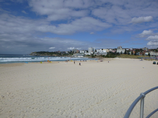
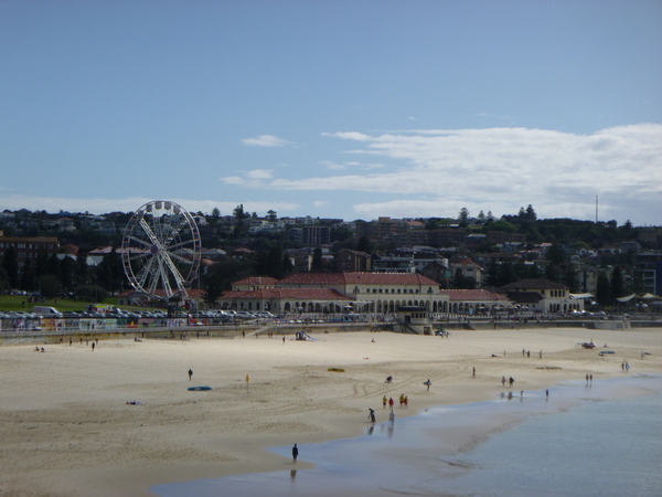
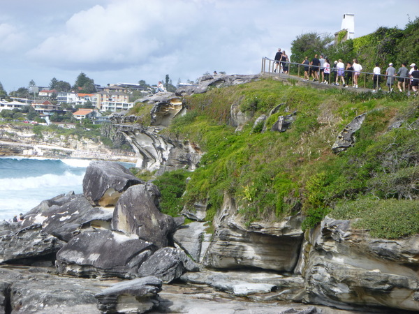
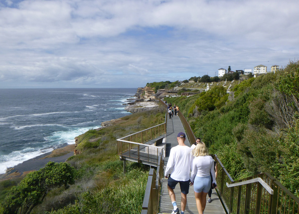
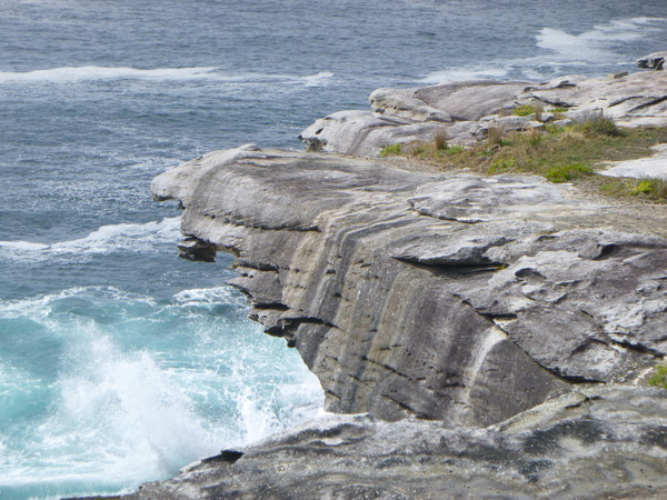
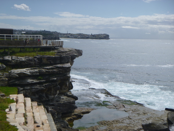
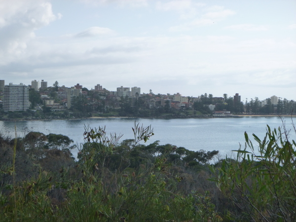
Bondi Beach – Coogee Beach Walk
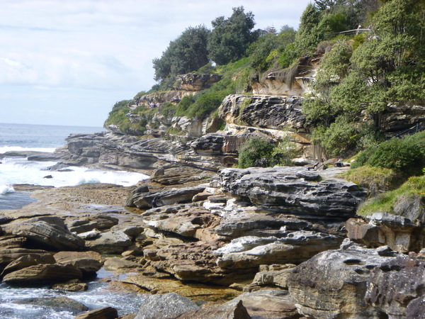
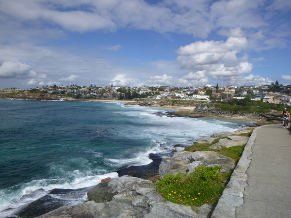
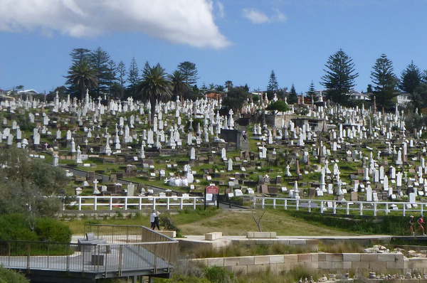
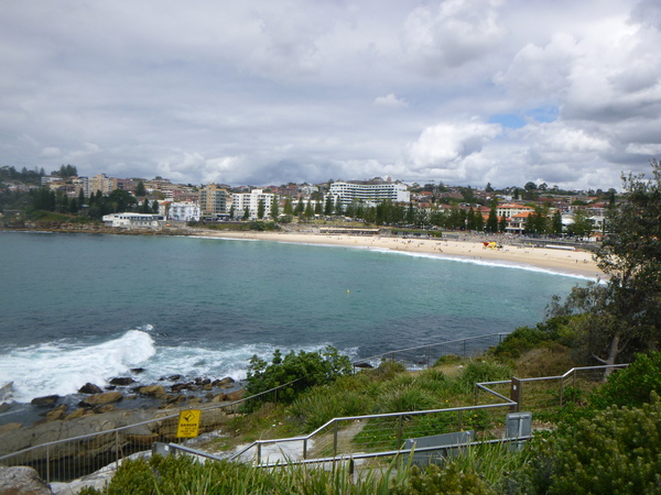
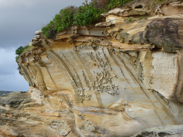
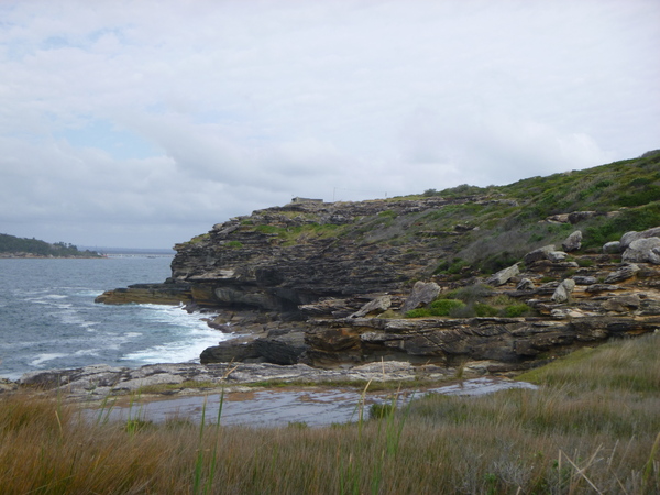
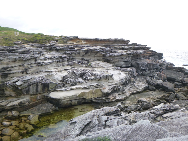
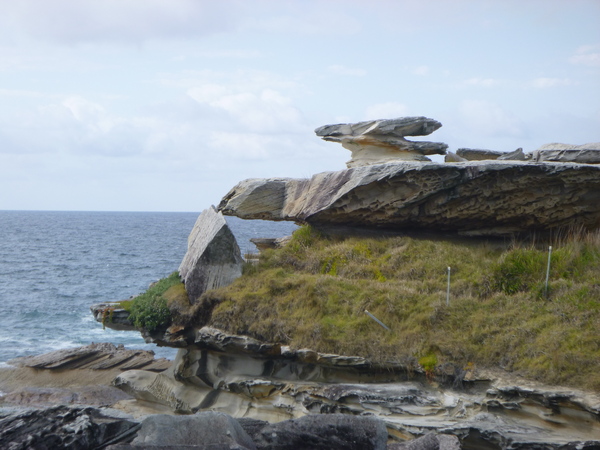
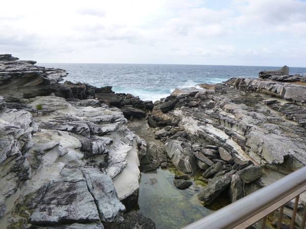
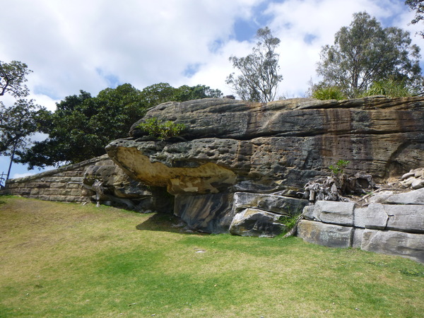
This walk is part of the Eastern Coastal Trail, and follows the eastern beaches for 6km one way. When I did this walk, on a Sunday morning, there were lots and lots of people on the walk. Some were jogging, some were strolling or walking, and in both directions. This walk had a very urban feel and was obviously one of “the” places to be, not suitable if looking for serenity and peace and quiet. But I enjoyed this walk. The views along the coastline were magnificent, with stunning craggy rock formations punctuated by pale yellow sandy beaches. At one point, the walk passed through a large cemetery. This trail was very much a “built” one that had lots of stairs, concrete pathways or boardwalks, and traversed various parklands and beaches.
Great North Walk: Lindfield West to Woolwich
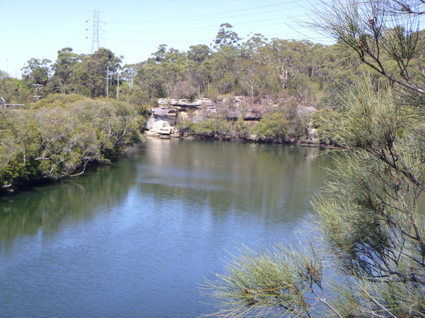
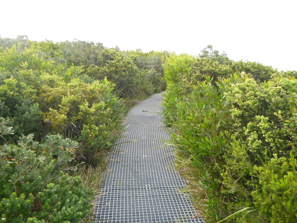
On a previous visit to Sydney I walked about 20km of the Great North Walk between Hornsby and Lindfield West. My plan on this holiday was to fill in the gap between Lindfield West and the start of the walk near Sydney’s CBD. On this holiday I hiked from Lindfield West to Woolwich on the Great North Walk. So after this hike I’ve completed about 40km of the 260km length of the Great North Walk, completing the section between Hornsby and Woolwich. While not impossible, the remainder of the walk is often in very isolated country, and would require more detailed planning and some equipment more suited to back-country hiking, such as an EPIRB for emergencies, if I’m to complete the full walk in the future.
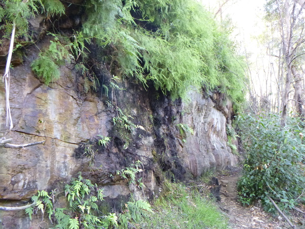
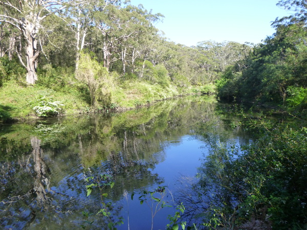
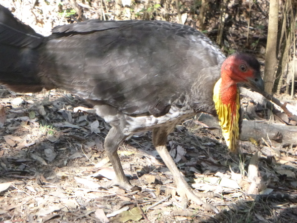
The scenery was mixture of rocky cliff faces, rivers, estuaries, subtropical forests, and the odd suburb here and there. A lot of this walk was in the Lane Cove National Park which also has some historical significance. On this walk I saw my first (and 2nd, 3rd & 4th) Australian Brush Turkey. They literally look like turkeys, but I wasn’t aware Australia had it’s own turkey and was surprised to find out that we did. These turkeys were very tame, I could often be as close as 30cm away from them and they didn’t run away but slowly wandered away seemingly in no hurry at all. They must be fairly familiar with humans. One of them was in the middle of building an nest.
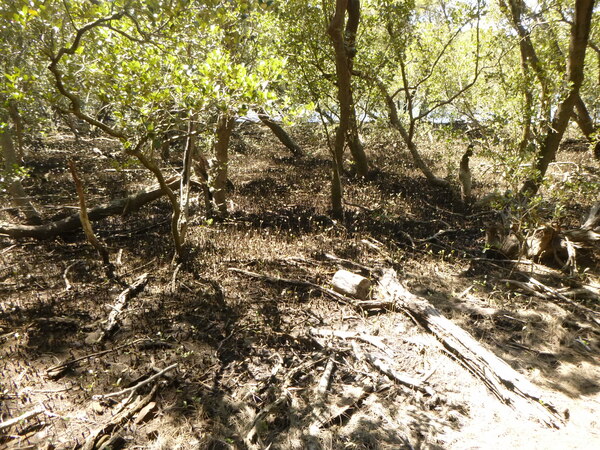
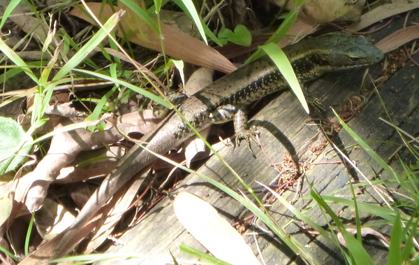
On this walk, I took a wrong turn or two, and at one point had to back track to find the trail again, but with the help of Google Maps and fairly regular “GNW” signs I managed to keep on the correct path most of the time and find my way back to the correct path when I did stray off it. In one section of the walk, where there was a lot of boardwalk sections, I heard a lot of scurrying and rustling leaves. I wondered whether it was snakes moving around in the undergrowth, but later I realised it was small lizards – the areas under the boardwalk sections seemed to play host to a number of colonies of those lizards and as I walked along the boardwalks the noise I made must have disturbed them and they scurried away.
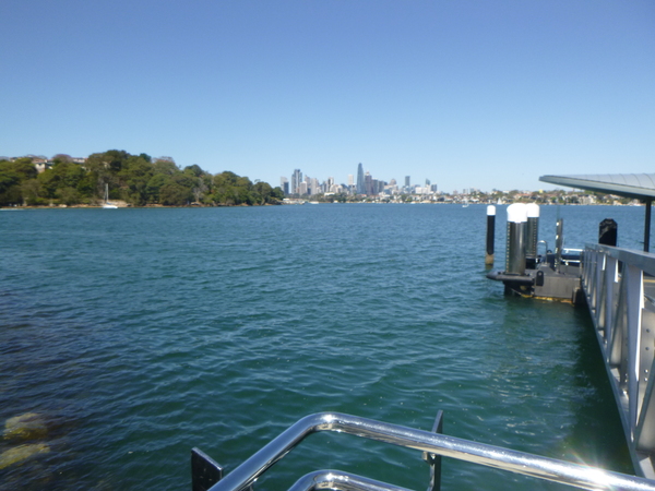
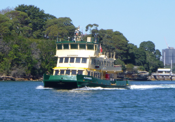
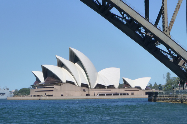
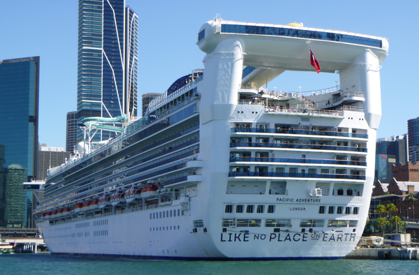
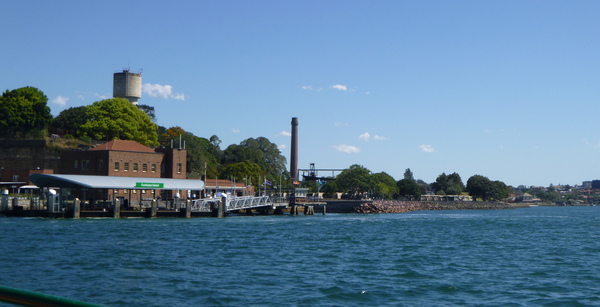
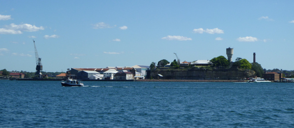
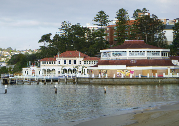
After the walk left the national park, it was a matter of negotiating the suburbs until I reached Woolwich, where the walk ended and I needed to catch a ferry or bus to Sydney. I chose the ferry. This was the first time I had been on a Sydney ferry, and it was not going to be the last. The ferry ride itself was quite an experience, for my first time. Not that it was bumpy or anything like that, but it provided a very different view of the area. The ferry went to Cockatoo Island before it went to Circular Quay, near the Sydney Opera House.
At 20km, this was my longest hike on Strava to date. Another record broken!
La Perouse and Botany Bay National Park
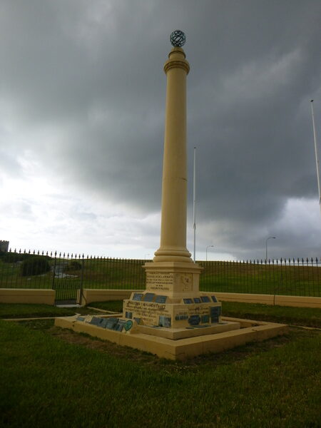
After consulting maps and websites I planned to do the Henry Head + Cape Banks walking tracks in Botany Bay National Park, La Perouse. I left my accommodation very early, with enough food for a breakfast at La Perouse before I did any exploring there. When I alighted the bus at La Perouse I expanded my plans to also include Bare Island (or at least the bridge over to it) and a monument, parkland and the stone building near the start of the planned walk.
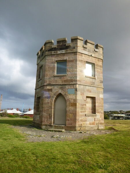
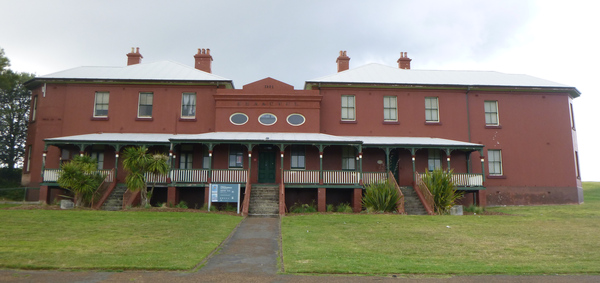
The stone building I wanted to see was “The Barrack Tower”. according to the information plaque attached to it, it was already in existence in 1820 and may have been built a number of years before, and was used by a small group of soldiers who kept watch for smugglers, and directed any “stray” ships. The building was under the control of the Customs House between 1831 and 1904.
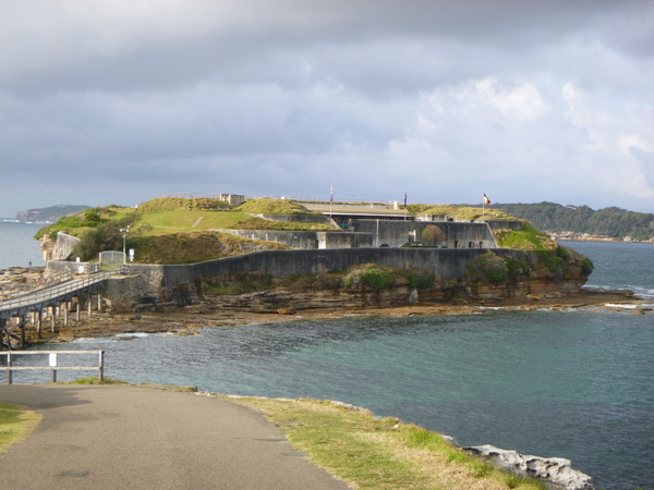
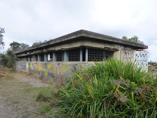
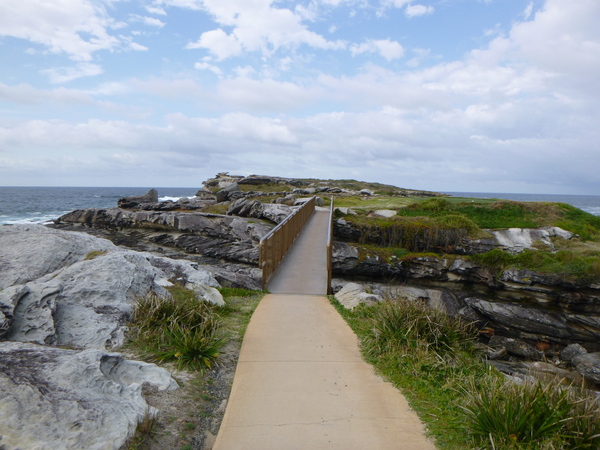
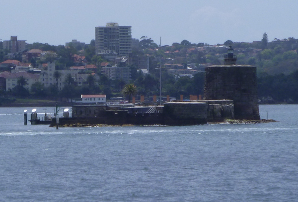
Bare Island is a small low sandstone island about 30 metres from the shore of the southern end of the La Perouse Headlands in Botany Bay and is heritage-listed. The island’s natural shape has been completely altered by the military fortifications on it which comprise the battery, barracks buildings, parade and courtyard, access bridge, laboratory room/guards quarters and tunnels used for military purposes. It was also a war veterans’ home (starting in 1912), a museum and is now a historic site. It is significant because it is an almost completely intact example of late nineteenth century coastal defense technology and reflects the development of coastal fortifications designed by the British Army, from locations around the world over more than a century including increasing understanding of ballistics and materials science that was a product of the Industrial Revolution. Bare Island, compared to earlier coastal defences constructed in Australia like Fort Denison or the Middle Head Batteries shows the usage of new materials such as concrete and the ever-increasing power of guns. It was built from 1881 to 1889 by John McLeod on behalf of the NSW Department of Public Works. The island is connected by a footbridge to the mainland of La Perouse. The waters around the island are popular with scuba divers and the Bare Island anglerfish is named after the island.
At the time of European contact the Gweagal and Kameygal Aboriginal groups were associated with island. It is mentioned in the journals of both Joseph Banks and James Cook. Banks collected shell specimens there, while Cook noted that the island described as “a small bare island” provided a convenient navigational marker. The name stuck. The European name given to the island is one of the first European names for any part of Australia’s east coast. In July 1788 noticeboards were known to have been erected on the island to advise visiting ships that the English settlement which started at Botany Bay had moved to Port Jackson.
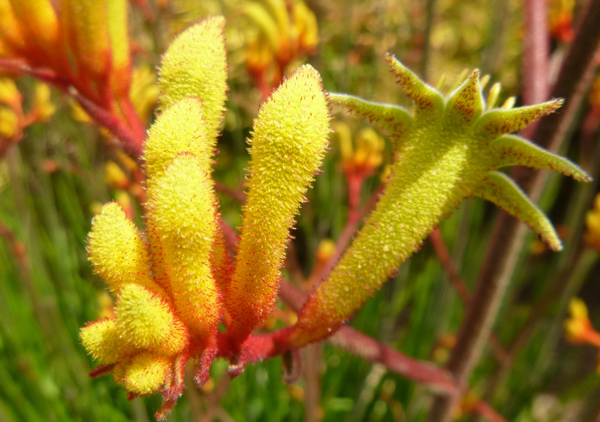
The Botany Bay area is recognised for its important cultural and historic heritage relating to the British settlement of Australia. It is a place where botanist Sir Joseph Banks and naturalist Dr Daniel Solander collected various plants in 1770 as part of the first landing of the Endeavour in Australia. Banks and Solander collected many plant species that are iconic with Australia. The national park also includes the site where Captain James Cook first set foot on Australian soil in 1770, marking the beginning of Britain’s interest in Australia. Botany Bay was where the first short-lived British settlement of Australia started, before it was moved to Port Jackson.
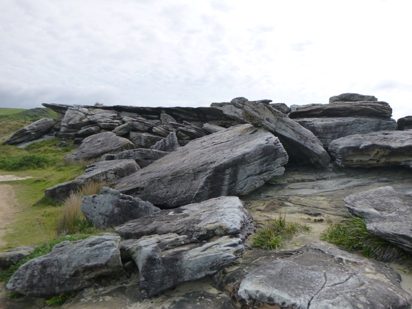
In the Botany Bay National Park there are a number of things of interest that I visited: Browns Rocks, some old disused fortifications, and Cape Banks.
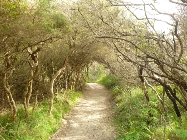
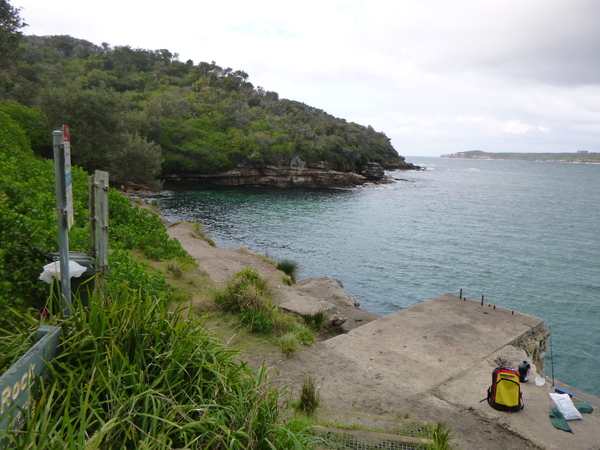
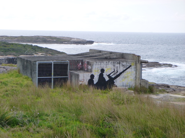
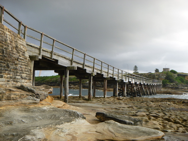
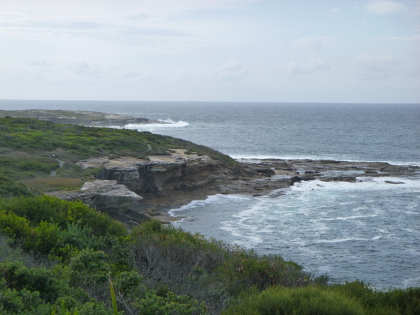
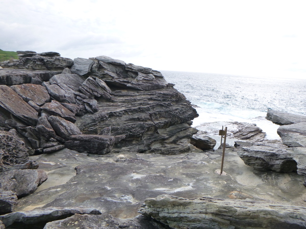
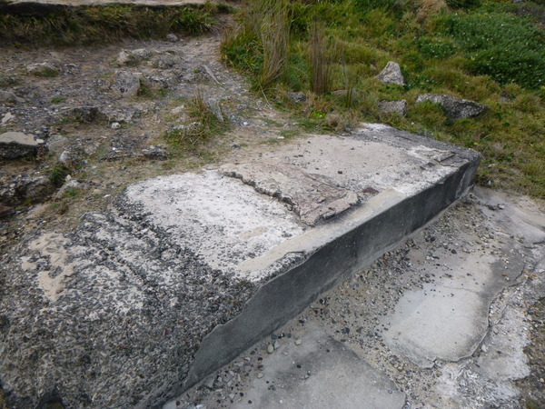
Cape Banks is accessed via a walking track that passes through a golf course, and then across a fairly high pedestrian bridge. The rock formations there were dramatic, and some old sections of concrete on the cape seemed oddly out of place in the jagged landscape.
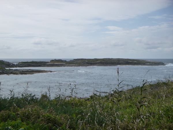
The public transport bus stop was literally across the road from the national park walks and very close to the other things I wanted to see there. Rather than do the national park walk and an out and back as indicated in the maps I saw I did it as a loop including a minor road. The total of this walk including exploring La Perouse and the Botany Bay National Park was 10km.
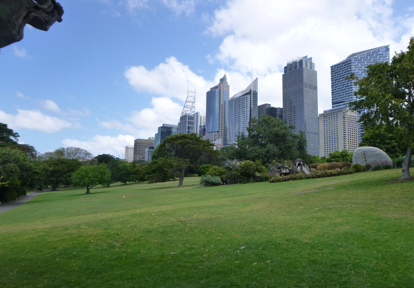
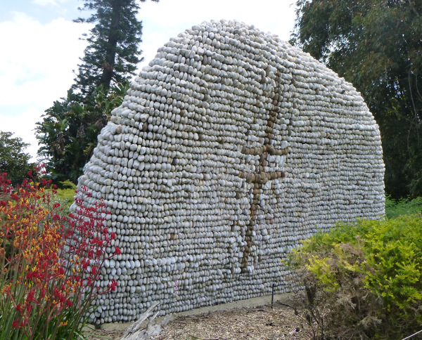
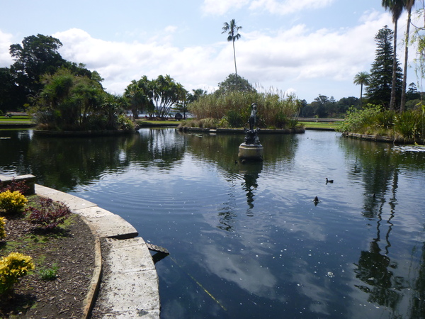
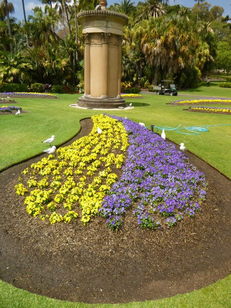
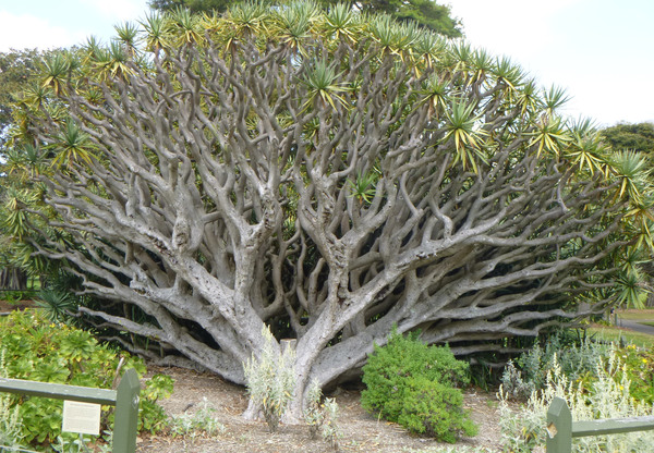
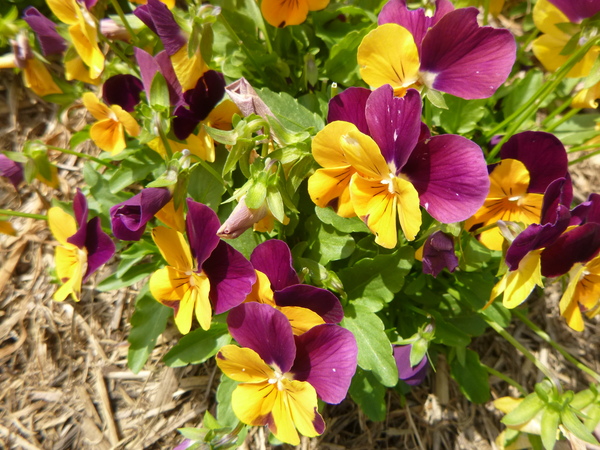
Sydney’s Royal Botanical Gardens and Domain
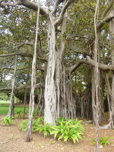
After catching the bus and light rail from La Perouse to Circular Quay I went for a walk through the Royal Botanic Gardens and around the Domain. The Botanic Gardens and Domain are host to a number of interesting things. The Botanic Gardens have lots of lawns (as Botanic Gardens often do) and a variety of plants, exotic or otherwise. Possibly one of the more interesting features of the gardens was the inhabiting of their ponds by Australian fresh water eels (Anguilla reinhardtii). The ponds weren’t populated by people introducing those eels to the ponds, but by the eels colonising the ponds by themselves. The ponds are drained regularly by the garden’s caretakers, and whenever the ponds are refilled the eels appear in the ponds within weeks. Staff have seen baby eels squirming across the damp grass to the ponds at night from the nearby harbour. Eels have a slimy coating of mucus all over them which helps protect them from diseases and predators, and also helps them wriggle across the grass from pond to pond, or harbour to pond. In a strange ‘circle of life’ kind of way, the adult eels take ducklings as a tasty meal is balanced out by adult ducks finding the baby eels a tasty meal.
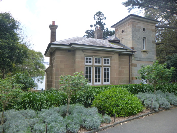
Also in the Botanic Gardens is Victoria Lodge. Victoria Lodge, previously known as Eastern Lodge, is a former gate house built in 1865 as a residence and landscape feature on the garden’s north east boundary. The lodge has high cultural significance as it is the only surviving lodge constructed to define the boundaries on each side of Farm Cove, a tidal inlet and shallow bay in Sydney Harbour that is separated from Sydney Cove by Bennelong Point on which the Sydney Opera House is located. The tower on the building reinforces the lodge’s importance as a landmark.
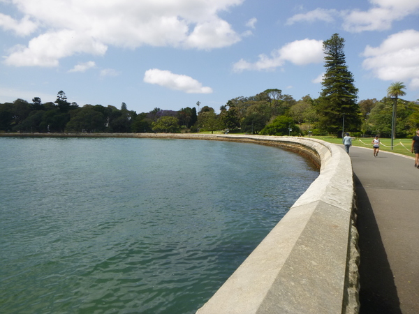
In the Domain, over yonder from the gardens, is Mrs Macquaries Point. This is the location of Mrs Macquaries Seat and Mrs Macquaries Road. The seat overlooks the harbour with good views of the naval dockyards and Fort Denision on Pinchgut Island.
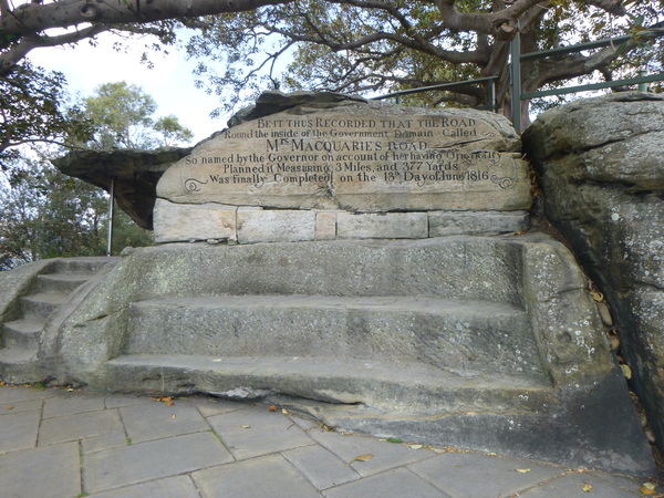
The road is named what it is because Mrs Macquarie planned it’s route. The road was completed in June 1816.
At the time I did the walk around the Botanic Gardens and Domain there were a lot of joggers and walkers. Not as many as when I did the Bondi to Coogee walk, but still a significant amount. I guess they were people who worked in the nearby office buildings who had gone for a jog on their lunch break.
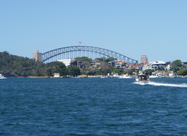
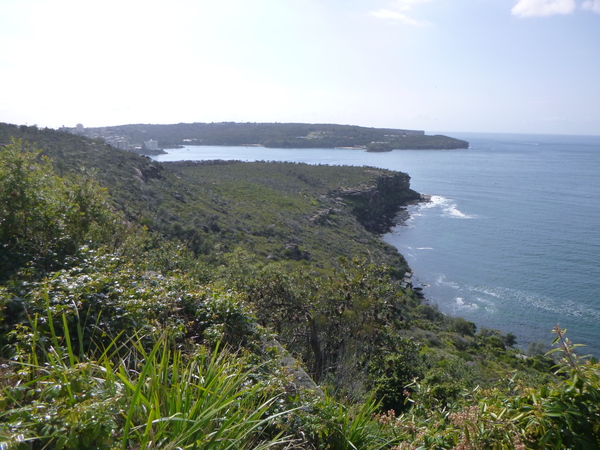
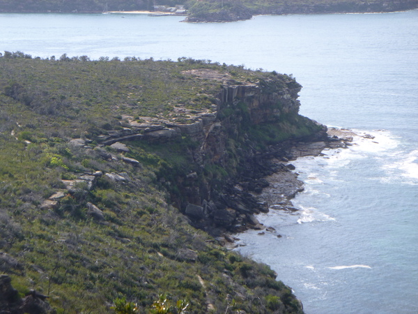
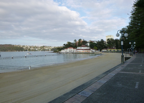
Manly to The Spit Walk
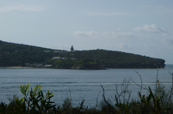
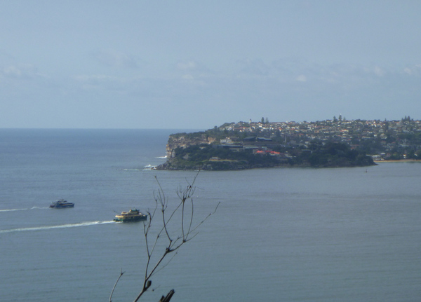
On the next day I planned to get the ferry from Circular Quay to Manly and do the Manly to The Spit walk which starts a short distance from the ferry terminal at Manly. I started this walk at about 7:30 in the morning, with a detour or two to see points of interest. There were lots of people with dogs, and a maybe 20 or so joggers, and some walkers in the more ‘civilised’ sections. Commuters seemed to be in the majority near Manly, probably because that was where the ferries for Sydney depart and also the time of day I was there. On the more natural sections such as Dobroyd Head and Grotto Point areas in Sydney Harbour National Park, I only encountered a few other hikers and the occasional jogger. In this section of the walk the scenery became very dramatic with the various headlands, jagged cliffs, and views out to the Tasman Sea beyond the land. There were a number of places where there were good panoramic views in different directions.
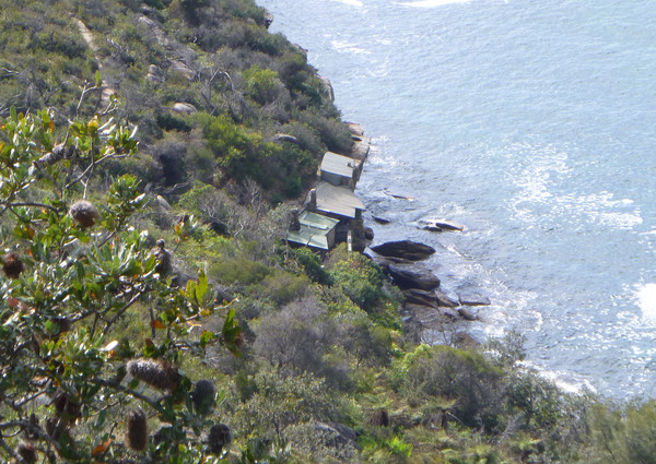
The weather on this walk seemed cooler than yesterday, maybe there was a breeze coming in from the Tasman Sea, which wasn’t far away. At one of the lookouts, I spotted what looked like huts hugging the rocky shoreline. There are called The Crater Cove Huts and were built between 1923 and 1963. Some were used by fishermen in the 1920s while they fished the cove. In the 1930s some were used by people experiencing the hardship of the Great Depression. Later, in the 1960s, some came to Crater Cove seeking solitude. In 1984, existing occupants of the huts were forced out of the huts by the National Parks and Wildlife Service and the area became the national park that it is today.

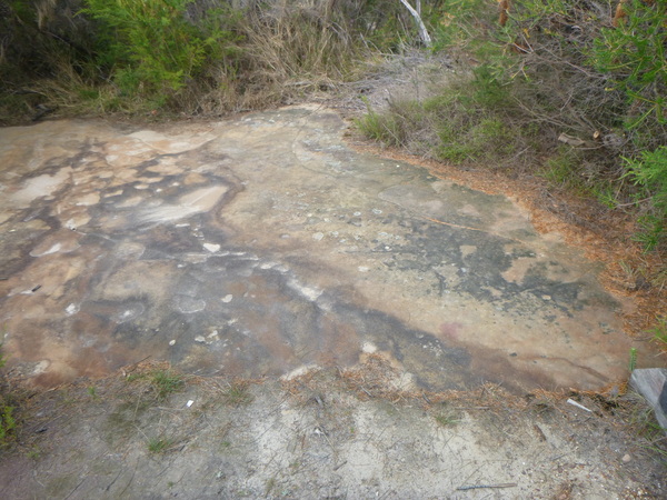
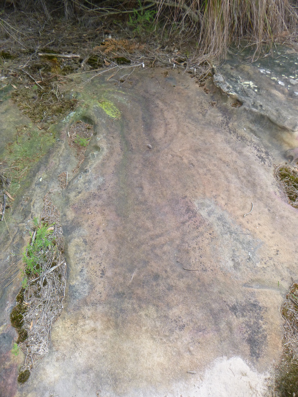
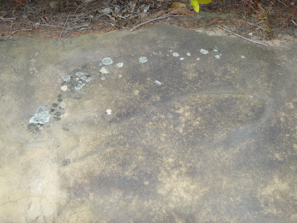
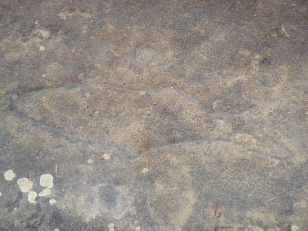
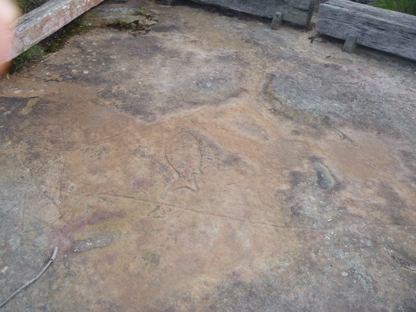
At Grotto Point there are a number of Aboriginal rock carvings, featuring various animals and marine creatures. Some of them were a bit hard to see and made me wonder whether the shapes were just imagined, while others were very obvious.
By the time I had completed this hike I had walked 11km for the day.
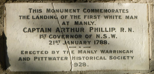
The first white man to set foot at Manly (at what is now Manly Cove beach) according to a plaque there was Captain Arthur Philip RN who at the time was designated the 1st Governor of New South Wales. This happened 21st January 1788, 5 days before the ‘official’ landing of the First Fleet and raising of the Union Flag by Arthur Phillip at Sydney Cove on the 26th. Also at Manly Cove, but on 7th September 1790, the same Governor was speared in the shoulder by an Aboriginal man named Wil-le-me-ring as Phillip approached him while the Aboriginal people were feasting on a beached whale. According to some sources this was due to another Aboriginal man called Bennelong being kidnapped by order of Governor Phillip in November 1789 to try and make contact and establish relationships with the indigenous inhabitants on behalf of King George III. It seems that Bennelong masterminded the attack as personal payback for being kidnapped.
Captain Arthur Phillip was also the person who named Manly Cove. According to an information sign I read along the walk, Phillip was impressed by “their (the Aboriginal’s) confidence and manly behaviour” which inspired him to name the place Manly Cove.
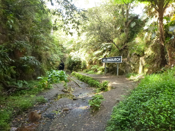
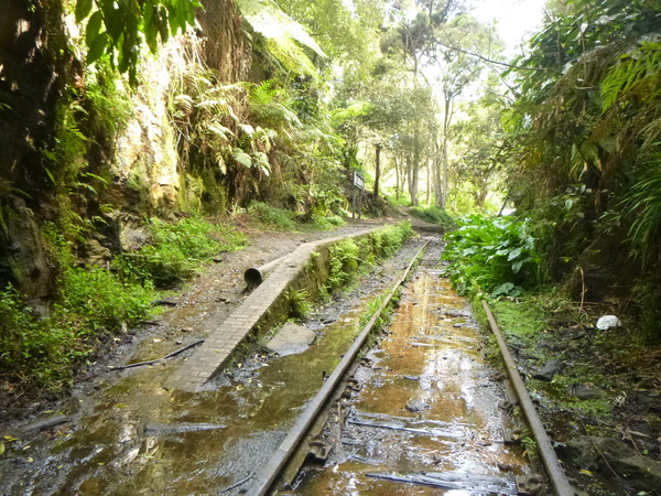
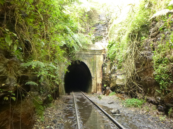
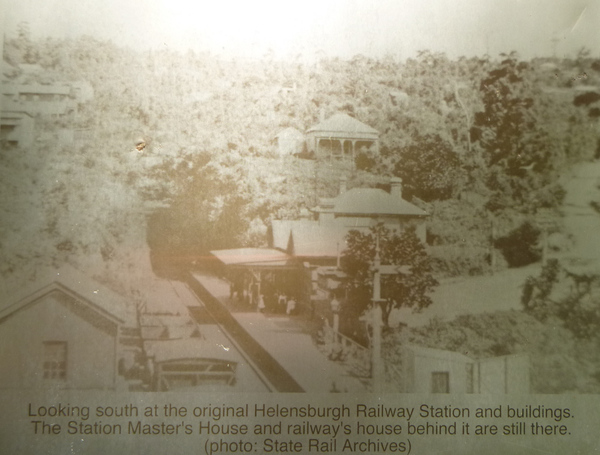
Old Helensburgh railway infrastructure
The next day I had planned to explore the Royal National Park to the south of Sydney, around Bungoona Lookout. But on the National Parks and Wildlife Service website it showed that the Royal National Park, along with some other parks in the greater Sydney area, were closed due to high fire danger. So after booking my big backpack as luggage for the overnight train journey back to Wangaratta that departed in the evening, I caught an electric Intercity train bound for Kiama and alighted at Helensburgh to explore the old station and tunnels there.
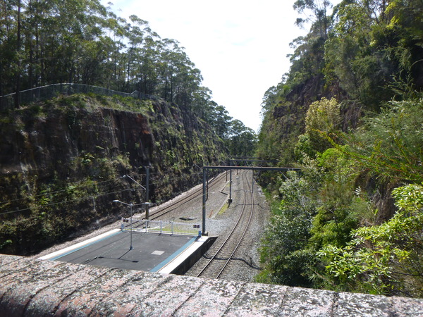
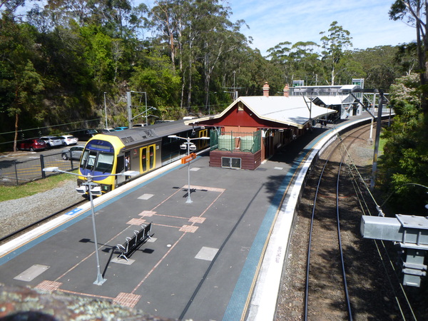
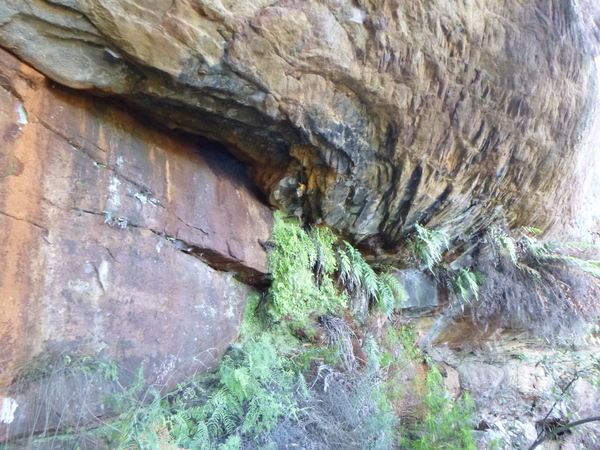
The railway through the mountains between Sydney and Woollongong has undergone various re-alignments and upgrades over the years. The old Helensburg station and tunnels are on an old alignment used while the railway comprised of a single track. When it was duplicated, the railway was changed to use the current alignment. Today the tunnel plays host to a colony of glow worms.
Over the years I’ve spent travelling on NSW’s trains, I’ve noticed re-alignments in the Blue Mountains, near Bathurst and Lithgow, the Zig Zag Railway (now a tourist attraction) and on the Albury line especially between Goulburn and Cootamundra. Some of these re-alignments were done during upgrading of those lines to handle heavier and more frequent trains, some might have been done to made the gradients less severe, such as the Bethungra Spiral between Junee and Cootamundra. Often the original alignments are not accessible due to them being on railway or private land but they can be seen from the train or a nearby road.
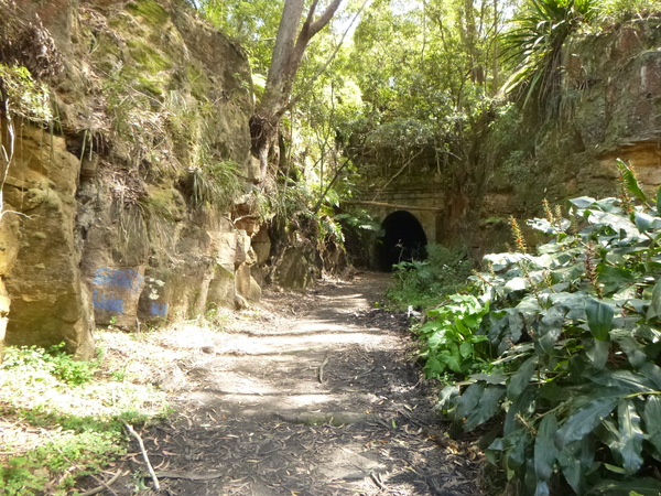
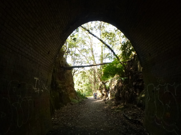
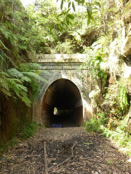
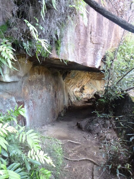
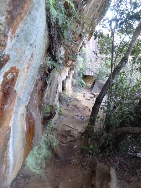
The old Helensburg station and tunnels are examples of those old alignments and infrastructure that are publicly accessible, and easy to explore inspite it being very muddy.
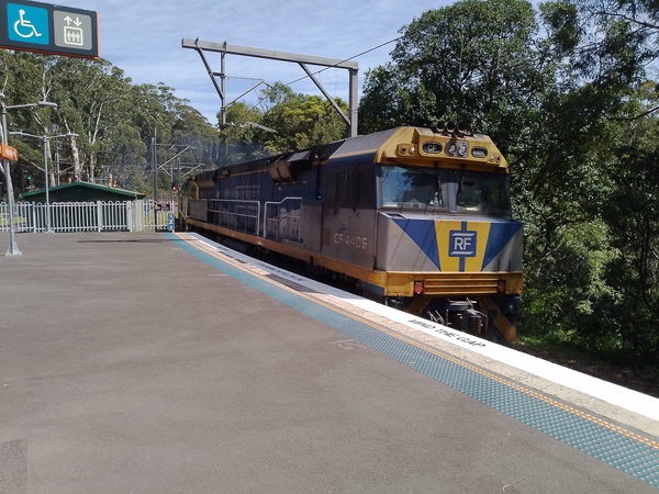
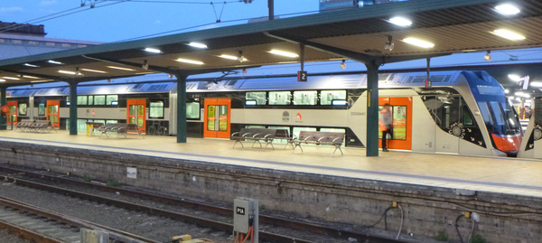
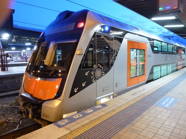
After exploring Helensburgh I returned to the currently used railway station and awaited a train back to Sydney Central, where I then awaited the overnight train to Melbourne. While waiting for the train for Melbourne to arrive, I saw a brand new, not yet in service Mariyung electric train. These trains are due to go into service in 2024, to replace the NSW Trains Intercity fleet.
You May Also Like
One Comment
Sandra Glew
Hey James,
Sydney and sububs look good, I have never been to Sydney. James you should write a book about all your travels around Australia and your challenge bike rides. What you write on your blog is very interesting and with the added photos it makes one feel as if they are there also.
Cheers
Sandra