A Whole Bunch of Firsts
For 5 days before Easter 2018, I had the opportunity to embark on that most james-like of holidays – a cycling holiday. But that holiday proved to have a lot of firsts:
- First time riding on the Bellarine Peninsula.
- First time riding on the Mornington Peninsula.
- First time on a ferry or ship.
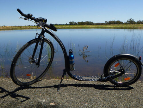
- First time I used a hiking tent and pack for a cycling holiday.
- First time camping overnight away from towns on a cycling holiday.
Sunday 25th March, and the forecast was for strong winds, possibly rain, and fairly low temperatures. Not exactly the best weather for a cycling holiday, but it was that or spend my annual leave at home. After uneventful train trips from Springhurst, near Wodonga, in Victoria to South Geelong, I started the first ride of the holiday – the Bellarine Pensinsula Rail Trail. I always imagined the Bellarine Beninsula as a fairly flat place, but the rail trail was more undulating than a ‘fairly flat’ region would have required. And there were even a few descent climbs which got my huffing and puffing while lugging about 10kg of extra weight in the bike’s panniers and the hiking pack on my back. The first section of the rail trail was over or along side the old broad guage Victorian Railway branchline.


But after Drysdale, the trail was beside the 3 foot 6 inch guage Pellarine Peninsula Tourist Railway all the way to Queenscliff. The Bellarine Peninsula Railway is on the formation of the broad guage branch, but re-guaged to 3’6″. Being quite interested in railways, this suited me fine, and I pedalled along at a fairly leisurely pace, or at least it felt that way with the rather strong tailwind that blew me along. I was hoping to see a train or two while riding along this section. Eventually I did see a train or two, but it wasn’t until much closer to Queenscliff.


After reaching Queenscliff, I found the Queenscliff – Sorrento ferry, for the next leg of the day’s journey. The ferry was a rather large ship, but not like the huge cruise liners or sea-going ferries. It was large enough to inspire confidence in it’s ability to make the journey, always a good thing! By the time I got to the ferry it was about 2pm, much later than I thought it would have been so while on the ferry I purchased some lunch, hoping that I would not experience sea-sickness. Retrospectively, I needn’t have worried. Even with the up and down motion of the ferry, and a belly full of food I didn’t feel even a slight bit queasy.


Once the ferry arrived at Sorrento, I continued my journey to the foreshore camping ground I had booked online for the night a few days before. After I had been riding for a while I started to wonder if I had passed it, but just about that time I saw the sign indicating that I was there. Phew! After setting up camp, I had to walk into Rye, a few kilometres away, to buy something for the evening meal and breakfast the next day. While walking back from the Rye shopping centre to Tyrone Foreshore Campsite I found a reconstructed Limeburners Kiln, shown above. A nearby plaque commemorating it said “This reconstructed kiln is a memorial to one of the earliest industries on the [Mornington] Peninsula and is a tribute to our early settlers and their rugged enterprise. Duein the mid-1800s natural limestone was mined and burnt in kilns to produce lime, for making mortar. Most of the lime as loaded in barges and shipped to Melbourne for use in the building industry. The last commercial burning of lime on the peninsula was carried out in the Rye area”. This was the very first time I had camped in a hiking tent when on a cycling holiday where I had to carry everything I needed. And so by the evening I was very thankful for the rest.


Monday dawned overcast and windy, with threatening grey skies. So I wore 3 layers of clothing on my body – a cycling jersey, a second long-sleeved layer for warmth, and then a waterproof jacket just in case it started raining.
Well, it didn’t start raining. But there were some places along the ride where I was thankful I had the waterproof jacket on. In places the route I took was within about 10 metres of the beach, and the wind was so strong that the normally docile Port Phillip Bay looked like a surf beach and sent sea water spraying over me from the waves breaking against the sea walls.


After climbing through Safety Beach, Mt Martha and Mornington I eventually arrived at Frankston, expecting that I would have a nice leisurely train ride into central Melbourne. Alas, this was not to be. About 3 stations along the line from Frankston, the passengers of the train I was in were informed that the overhead wires that feed electricity to the train were damaged and that the train wouldn’t be continuing and would be replaced by a bus. Not one of this big coach busses with plenty of space to carry a bike in it’s metallic belly but those much close to the ground metro busses with no storage area at all. So I had to ride to Cheltenham, about 15km away. Thankfully it was fairly flat, and it wasn’t raining, and I could ride along the roads that followed the railway or I might have got somewhat lost. Eventually I arrived at Cheltenham railway station and caught a train to Southern Cross statuon in Melbourne. Then it was on to Bendigo, where I stayed at a caravan park about 10km from the railway station.
Bendigo has a good network of bike trails, but I only really got to ride on one of them that day, the Bendigo Creek Trail.


By the next morning the weather forecast for the region was for sunny days, even as high as the high 20’s celsius. And I was on my way to Pyramid Hill. A place I had been through on the train numerous times, but had never actually explored the town and it’s environs. The plan was to explore the town, ride out to the town’s namesake – a pyramid shaped hill and stay overnight at the caravan park. This was been the least expensive caravan park I have ever stayed at, costing only $10 for the night. After a rather pleasant afternoon riding around, and talking to others staying at the caravan park, I went to bed early (there really wasn’t much else to do after dark).


Then there was Wednesday. After a good night’s sleep on my self-inflating bed roll and with my self-inflating pillow to rest me head on, it was time to pack up camp and head south east to the Terrick Terrick National Park, near Mitiamo. When one travels through the region by train, it looks very very flat. But I was to find out that looks can be deceiving. Or maybe it was just the roads I rode along to get to Terrick Terrick National Park were more hilly than everywhere else in the region? The ride was along almost all gravel roads, with the destination being the Mt Terrick Terrick Campground, a free camping campground with no facilities except some tables and a drop toilet. After setting up camp I walked to the top of Mt Terrick Terrick, about 400 metres from camp. Mt Terrick Terrick is a rather large granite outcrop rising to about 120 metres high, and the view from the summit was amazing – 360 degree views, with flat land as far as the eye could see in all directions punctuated by the occasnial mountain range. I reckon one of them looked like the Grampians, but I wasn’t so sure it would be close enough to actually see from where I was. I also rode into Mitiamo to buy some food for the evening meal and tomorrow’s breakfast, and some water. On the way into Mitiamo I was not concentrating on where I was going. The bike went into a deep rut in the road, and as I realised it and overcorrected, the bike slid out from underneath me and I hit the gravel.


It didn’t hurt much, and there were no broken bones or concussion. But there was plenty of blood oozing out of the resulting abrasions! So when I reached Mitamo, 7km away, I found the nearest public tap and doused the abrasions in water, to clean the wound and wash away the dried blood.


After retuning to the campsite, I went for a short ride around what was called Bennett’s Rocks. Not quite as high as Mt Terrick Terrick, but the view was just about as spectacular. And the ride itself was enjoyable too. I also found the Mitiamo Cemetery, and it was interesting to see that the cemetery was still being used for recent burials.


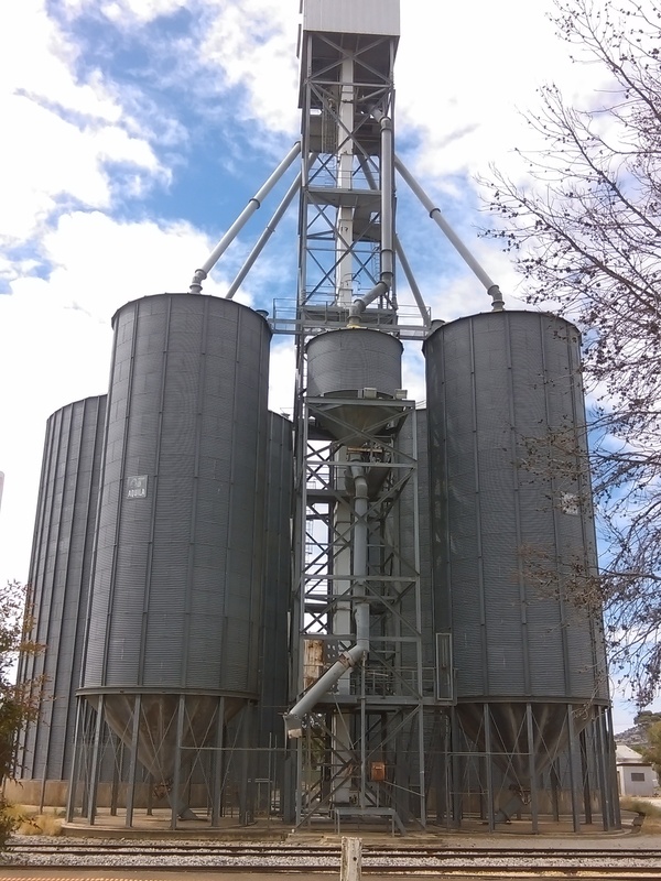
The next day, Thursday, I packed up camp, and rode into Mitiamo where I had some breakfast. While eating breakfast, I saw the morning Swan Hill – Southern Cross passenger train rumble through town. Then I struck out for Elmore about 45km away. The ride was very flat, with very straight roads. Not exactly the most interesting places to ride, but the scenery still held a few surprises. After about 20km of straight road, the road turned very lazily to the left and, behold, hi-rise haystacks. And I thought to myself, for there was no-one else around, “you know you’re in the country when there are more haystacks than people”. Eventually I happened upon an asphalt road, and I continued to follow it towards Elmore, with a brief stop to inspect the grain silos and what was left of railway station (not much apart from a mound of dirt) at Hunter.


I though I must have been within a very few kilometres of Elmore, but the sign I saw near Hunter said it was still about 11km away. So on I peddled, a little less energetically than before, and within about half an hour or so I was at Elmore where I stopped for lunch. This marked the end of my cycling holiday, but my cycling activities weren’t over yet. Over the next few days, while camping at Elmore I managed a few more rides and one rather eventful single track mountain bike trail that destroyed the rear derailuer on my mountain bike to the point where I couldn’t even ride the bike.


Once we arrived home I removed the deraileuer, and I am still pondering exactly what to do. That is the 3rd rear derailuer that has failed in about as many years. I’m seriously thinking of converting my mountain bike to a single speed – you know, those bikes that have only one gear. That would mean no derailuers! And from what I’ve read, it would make the bike much easier to maintain and repair, and would make it lighter. But it would be harder to peddle up the steeper hills. Maybe I need more of a challenge when climbing hills on my bike anyway.
You May Also Like