Out the Back of NSW
Between 19th and 28th March, I had annual leave and so I decided I would do some exploring. Due to the possibility of cross-border restrictions, travel permits for interstate travellers, and the possibility of COVID19 outbreaks in general, I decided to stay with New South Wales, the Australian state we live in, and away from major urban centres and public transport (that meant no train journeys for this batch of exploring). I had seen Lake Cargelligo on the map, and had travelled within about 20km of it on the Broken Hill train a number of times, but had never been there and I wondered what was there. After a bit of searching on the internet for attractions and things to do there, I decided that would be one place I would spend a few days. The other place I decided to visit was the township and region around Hay.
As I was going to be driving the car to these places, I also planned to visit some of the small towns between home and those destinations (something that would have somewhat hard or impossible to do using public transport in the time frame I had available).
Lake Cargelligo
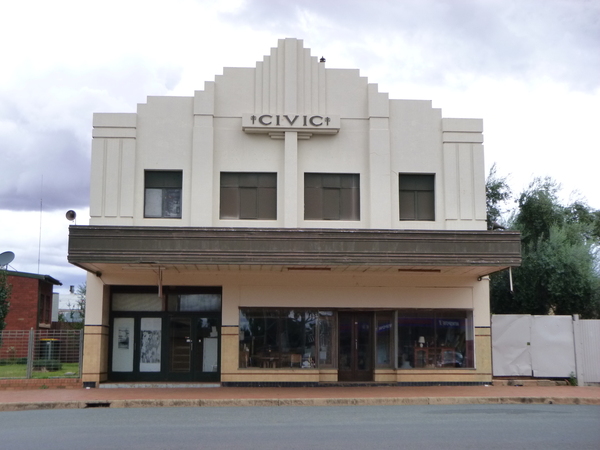
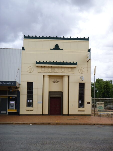
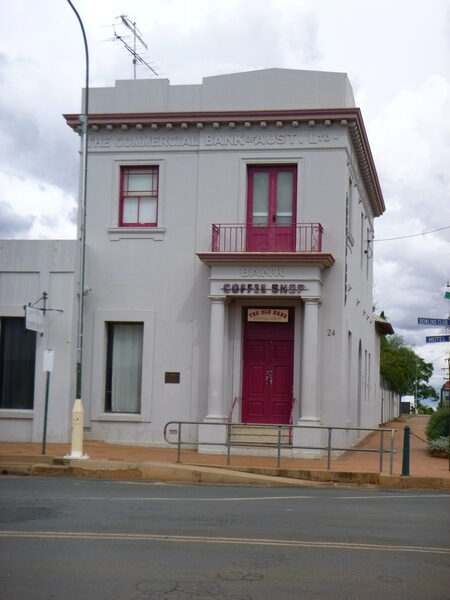
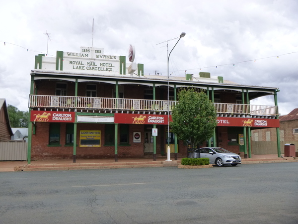
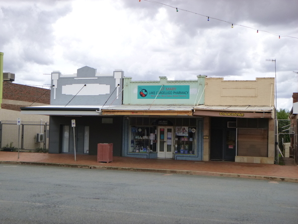
Lake Cargelligo (pronounced “car-jelly-go” according to some country folk I chatted with at the caravan park) is a small town of about 1400 people in a large farming region dotted with much smaller towns. That probably means Lake Cargelligo is “the” large town that serves residents of those much smaller towns and may account for the somewhat well appointed shopping and industrial areas for the size of town it is. It has 2 supermarkets, a number of service stations, the ubiquitous country pub or two, a modern looking hospital, a reasonable caravan park, sports grounds, some beautiful parkland, as well as other services that might not be found in similar sized towns that are closer to regional cities. The nearest regional city is Griffith, about 110km south of the town, and it is about 560km west of Sydney.
As one would expect, there is a lake close to the town – actually the town hugs the south west corner of the lake. There is a well made all weather walking and cycling path that follows the western shoreline of the lake from the southern tip of the lake for about 4 kms.
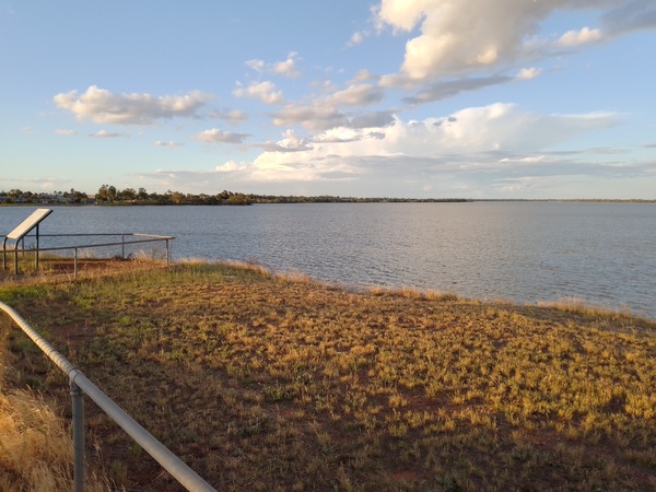
Lake at Lake Cargelligo 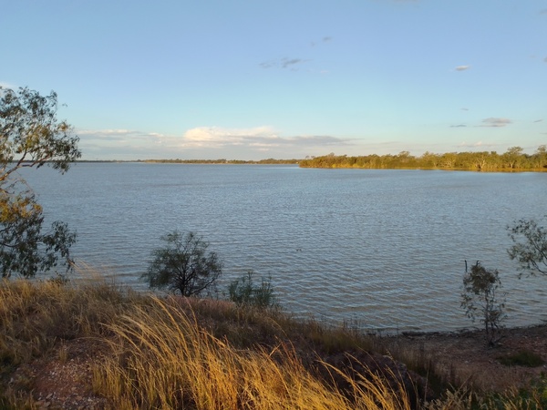
Lake at Lake Cargelligo 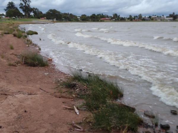
Waves on Lake at Lake Cargelligo
The name of the town has two possible sources:
1) A corruption of the Aboriginal word kartjellakoo meaning ‘he had a coolamon’.
2) Derived from the Wiradhuri and Ngiyambaa word “gajal” for water container, with the suffix “lugu” for “her” or “his”.
A ‘coolamon’ is an Australian Aboriginal multi-purpose shallow vessel or dish with curved sides, approximately half a meter long and similar in shape to a canoe. They were traditionally used by Aboriginal women to carry water, fruit, nuts, as well as to cradle babies, to winnow grains in a traditional bread-making process, as a general heating and cooking vessel and even as an umbrella. Coolamons were carried on the head when travelling any distance, or under the arm if used as a cradle. If being carried on the head a ring pad, made from possum and/or human hair, string, twisted grass, or feathers, was placed on the head.
The word “kartjellakoo” is believed to be the most likely source of the town’s name. The word “gajal-lugu” is considered to be dubious as a source of the name by some although it seems to me to have an obvious connection with the lake adjacent to the town and the coolamon.
When I stayed at Lake Cargelligo, there were severe storms and floods along the east coast and potential flooding forecast for some inland areas of NSW due to rainfall predictions in other areas across the state. This was somewhat concerning as I planned to stay in my small hiking tent at the town’s caravan park and I wasn’t completely sure that my tent would handle the amount of rain that was being forecast. But at the town and surrounding area I visited, not a drop of rain fell from Friday afternoon when I arrived until Sunday night which was the last night I would be staying there. I checked the rain radar a number of times on my phone, and it showed rain in the larger western NSW region but the rain appeared to be avoiding the region around the town until Sunday night. There was also a lot of rain forecasts for the areas I would be travelling on to get home on Monday and I was a little concerned about the possibility of local flooding. But even though there was evidence of a fair bit of rain having fallen on those roads, there was no flooding for which I was very thankful.
Another thing that was happening in some places in NSW at the time of my stay at Lake Cargelligo was mouse plaques. This concerned me somewhat more than the possibility of rain as at least with rain I could temporary sit down in the camp kitchen at the caravan park if the tent couldn’t handle the rain. But a mouse plague seemed likely to be more invasive. But I needn’t have worried about the possibility of a mouse plaque in Lake Cargelligo while I was there – I saw but one mouse for the whole time I was there and while I was watching that mouse scamper around ( I was at the Caravan Park at the time) a local dog took a keen interest in that mouse and after that I saw that single town mouse no more. I suspect the dog got it. Even out of town in my various travels and walks I saw no other mice so I think the mouse plaques had not reached Lake Cargelligo when I was there. Hopefully they won’t!
The Lake Cargelligo area is home to much to interest those interested in nature, especially bird watching. The lake itself has a number of bird hides, and there are good vantage points for observing our feathered friends a little away from the lake and around the other waterways in the region. Around 230 species of birds including some rare and threatened species have been recorded at the lake and surrounds, so it is somewhat of a “twitchers” paradise. On the Sabbath when I was staying there I visited a number of areas around or near the lake. I don’t think I saw any threatened or rare species, but I did find it interesting watching the various birds from inside the bird hides located in the region.
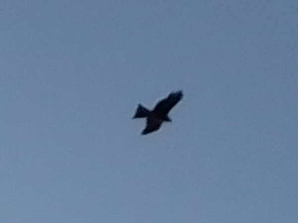
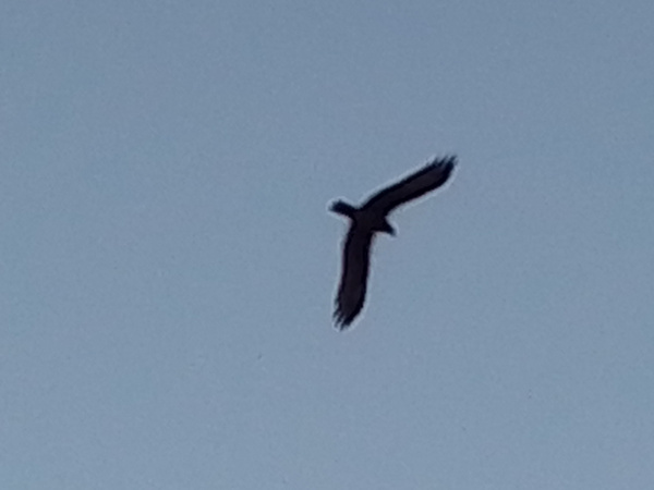
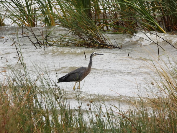
Bird on lake 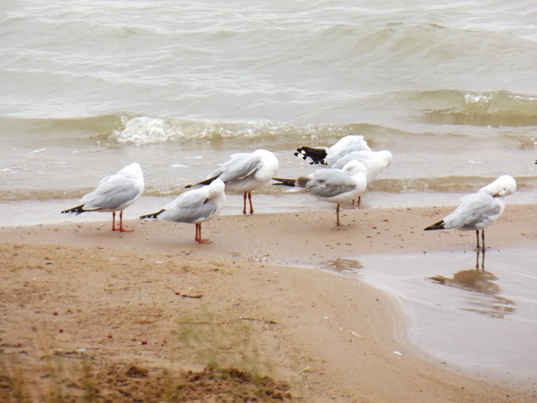
Seagulls near town 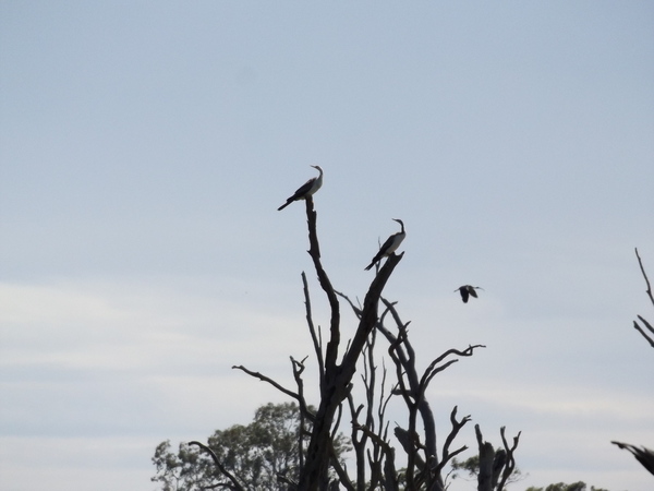

Nillson Lane Bird Hide 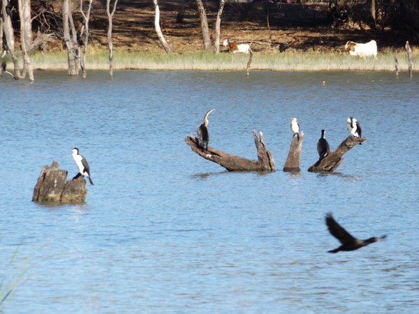
Birds from Nillson Lane Bird Hide
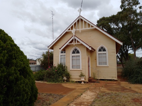
Also on Sabbath I also drove to the small township of Euabolong about 20km north east of Lake Cargelligo. There is not much at Euabolong, except for a pub, a small caravan park, a church and some houses. There is also a watercourse on the edge of town.
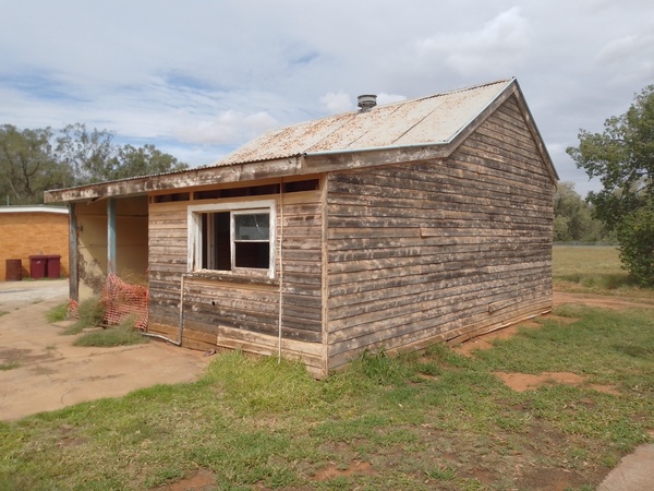
Old building at Euabalong Caravan Park 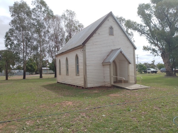
Church at Euabalong 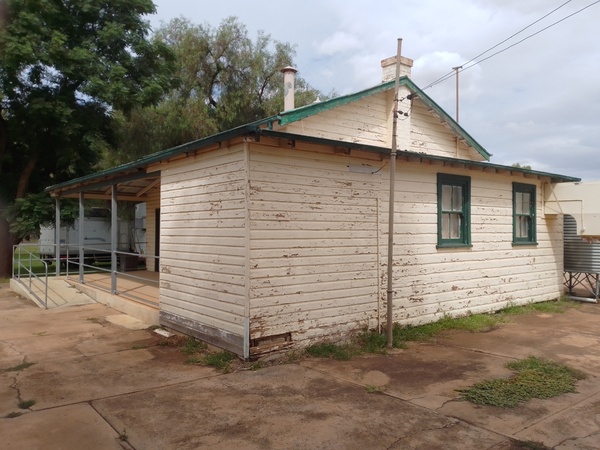
Old building at Euabalong Caravan Park 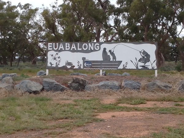
Euabalong Sign
On the Sunday I did a big loop visiting a number of the smaller settlements that surround it, namely the townships of Tullibigeal, Kikoira and Narradhan.
Tullibigeal Anglican Church 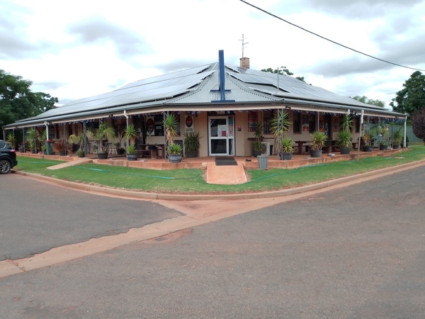
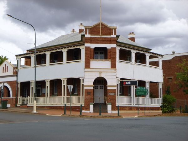
Tullibigeal Mayfield Hotel 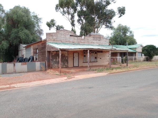
Old buildings at Tullibigeal
Tullibigeal is like many small towns around the countryside – not much there. The general store, known as Tullibigeal Co-Op is one of the few businesses in the town. The railway to Lake Cargelligo passes through the town, and there are some large silos and grain storage areas nearby, but when I was there the activity level was pretty low. Maybe that was partially because I visited it on a Sunday?
As part of the aforementioned ‘loop’ I visited the Bolo Chapel, a Roman Catholic chapel quite literally ‘in the middle of nowhere’. The chapel is located on a large farm, and even has a hermit in residence. The road to access the farm the chapel was located on was somewhat rough in places and I had to negotiate various pot holes and other obstacles on the road, the road being strait (not straight) and narrow seemed somewhat appropriate. Over all, the chapel is well worth a visit, whether you are Roman Catholic or not.
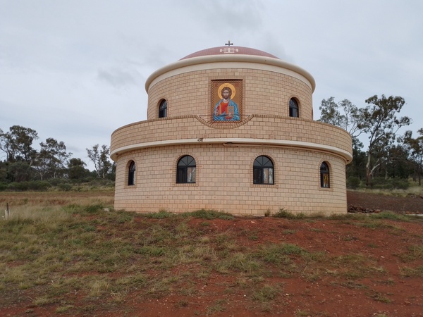
Bolo Chapel 
Bolo Chapel 
Bolo Chapel 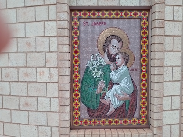
Bolo Chapel 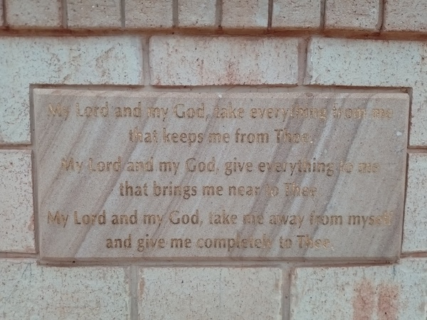
Bolo Chapel 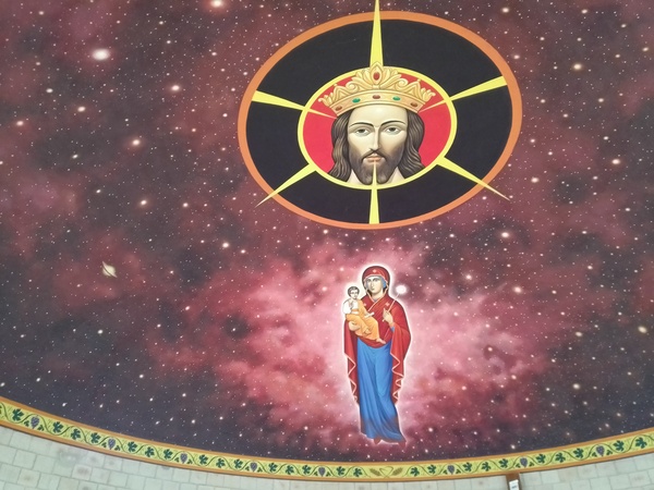
Bolo Chapel 
Bolo Chapel 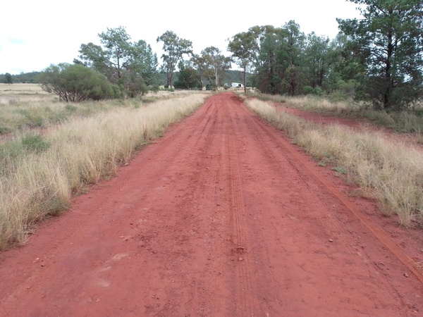
Road to Bolo Chapel
As part of Sunday’s travels I happened upon the almost non-township of Gubbata. The town was surveyed and only partially settled, so the native scrub in the township reserve that was originally to be used for the streets of the town was left largely intact while the area around the township site was cleared for agriculture. The remnant bushland area that was left is the basis of the Gubbata Nature Reserve. The reserve is dominated by mallee, yorrel, spinifex and scrub cypress. The reserve is managed to maintain an example of mallee habitats in an area that has been mostly cleared for agriculture and is an example of the original bushland encountered by settlers in the early days. The old railway station sign for the now non-existent station announces one’s arrival at the location.
Old machinery between Gubbata and Naradhan 
Old machinery between Gubbata and Naradhan 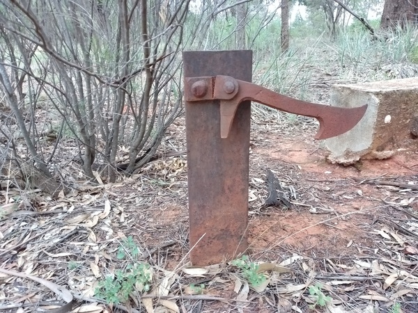
Old latch near railway at Gubbata. 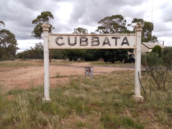
Gubbata Sign, ex-railway station but now next to the main road
The townships of Kikoira and Naradhan, on the same railway line as Gubbata, had a little more interest in them for me. I like the look of old buildings, especially those that have seen better days, maybe a little run down and in need a some TLC, and those two towns had their fair share of them.
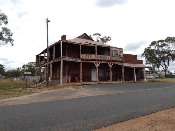
Kikoira Hotel 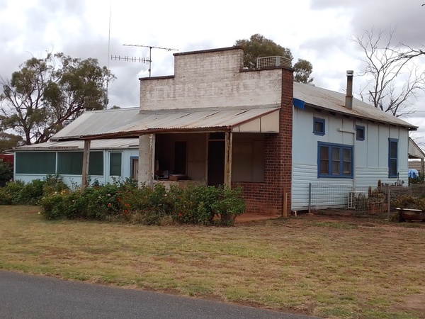
Old shop at Kikoira 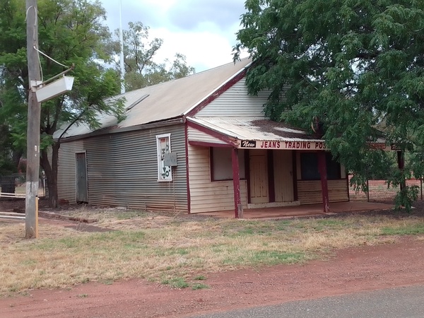
Old shop at Naradhan 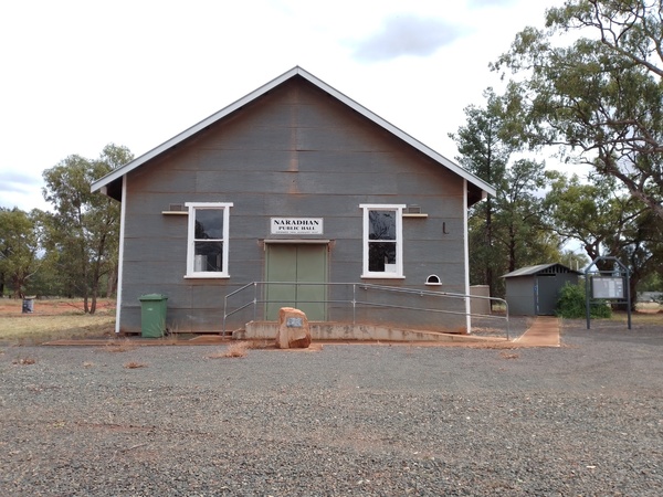
Naradhan Public Hall
Hay
Hay is a town located in the western Riverina area of south western New South Wales, Australia. It is the centre of a prosperous and productive agricultural district on the wide Hay Plains which includes sheep farming, and crops and horticulture of various types.

Murrumbidgee River at Hay 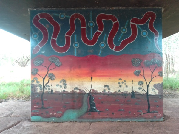
Art on bridge supports at Hay 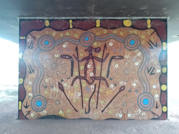
Art on bridge supports at Hay 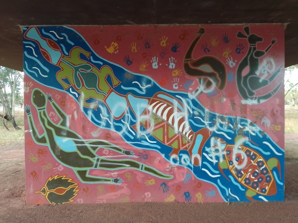
Art on bridge supports at Hay 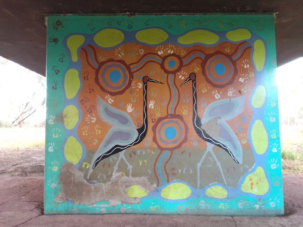
Art on bridge supports at Hay
Located at the junction of the Sturt, Cobb and Mid-Western Highways, the town is an important regional and national transport hub. The town is also built beside the Murrumbidgee River, which is part of Australia’s longest river system, the Murray-Darling river system. The main business district and most of the town of Hay is located on the north bank of the river.
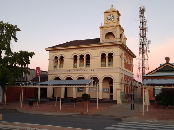
Hay Post Office 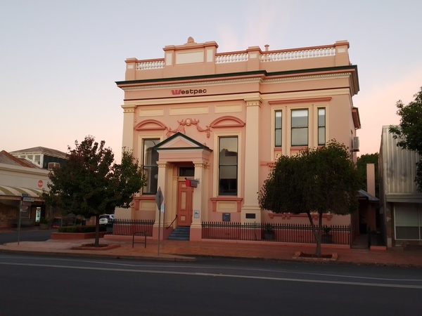
Historic building in Hay main street 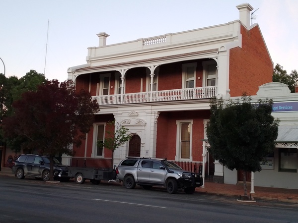
Historic building in Hay
The district surrounding Hay was occupied by at least three separate Aboriginal groups at the time of European settler expansion onto their lands. The area around the present township appears to have been a site of interaction between the Nari-Nari people of the Lower Murrumbidgee and the Wiradjuri who inhabited a vast region in the central-western inland of New South Wales.
In late 1829 Charles Sturt and his party of explorers passed along the Murrumbidgee River on horses, drays and a whale-boat on their journey to Lake Alexandrina (in what is now South Australia), later returning by the same route. During the late-1830s stock was regularly moved overland to South Australia via the Lower Murrumbidgee at the same time as stockholders were slowly settling westward along the Lachlan / Murrumbidgee / Murray rivers and Australia’s longest creek, the Billabong creek. By 1839 all of the river frontage near what is present-day Hay were occupied by squatters. This was followed by the establishment of prosperous pastoral runs by the mid-1850s. The relatively nearby Victorian gold-rushes provided an increasing market for stock and would have increased the viability and prosperity of the Hay area. One of the popular routes established in the mid-1850s crossed the Murrumbidgee River at Lang’s Crossing-place, very close to the current township.

Sculpture next to riverside path 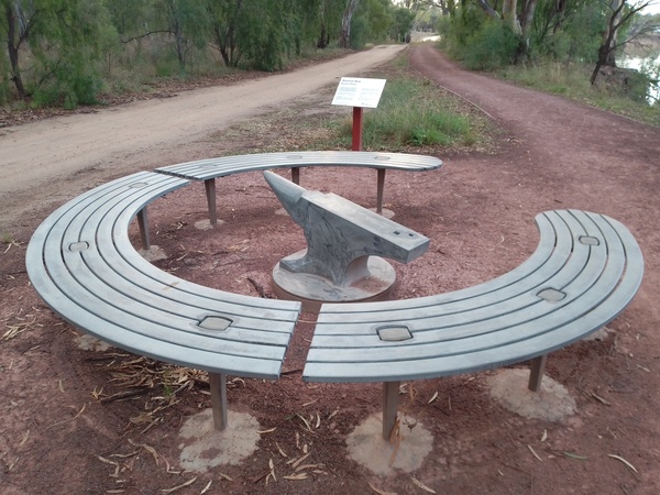
Sculpture next to riverside path 
Sculpture next to riverside path 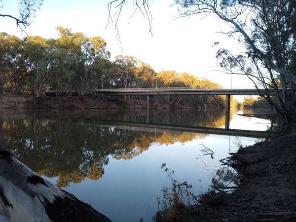
Road bridge over the Murrumbidgee River 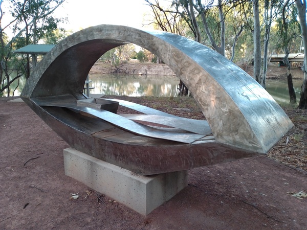
Sculpture next to riverside path
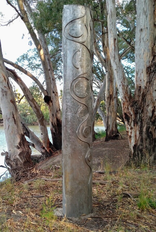
Sculpture next to riverside path 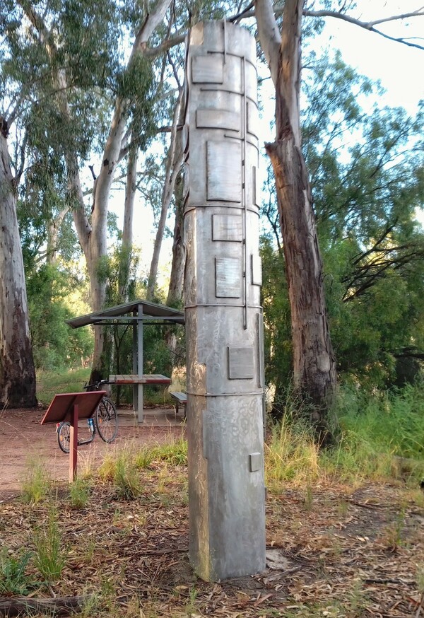
Sculpture next to riverside path
The Hay area was and still is a major sheep farming area and has a museum about sheep farming called “Shear Outback”. I spent a morning there, looking around at the various exhibits. Quite eye opening. Did you know that sheep shearers can burn more energy in a day than elite athletes? I didn’t until I visited the museum. I was also interested to find out that sheep shearers can only work in that profession for about 20 years due to the stress on their lower backs, and that before the motor car shearers would travel between shearing sheds by foot, bicycle or horse, often travelling huge distances from Victoria to Queensland following the shearing work.

Shear Outback Museum 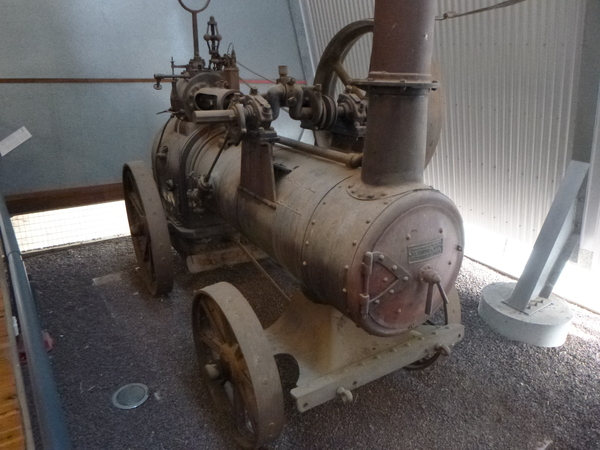
Shear Outback Museum – Steam Engine 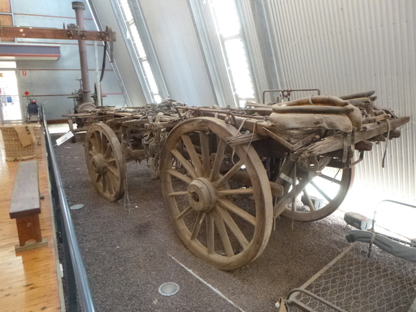
Shear Outback Museum – Dray 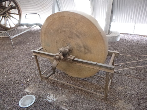
Shear Outback Museum – Grinmding Wheel 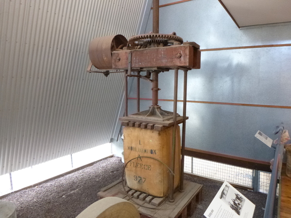
Shear Outback Museum – Dump Press 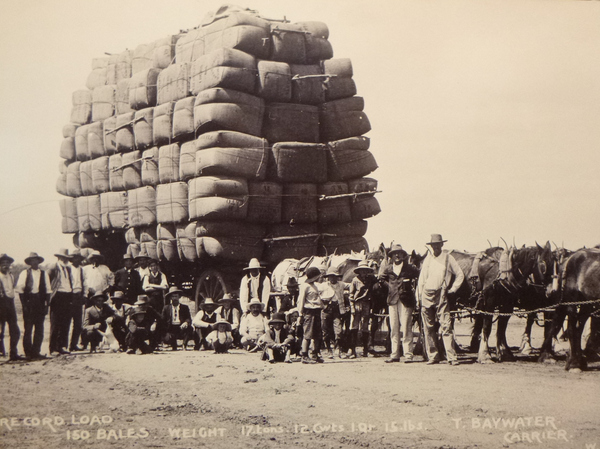
Shear Outback Museum – 150 bales on a dray 
Shear Outback Museum – Koerts Tumble Over Press 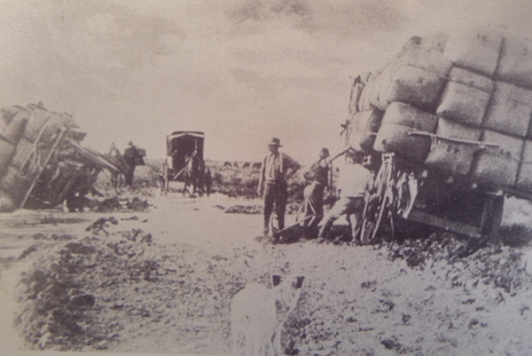
Shear Outback Museum – bogged on the Hay Plains 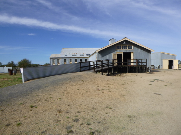
Shear Outback Museum – Shearing Shed 
Shear Outback Museum – Shearing Shed 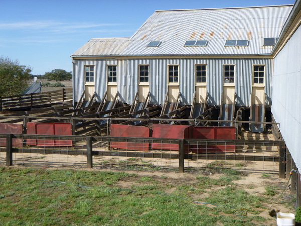
Shear Outback Museum – Shearing Shed 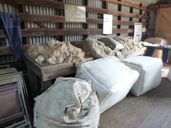
Shear Outback Museum – Inside Shearing Shed 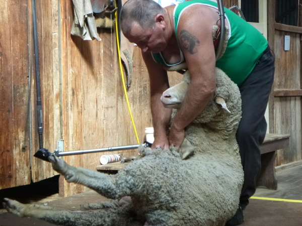
Shear Outback Museum – Shearing Demonstration
The town itself has the appearance of being well looked after, and has quite a lot of substantial historic buildings including an old prison which today is a tourist attraction.

Church 
Court House 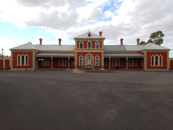
Railway Station (now a museum) 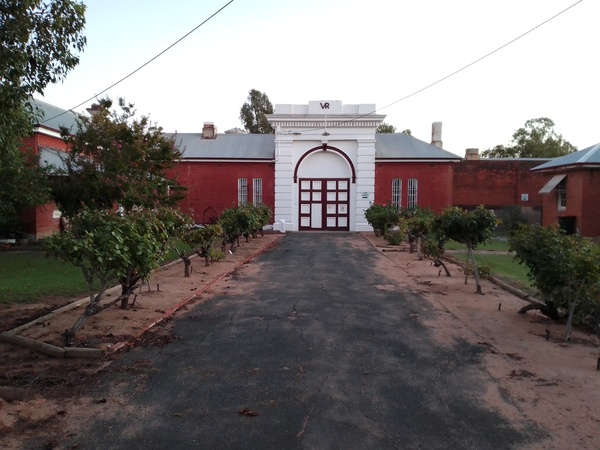
Old Hay Jail
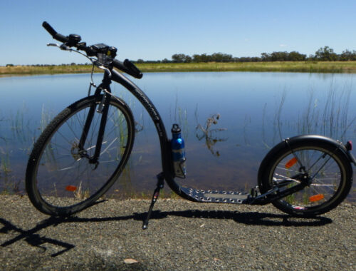
There are some good bicycle and walking trails in the natural bushland that lies between the township proper and the river so I’m glad I took my Kickbike as I was able to do some bike rides on the various trails on the nor5th and south side of the river. The trail the follows the river on the north side of the river had a series of sculptures and interpretive signage outlining the significance of the parkland.
Part of Hay’s history is it’s involvement in the two World Wars. This is commemorated by murals on the town’s water towers, and with a military graveyard attached to the town’s cemetery.
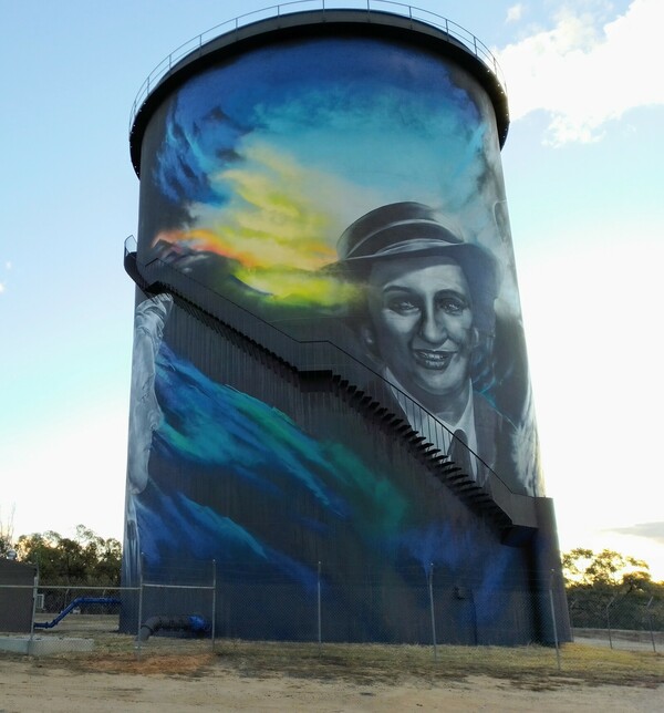
Hay Water Tower Mural 
Hay Water Tower Mural 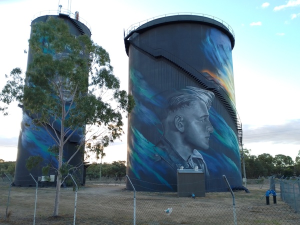
Hay Water Tower Mural 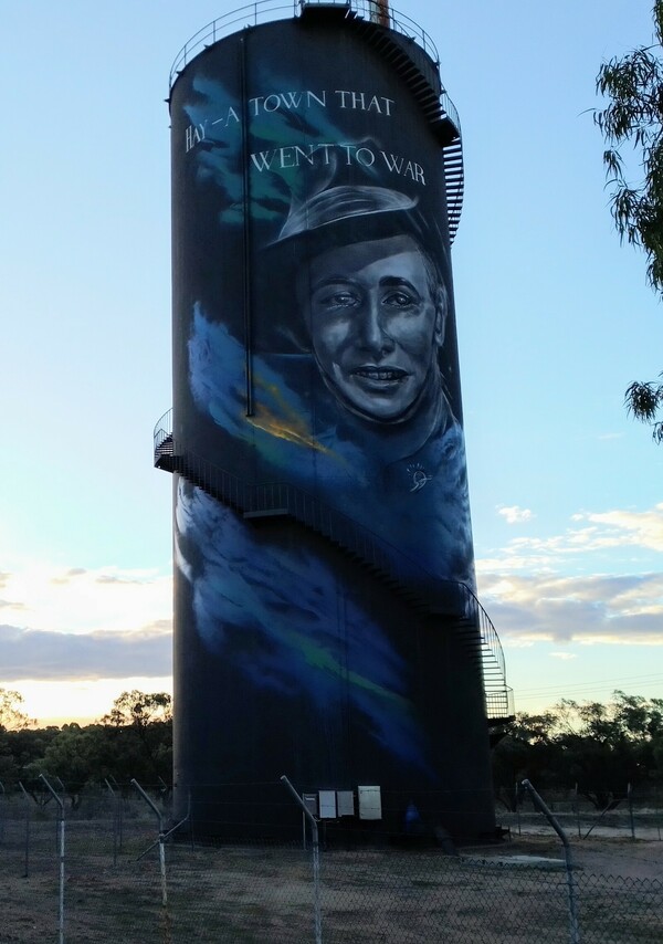
Hay Water Tower Mural 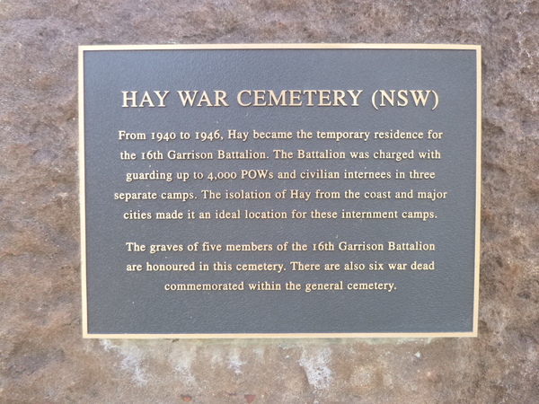
It was also the location of a POW (Prisoner-of-War) camp during the Second World War. Part of the reason for choosing Hay for the location of such a camp was because of it’s isolated location surrounded by semi-arid land, and that it was at the end of a railway line. These two attributes would have made it hard for prisoners to escape the area if they happened to break out of the POW camp, and allowed for fairly easy transport of prisoners to there.
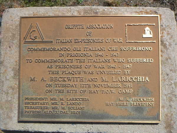
Hay POW Camp Plaque 
Hay POW Camp Plaque 
Hay POW Camp Remains 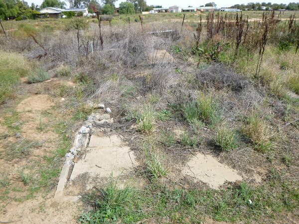
Hay POW Camp Remains 
Hay POW Camp Remains 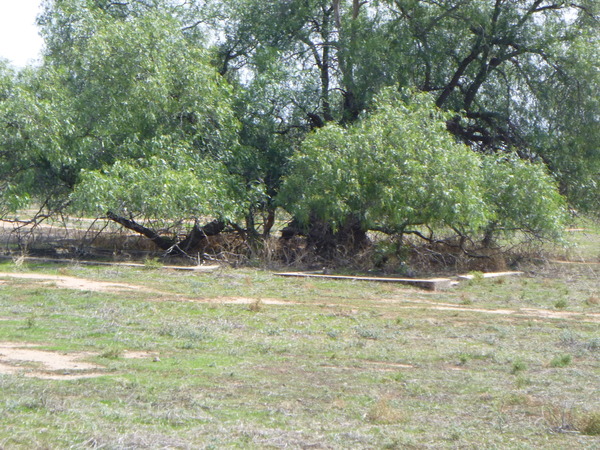
Hay POW Camp Remains

Hay POW Camp Remains
The drive to Hay from home was somewhat of an eye-opener. Where we live, we can see mountains and hills in the distance. But after Jerilderie the landscape became somewhat monotonously flat. After Conargo, the flatness of the landscape continued and from there the road turned to gravel for about 50km or so. Between Conargo and Hay there were little or no trees visible from the road, and only the occasional indication of farms, often in the far distance. I believe this is part of what is called the Hay Plains, which stretches in all directions from Hay and is very flat land, with few trees.

A little north of Hay, there is a dedicated Sunset / Sunrise viewing area. I read somewhere that the Hay area, because of the flatness of the landscape, is particularly good for watching such natural events. I also read that the area is also particularly good for star-gazing because of the lack of light pollution. To open Sabbath at Friday sunset, I drove out there, with a view to having my evening meal while I watched the sunset. A ‘meal and a show’. Not that the meal was anything special – it lacked that gourmet feel.

But the sunset. Well, here are some photos.

Hay Sunrise / Sunset Viewing Area 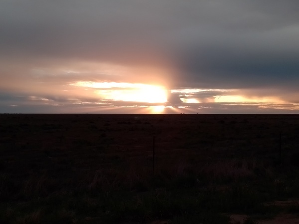
Hay Sunrise / Sunset Viewing Area 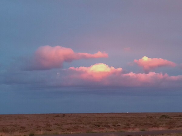
Hay Sunrise / Sunset Viewing Area 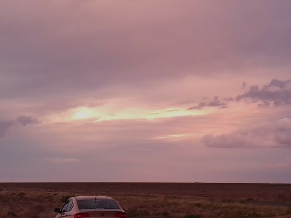
Hay Sunrise / Sunset Viewing Area 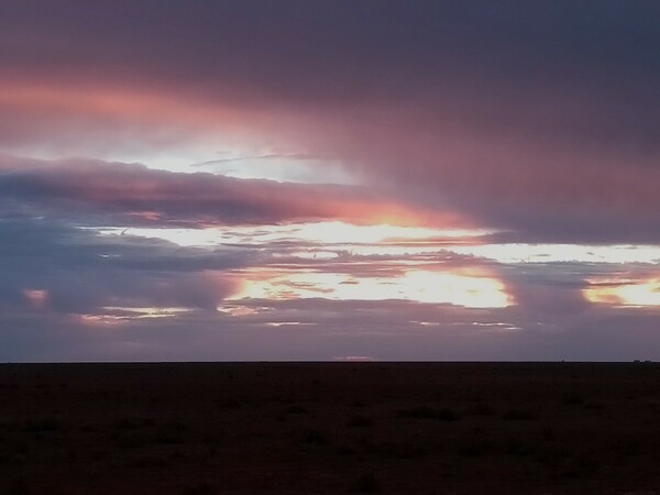
Hay Sunrise / Sunset Viewing Area 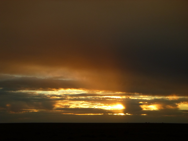
Hay Sunrise / Sunset Viewing Area 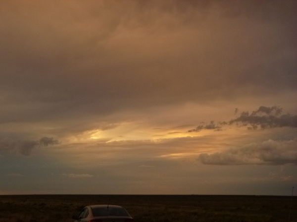
Hay Sunrise / Sunset Viewing Area
About 40 minutes drive north west of the town is the Kalyarr National Park. When I think of a national park, I think mountains, lots of trees, maybe a lake or river. Based on that expectation the Kalyarr National Park is the most unexpected national park I have ever visited! It is almost dead flat, the only water course is a seasonal one, and there are very few trees – mostly those trees seem to be found next to the seasonal water course. But despite the look of being barren and dead, it and the surrounding countryside is home to emus, kangaroos and plenty of birds. And there are plenty of small bushes which I assume would be home to countless small animals like lizards and bush rodents. It’s also very isolated – once I left the immediate surrounds of Hay township I think I only saw one house, a station homestead, and no other vehicles for the whole drive there and back. The national park was at least 20 minutes or so from that house. And there was no mobile phone reception more than about 10km out of Hay. The sense of isolation is palpable. Strangely, when I visit mountainous national parks that are more than 20 minutes from the nearest house the isolation isn’t anywhere as obvious. Maybe it was the fact that I could see across the flat landscape in all directions and see little or no evidence of civilisation that caused the sense of isolation to be so intense.
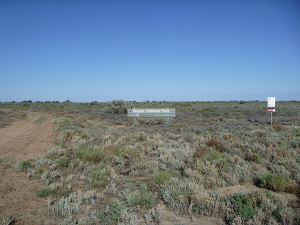
Kalyarr National Park Sign 
Kalyarr National Park – Camouflaged Kangaroo 
Kalyarr National Park – Animal Tracks 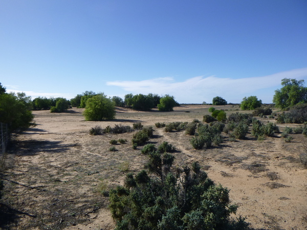
Kalyarr National Park – Seasonal Water Course 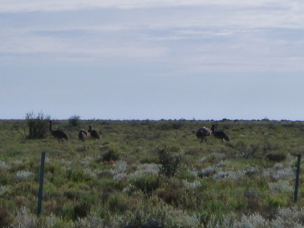
Kalyarr National Park – Emus
To break the journey to and from Hay, I decided that I would also do some exploring of some of the small towns between home and Hay in both directions. I visited Lowesdale-Burraja, Coreen, Daysdale, Oaklands, Jerilderie and Conargo.
Lowesdale-Burraja, Coreen and Daysdale
These three very small towns are between home and Oaklands. Despite their small size each town had it’s own things of interest.
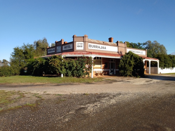
Burraja Hotel 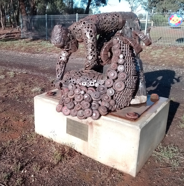
Burraja-Lowesdale Shearing Ram Sculture 
Coreen Presbyterian Church 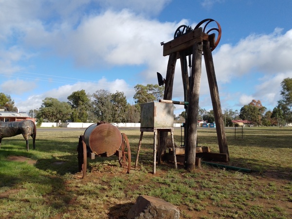
Daysdale Historical and Art Display 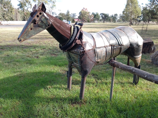
Daysdale Historical and Art Display
Oaklands
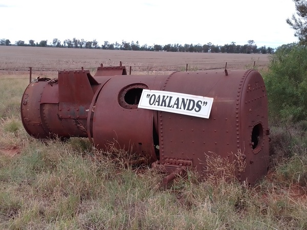
Oaklands, about an hours drive from home, really surprised me. It was completely different to how I envisioned it, in a good way. The town was very well presented with a tree lined main street, with some nice historic buildings. The town is not particularly large, maybe 500 people live there. I spent about an hour walking around the town and along the road to the silos and railway sidings in the hope of seeing a train or at least some carriages. But, alas, none were there. Of particular interest was the historical machinery display near the centre of town, and a very large teacup at the CWA meeting rooms.
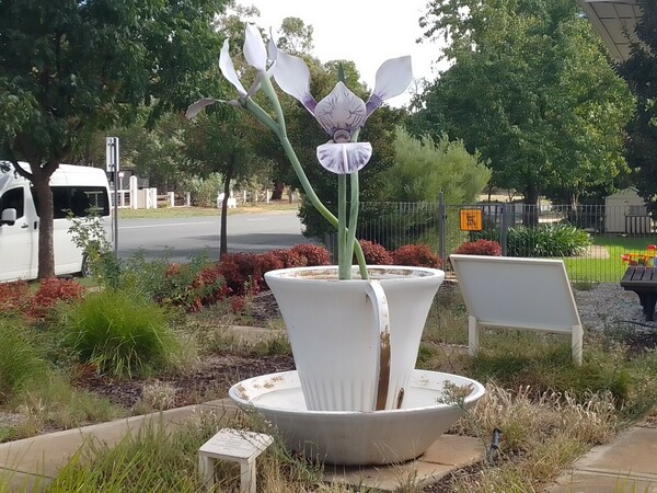
Orchid in a tea cup at Oaklands CWA 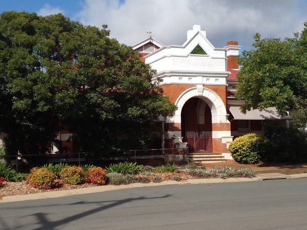
Historic building at Oaklands 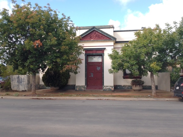
Historic building at Oaklands 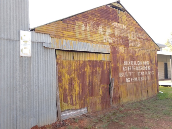
Old industrial building at Oaklands 
Shop fronts at Oaklands 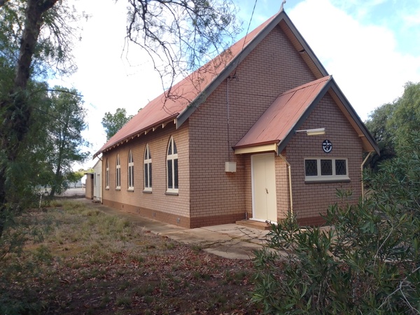
Church at Oaklands 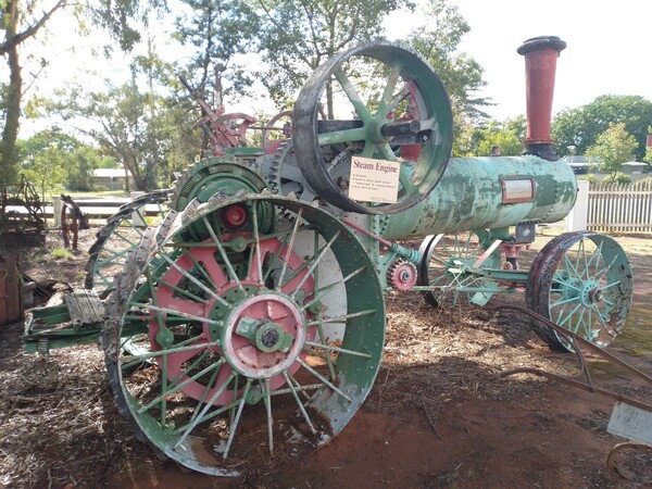
Steam engine at Oaklands
Jerilderie
The township of Jerilderie is located on the Newell Highway, one of the main north-south inland highways through the centre of NSW. It is somewhat suitably located to be an overnight stopping place for people travelling by car from southern Victoria to Queensland which might be why it appears so well looked after with some very pleasant parkland and a large man-made lake. The Billabong Creek, which has it’s headwaters in the Great Dividing Range north of Holbrook, NSW, and is believed to be the longest creek in the world at 320km length, runs through the town. There is some claim that the Billabong Creek is as actually as long as 596km long. In any case, it’s long – for a creek – and it’s waters eventually reach the Murray River, Australia’s longest river.

Lake at Jerilderie 
Military gun display at Jerilderie 
Old grader at Jerilderie 
Army tank at Jerilderie 
Roller at at Jerilderie 
Old steam engine at Jerilderie 
Metal art (a man on a bike) at Jerilderie
Also at Jerilderie there is a very large windmill on display, one of the largest in the Southern Hemisphere, that once used for irrigation of the Goolgumbla station.

The windmill was built by the Steel Wings Company or North Sydney in 1910 and was transported to Jerilderie by rail and then taken to Goolgumbula Station by bullock wagon. it provided water to the station’s homestead, ram sheds and dams via a 27 mile channel system. The windmill is believed to be one of only 6 of it’s kind ever built and is the only one of it’s kind that is still in operatable condition. it standar 50 feet high, with the fan having a diameter of 25 feet. It has a ‘governor’ mechanism which automatically turns the machine out of high winds to lower the chance of wind damage in high winds.
There are also a number of historic buildings there and a doll museum (open by appointment).
Conargo
When I drove to Hay, I went through the township of Conargo, but didn’t have time or inclination to stop there as I knew I was still a fair distance from Hay. On the journey home, I decided to stop there and have a look around. Conargo, like Jerilderie, is located near to the Billabong Creek. William McKenzie, born on Scotland in 1820 and immigrating to Australia when 20 years of age, is believed to be the founder of the township. In 1856 he settled at Conargo, and over time built much of the settlement and had a number of business interests in the town. In 1860 the Government Gazette announced that notice had been given that a site had been fixed for a town to be called Conargo “on the Billabong Creek where the road to Wagga leaves that creek”. The town was surveyed on the flat ground either side of the Deniliquin – Conargo Road and extended about a mile south of McKenzies Inn.
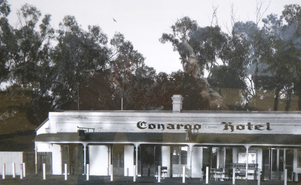
Old photo of Conargo Hotel 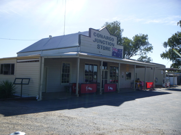
Conargo General Store 

The area and plains around Conargo Hay is centre stage for wool production, the Merino stud farms around Conargo being known around the world. The foundation of the Merino wool of today was born in the area on the Riverina Plains, where the Peppin Merino was developed. This was the first sheep bred to not only survive, but thrive, in harsh Australian conditions and to produce an exceptional quality fleece. Today, over 70% of all Merino sheep are bred from the Peppin Merino. For more than a century wool provided the backbone of the Australian economy, the shearer being seen by many as the quintessential symbol of Australia.
You May Also Like
2 Comments
Sandra Rae Glew
Hello James,
This trip you did was very interesting. Hay and Jerilderie look lovely country towns. The Shear museum would be what I would visit if I went there. It’s sad that so many of the little towns have old shops and buildings just rotting away. Pity someone couldn’t use them for housing homeless people – but I guess it’s too far away from any major towns. You write a good description of everywhere you go. One day you should write a travel book and your photos are really good. Oh, and the paintings on the water towers are spetacular.
Luv Sandy
Mum
Hi James,
The Billabong Creek mentioned, is it the same one that goes through Culcairn?
I enjoyed your blog, it’s like a history lesson for me. The art on the water towers is amazing.
Through your travels I visit places I will probably never see otherwise.
Thanks for this travel dialogue and photos. I’m now looking forward to the next one.
Luv Mum