Everywhere is within walking distance if you have the time
The title of this post is a quote from someone called Steven Wright. I can’t remember where I first saw it, or even who Steven Wright is, but the idea of everywhere being within walking distance if you have the time is a basically sound statement. And is a good description of the contents of this blog post. For many years I have enjoyed walking and hiking, particularly in natural settings. For a few weeks in March and April I took some annual leave and decided that I would do *some* walking and hiking during that time. This annual leave would also include some train and bus journeys, and some rather long car drives.
SYDNEY, NSW
23rd March 2023
Rebecca was going to Sydney for an Elia Wellness health conference at the San (Sydney Adventist Hospital) and Thornleigh, where we had booked accommodation, is in fairly close proximity to the San. While Rebecca was at the conference I planned to take the opportunity to walk some of the bush walks near Thornleigh. After some checking on the internet, I decided to walk two sections of the Great North Walk that could be walked from where we were staying for the weekend.
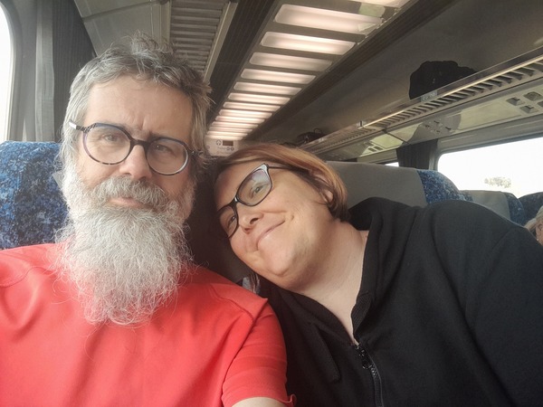
Rebecca and I caught the NSW Trainlink XPT train Wangaratta to Moss Vale, then a NSW Trainlink Xplorer train from Moss Vale to Bundanoon. We stayed overnight in Bundanoon. I think this was the first time I had gone on such a long train journey with Rebecca, and it was nice to have someone I know with me.
24th March 2023
This morning, before we left Bundanoon to complete the train journey to Thornleigh in Sydney, I walked the Glow Worm Glen walk in Bundanoon.
The vegetation around the trail was damp from the morning dew, and the track was somewhat slippery. Thankfully I was wearing newish hiking book with plenty of tread, and didn’t slip too much, but even with the good amount of tread on the boots I could still feel the trail was somewhat slippery under foot in places.

The Glow Worm Glen after which the walk is named is a natural rock feature frequented by the larvae of fungus gnats, otherwise known as glow worms. Adult female fungus gnats can lay around 130 eggs and then die soon after. After 8 days or so the larvae start to hatch. They position themselves near tiny cracks or seepage spots where they can retreat to if it gets too cold or dry. When night falls, they lure insects into their webs using their glowing tail lights. These lights are created by a chemical reaction between some of their body fluids and oxygen.
After we had breakfast we went to the railway station and caught an Xplorer train from Bundanoon to Sydney Central, then Sydney electric train to Thornleigh.
25th March 2023
The Great North Walk, a portion of which I did today, is a long distance (210+km) walk between Sydney and Newcastle. Over the weekend I only hiked about 30km, but I think it would be interesting to do the rest of the Great North Walk. Maybe that’s a plan for some future time.
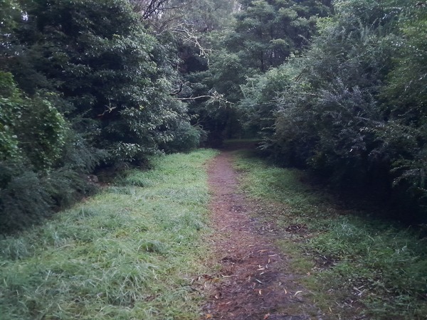
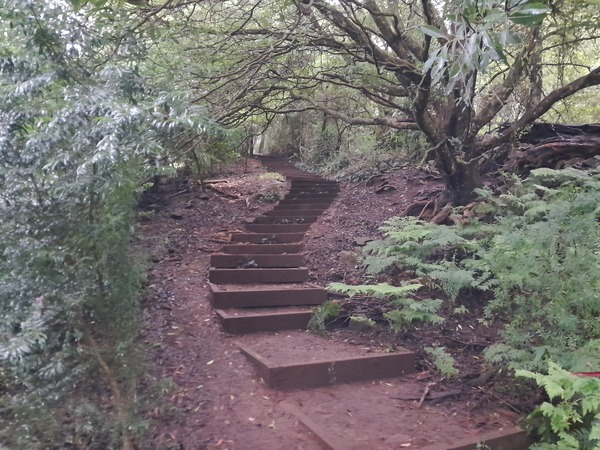
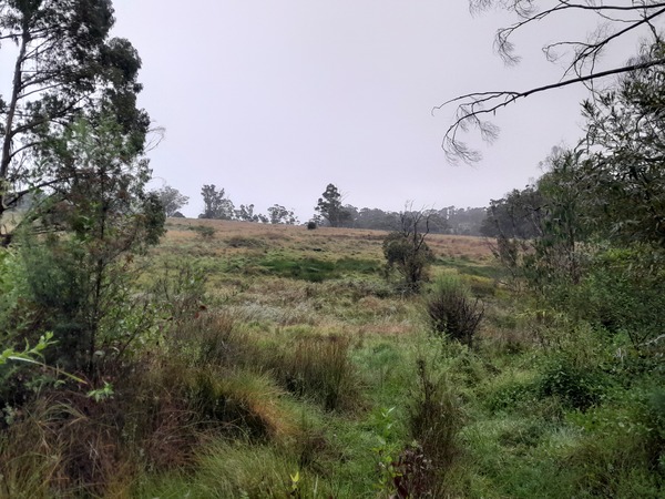
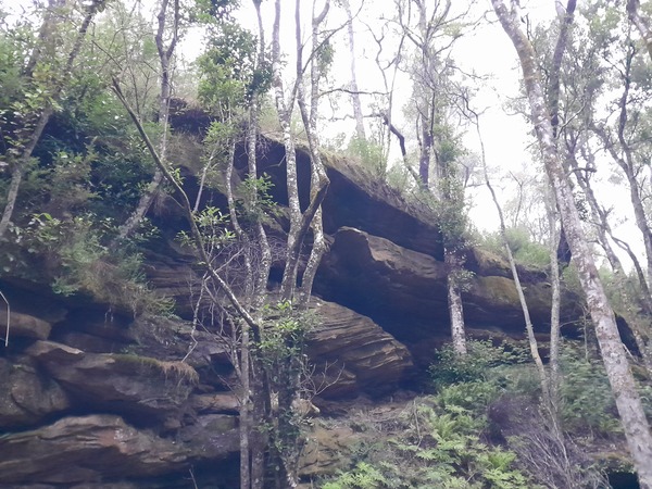
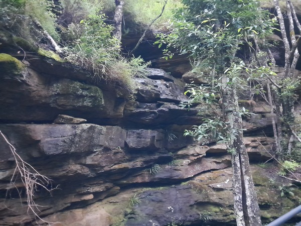
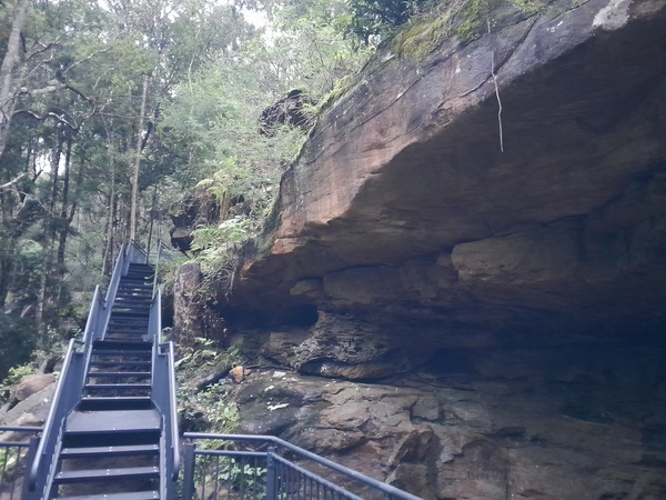
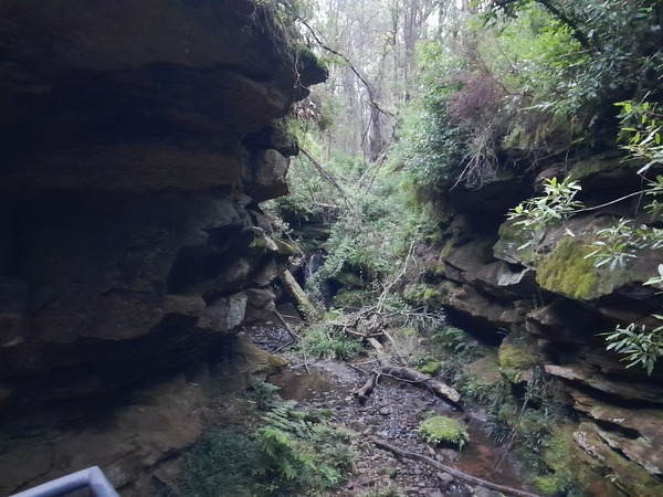
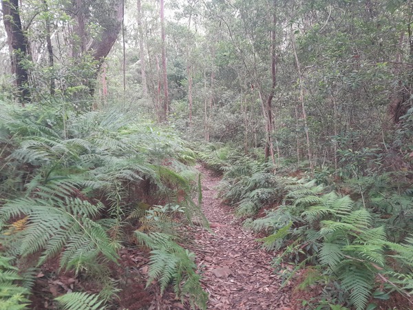
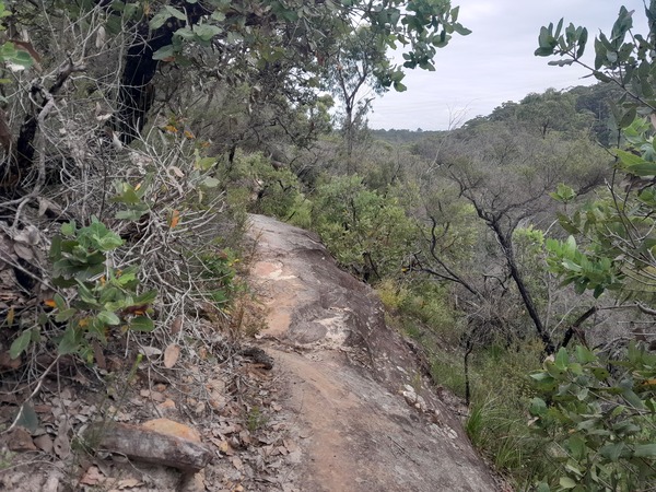
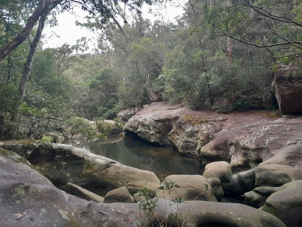
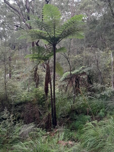
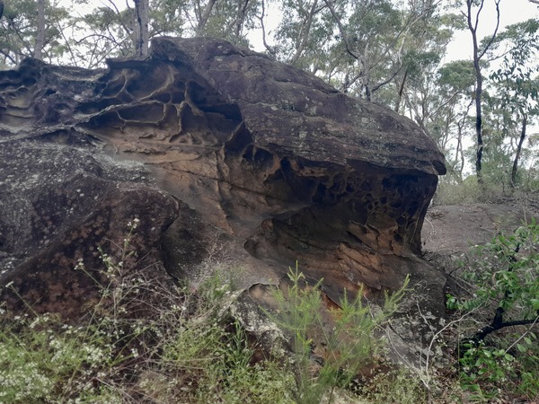
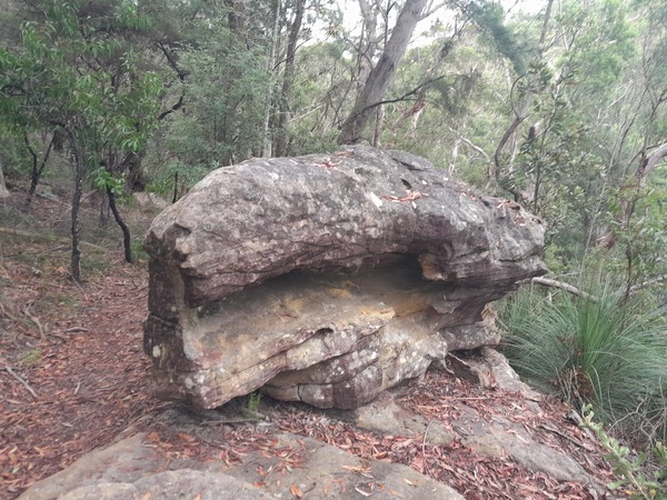
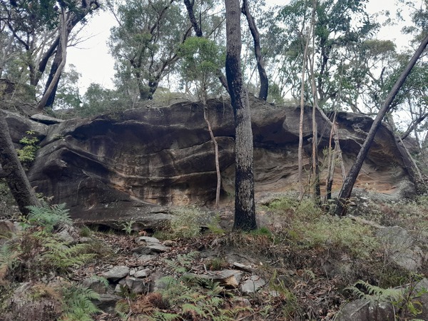
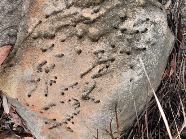
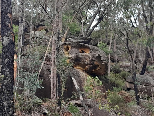
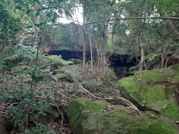
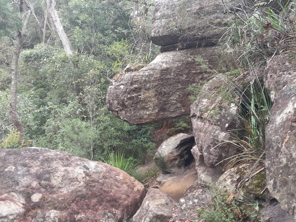
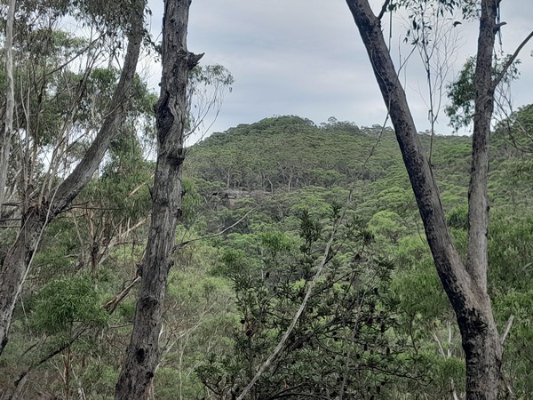
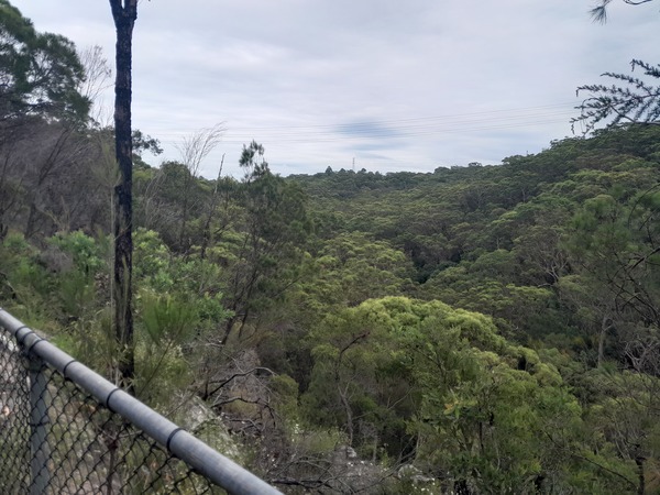
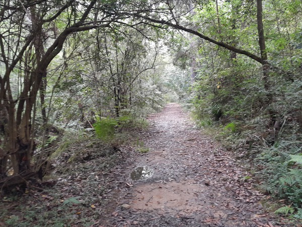
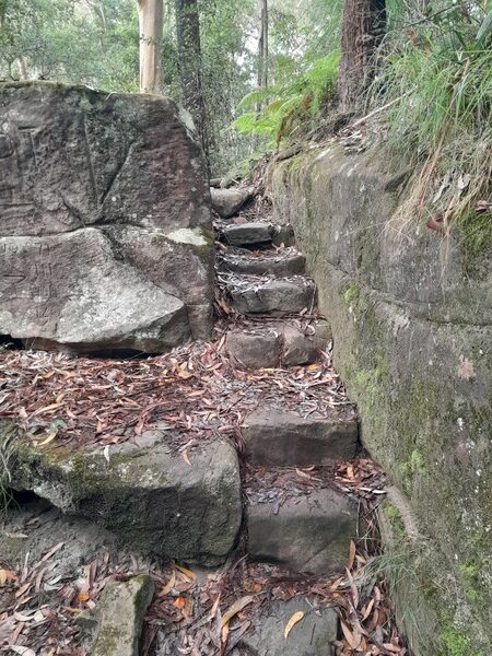
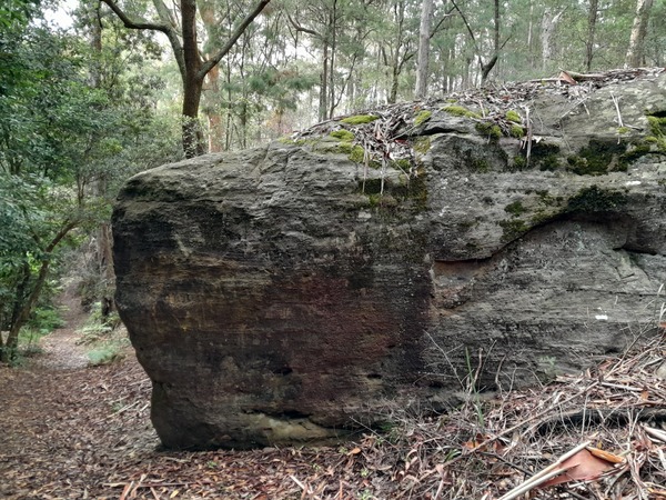
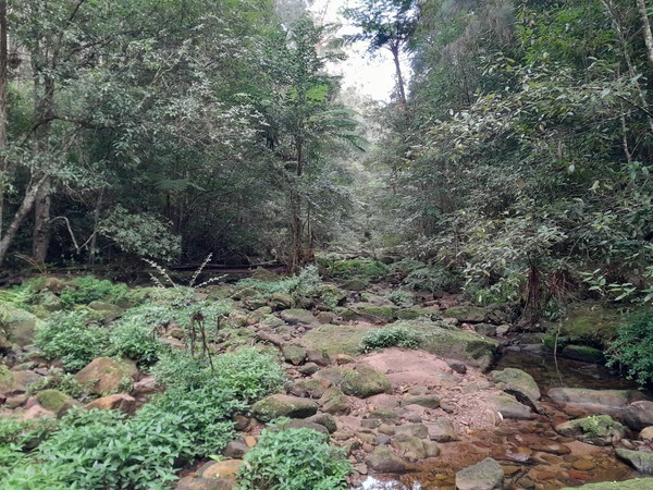
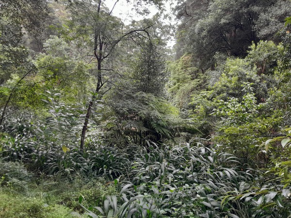
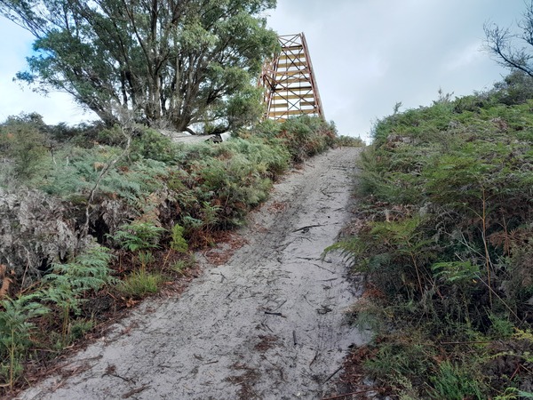
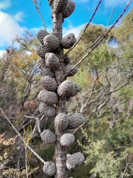
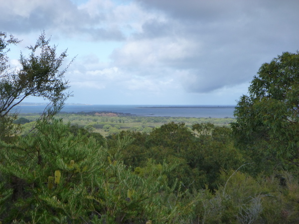
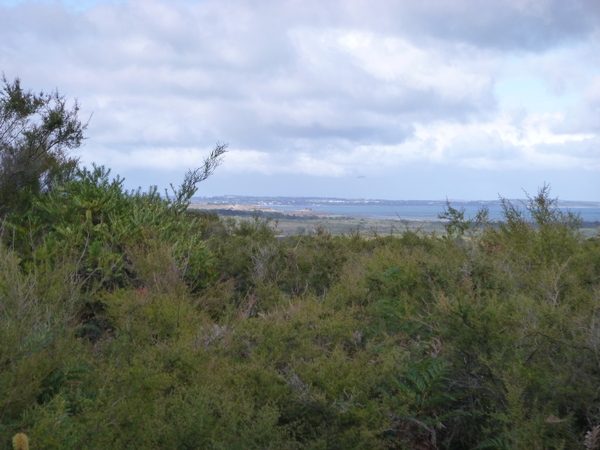
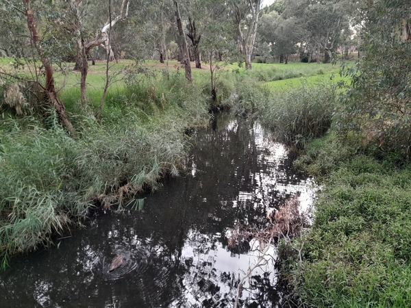
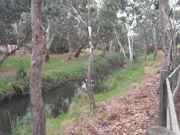
The scenery on this day’s hike was comprised mostly of lots of temperate forest, rock faces, and creeks. There were a few places where the trail went along the top of a cliff face, which offered good views out across the valley to the mountains beyond. There was plenty of scrambling up and descending careful down mountain sides on this walk. The trail was varied, as the following photos show…
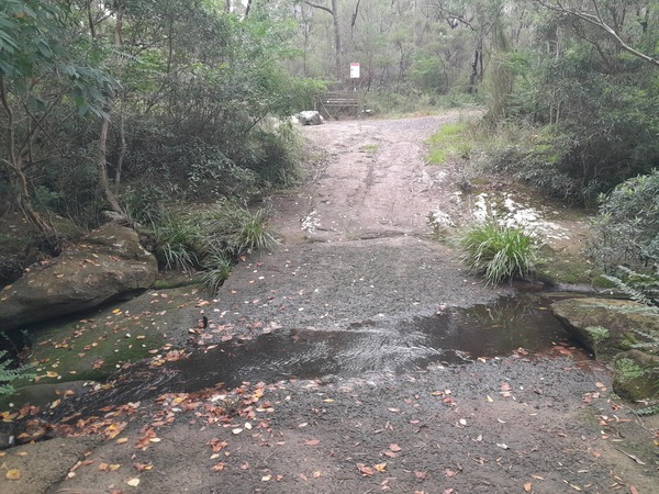
Most of this walk was within 2km of some of Sydney’s northern suburbs, but it seemed like a world away, except for the frequent passenger aircraft flying overhead. After I had walked about 8.5km along the Great North Walk today, I encountered a difficult creek crossing which would have required me to scramble over some pretty large uneven rocks.
This meant a higher possibility of injury, which I seriously wanted to avoid, so I back tracked a few kms and decided to walk along a part of the Blue Gum Walk, which eventually brought me to the edge of Hornsby, a northern suburb of Sydney. I consulted Google maps to see what the best way to get to Hornsby was and made my way there.
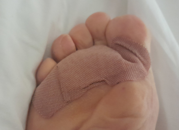
After my experience with blisters on an overnight hike a few weeks ago in the Warby Ranges in north east Victoria, I decided to try to preempt the possibility of getting blisters on the hikes I would be doing over this 3 weeks by putting some large ‘bandaids’ on the balls of my feet before each hike. I wasn’t sure whether this would work when I thought of the idea, but after 14km of walking on today’s hike my feet were still comfortable (ie, no blisters felt forming) although still a little sore in my new hiking boots. I guess it worked?
I was originally planning to walk from Hornsby back to Thornleigh through the suburbs to complete a loop. But by the time I got to Hornsby, I was ready to rest my feet as they were a bit sore, probably from the newness of the hiking boots, so I caught the train the short distance back to where we were staying.
Total distance of the hike today was 14.3km.
26th March 2023
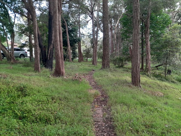
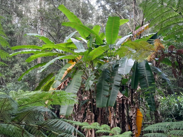
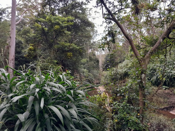
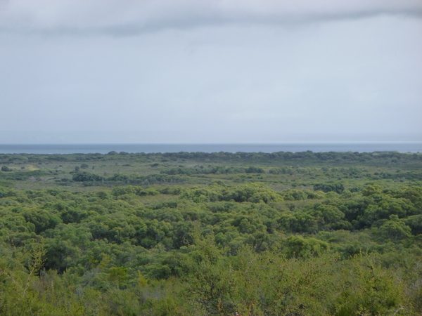
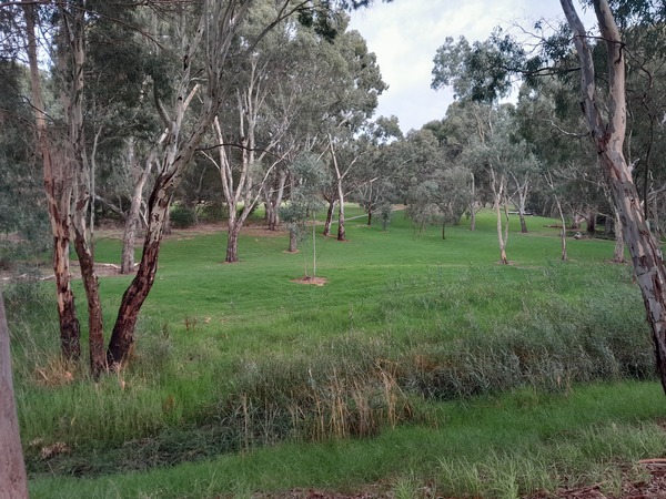
Today I hiked from Thornleigh to Lindfield via the Great North Walk. A lot of the hike was in the Lane Cove National Park. Plenty of interesting rock formations, and plant life. The distant hum of machinery and / or vehicles seemed out of place in the depths of the forest, but like yesterday’s hike this was also in fairly close proximity to suburbs even though at times it felt like it could have been a long distance away.
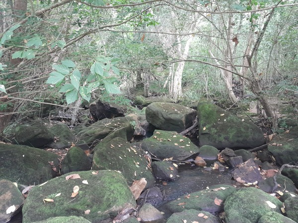
The trails on this hike ranged from single file walking trails to management vehicle trails, with numerous creek crossings. These creek crossing required me to pick what I thought would be the best place to cross, and to avoid getting my feet wet, if possible. Most of the time I picked a good location, but other times there were very few good places to cross and so I had to risk what crossing points there were.
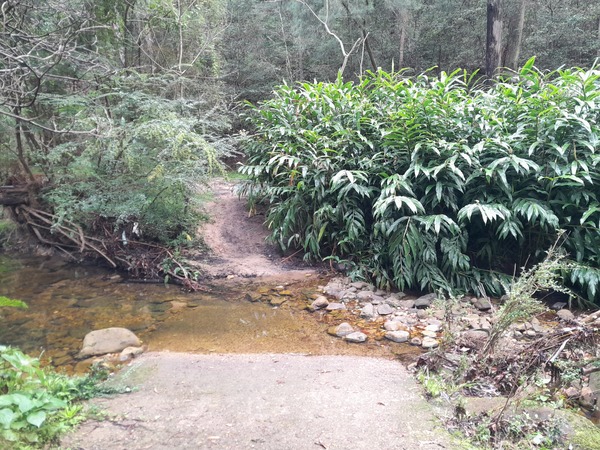
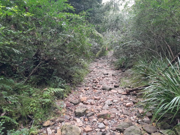
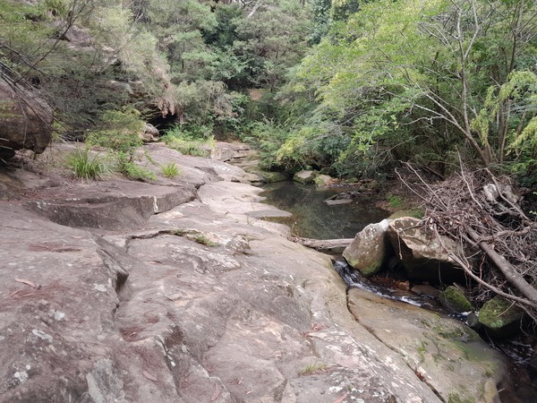
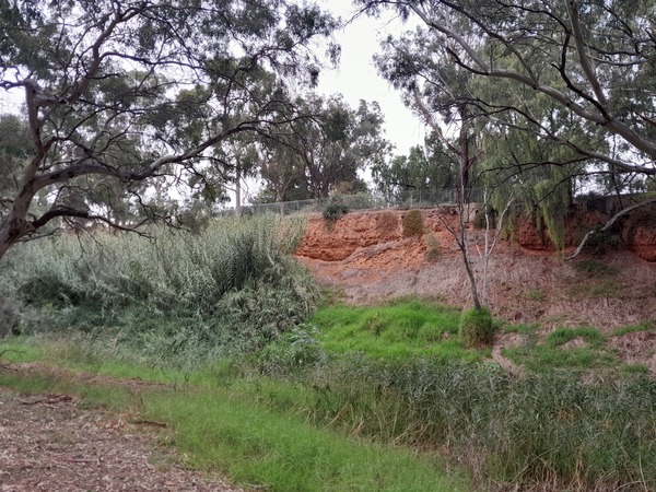
Thankfully the creeks weren’t in flood, which would have made them impossible to cross and meant the hike would be cut short. The scenery was somewhat similar to yesterday’s hike in some places, but most of it was very different with different lush vegetation including Wet Sclerophyll Forest, and damp valleys. The word “schlerophyll” means “hard leaved”. Wet Schlerophyll Forests are characterised by tall eucalypts with an understorey of shade-loving plants that can also be found in rain-forests.
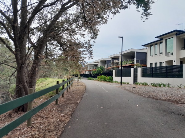
The last few kms of the hike were through the suburbs to Lindfield railway station, where I caught a train back to Thornleigh.
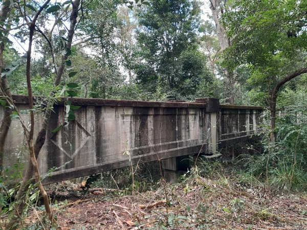
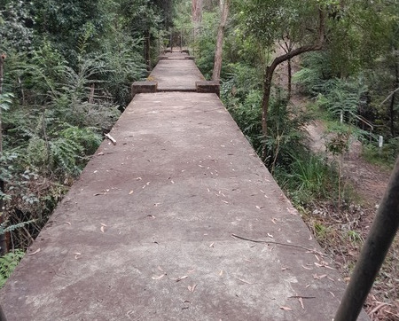
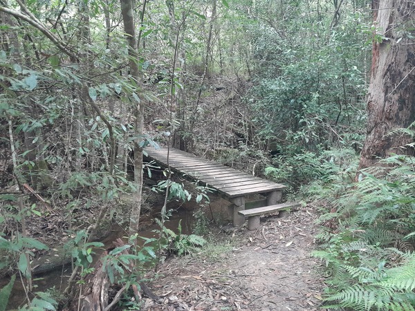
The 2 photos above are of a bridge that looked like a disused railway bridge, although I’m not sure that’s what it was used for. When I posted the photo on Instagram someone commented that it was once used to carry a water or sewerage pipe. The bridge is a few km west of the Ryde Rd overpass.
Total distance of the hike today was 15.9km.
The next day, we left Sydney by train, and arrived back home more or less when we planned to. For Rebecca that meant the next day she was due back at work. For me the adventure continued…
FRENCH ISLAND, VICTORIA
28th March 2023
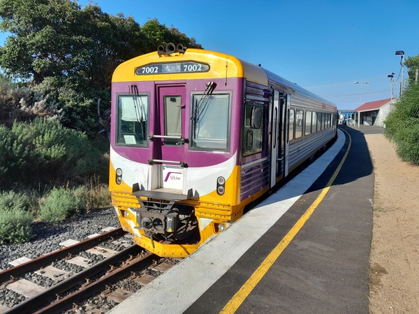
This morning I caught a Vline bus from our home town to Wangaratta, to connect with what would have been a train to Southern Cross in Melbourne, Victoria. But the train was replaced with a bus for the whole journey. It arrived at Southern Cross about 40 minutes early so I was able to get an electric train to Frankston at 1:59pm instead of later! This meant I easily got to Frankston to catch the Sprinter from Frankston to Stony Point to arrive there by 6pm which is when the Stony Point Caravan park office shut for the day.
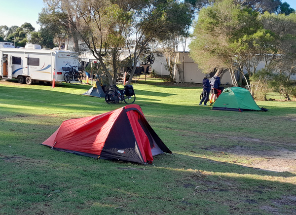
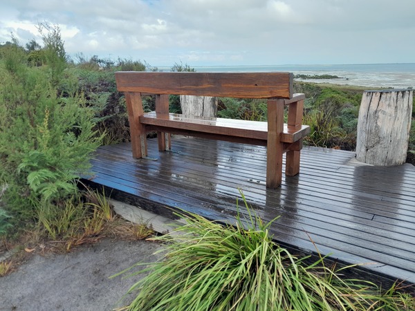
The Stony Point Caravan Park is literally next door to the station, and the jetty is a short walk (a few hundred metres at most) away. Apart from some rain early in the day the weather was been fine.
I pitched my tent near the camp kitchen, made something hot for my evening meal. After I had eaten, it wasn’t long before I decided to go to bed.
29th March 2023
I was up early, and as the low clouds suggested rain, I packed up everything fairly early and sat in the camp kitchen while I was charging my phone and battery pack in preparation for the next few days without access to electricity.
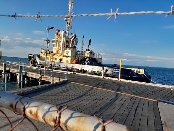
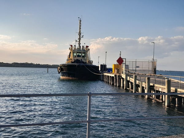
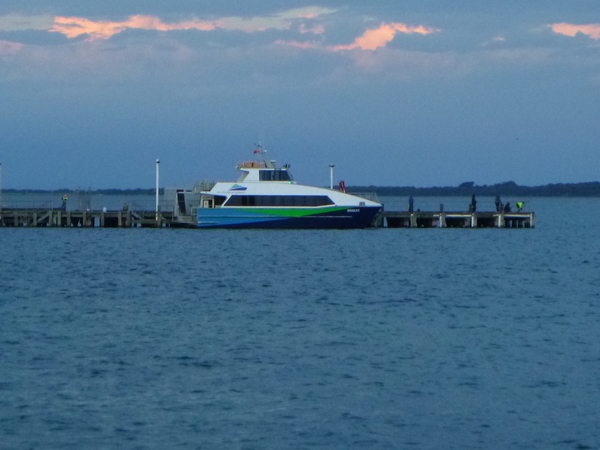
While having breakfast today, I had an opportunity to chat to some others who were camped nearby. They were a group of cyclists that had ridden from Canberra, ACT, and were continuing east along the Gippsland coast. Or at least that’s what they were planning. We talked for a bit about cycling, and especially bicycle touring, which I have also tried in the past and swapped tales of adventures by bike. After I had finished breakfast and the cyclists had gone to get ready for their day’s ride, watched TV to fill in some time. Not that there was much of interest on TV at that time of day, but there really wasn’t much else to do once the cycling group left. After about 9:40am I walked over to the Stony Point jetty a short distance away to catch the ferry which was due to depart at 10am.
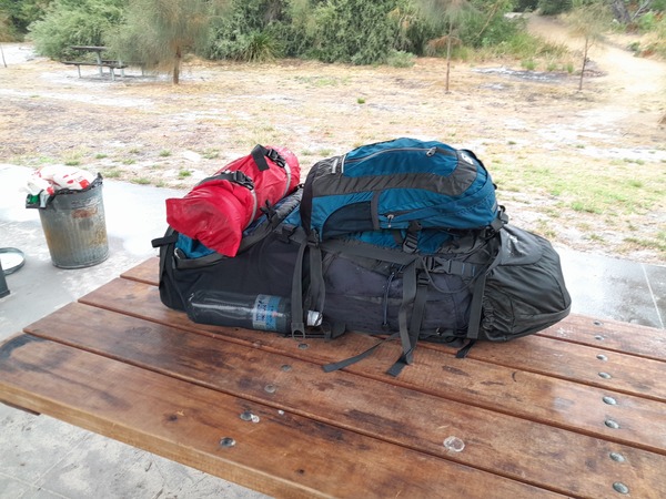
For the next few days, I planned to go to French Island and do some hiking with full camping kit, and some day hikes. I had booked a campsite at Fairhaven Campground about 6km from the Tankerton jetty, and a ticket on the French Island ferry. It hadn’t really rained at all by that time, but the skies looked like they wanted to rain.
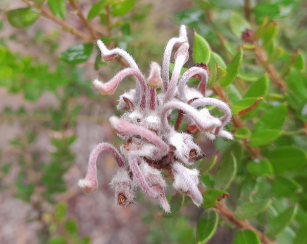
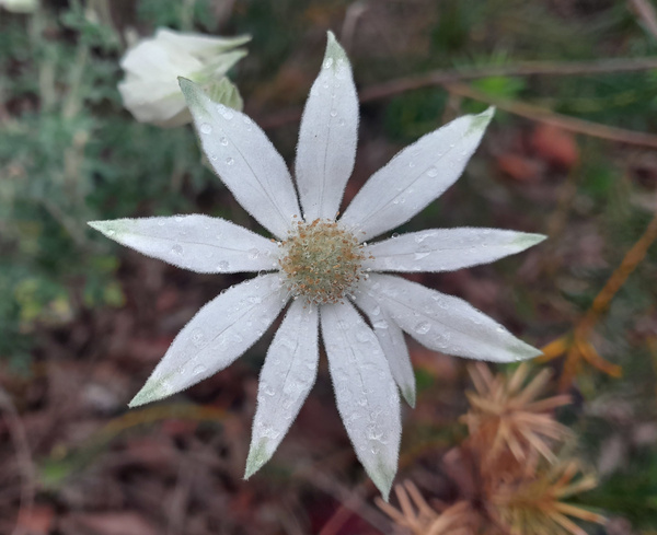
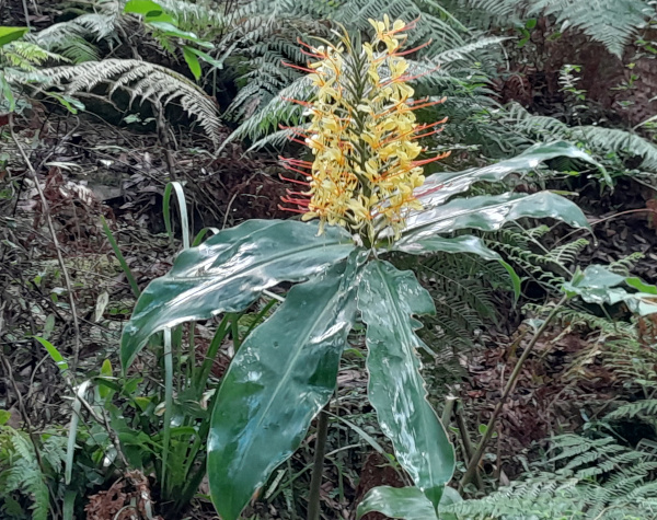
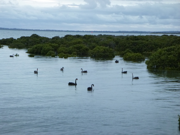
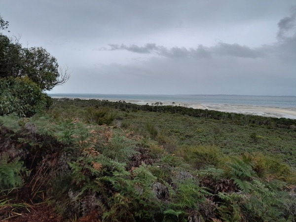
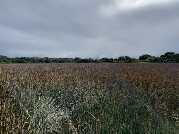
For the first 25 years of my life, I lived within 70km of French island. I visited the surrounding area including the Mornington Peninsula, Phillip Island and various places on the mainland around Westernport Bay quite frequently, but I never ventured onto French Island itself. It always seemed just too isolated to get to. French Island is the largest coastal island of Victoria and is located in Westernport Bay south east of Melbourne, and is isolated by the fact that the only way to get there is by ferry from Phillip Island or Stony Point, or by car barge from Corinella. The island is a similar general shape to the state of Victoria and is home to the French Island National Park which is approximately 11000 hectares in size and covers 2/3rds of the island. The only settlement on the island is Tankerton, a few kms from the Tankerton jetty on the south west corner of the island. The vegetation of the island appears as a vast sea of impenetrable scrub, at first glance, but in fact the flora of the island is very diverse with over 580 different indigenous species including more than 100 native orchids some of which are only found on French Island. There are extensive wetlands in the national park which range from permanent to temporary all of which provide habitat for the local fauna and flora. The island is an unincorporated area directly administered by the government of Victoria, and is a declared locality of Victoria having its own postcode, with 139 residents with an average age of 52 years according to the 2021 census. Community issues are dealt with by the French Island Community Association.
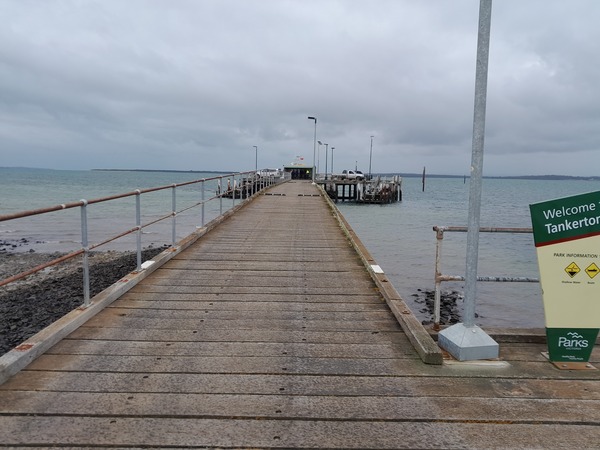
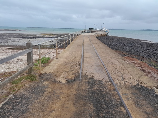
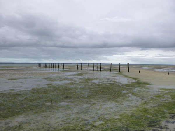
The Tankerton jetty must have had a ‘tramway’ of some sort in the past, as there is a section of rail embedded in the concrete causeway leading up to it. I did a bit of a search on the internet to see if I could find out more about it, but without success. Tramways on jettys were fairly common across Australia, varying in length from the length of the jetty to kms beyond the jetty. Most of them are not used at all today. Obviously the one on Tankerton jetty is not used today either.
The hike from Tankerton jetty to the Fairhaven Campground was under various intensities of rain but not usually heavy, but I got too hot with the raincoat on so I decided to take it off and just put up with the rain for the 5km or so of hike to the Fairhaven campground.
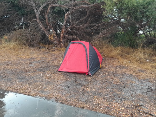
At Fair Haven campground I set up my inner tent and fly under the covered BBQ area due to it still raining, then transplanted the constructed tent a short distance away then quickly got the inflatable bed roll & pillow, and sleeping bag set up in the tent. Then put my backpack in the tent. I managed to minimise the amount of rain that got into the tent, very little rain getting into the tent.
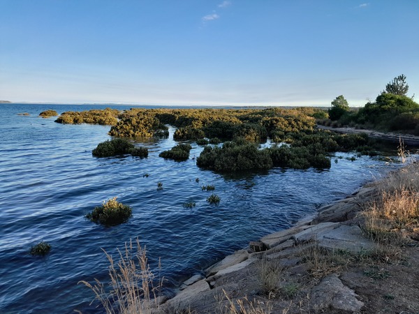
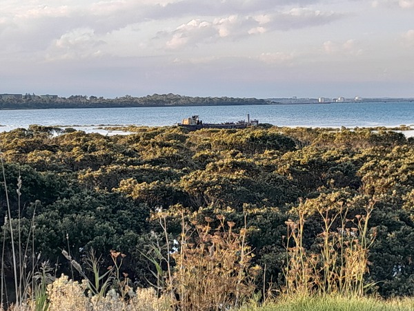
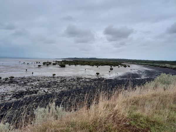
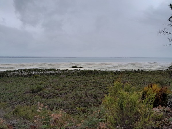
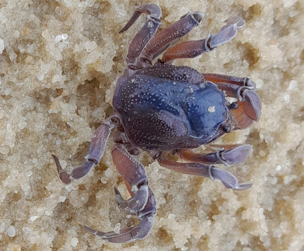
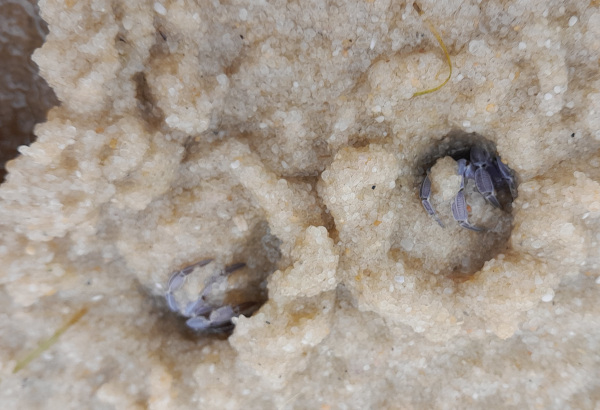
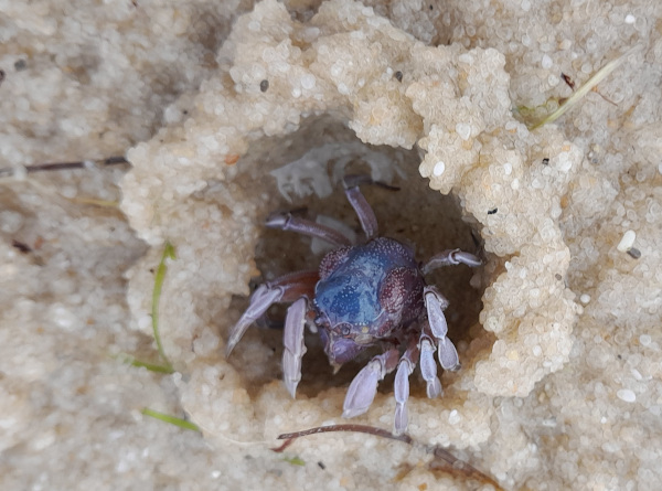
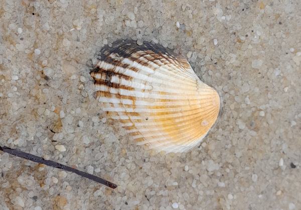
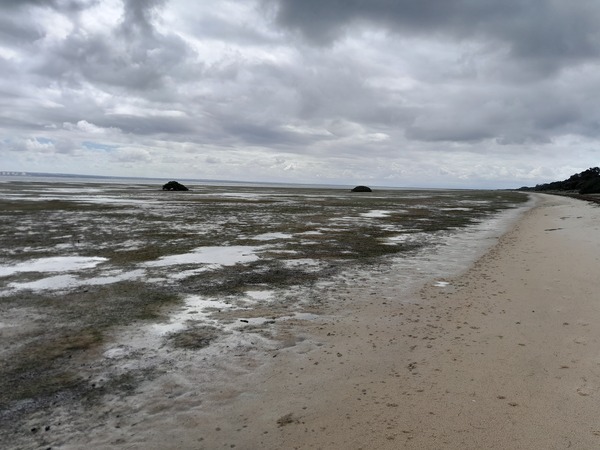
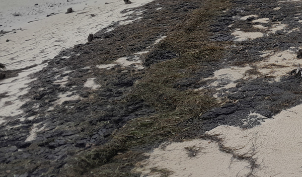
The wind was strong for the rest of the day, with occasional rain. I went for a walk south along the beach from Fairhaven campground. I encountered something I don’t think I’ve ever seen before. There were formations that looked very much like seaside rock, but when I walked on them they were spongey underfoot. Some formations were harder than others and seemed like they were rock at first, but after forcefully digging my foot into them I realised they were spongey too. It seems they were made of plant material, maybe sea grasses washed ashore at high tide, that had been compressed to form a hard almost rock-like formation over time. I also noticed these on the Fairhaven North Beach walk I did later as well. Also on the walk south along the beach, I noticed the beach was pock-marked with little holes. As a walked along I realised what was making them – small blue crabs.
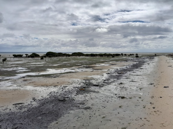
Near the campground, there are the remains of an old pier. Usually when there are remains of old piers in a location, it indicates either the previous existence of a nearby settlement or some type of industry. A search on Trove revealed the following:
- In May 1914, there was a request that “provision should be made on the Estimates for a subsidy of £300 for the extension of Fairhaven jetty” and that “it was stated that the production of the island would be stimulated by the improvement”.
- That there was a “Fairhaven correspondent of the ‘Peninsula Post’ ” in Feb 1916 .
- In May 1919, mention is made of “the choosing of a site for the new Star of Hope school”, the “site decided on by those present was near the Fair-haven jetty“.
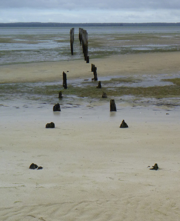
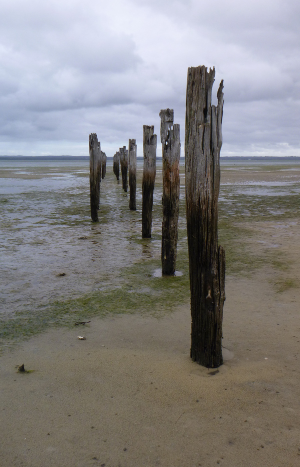
So it seems that even though there are just remains of the jetty at Fairhaven today and no obvious evidence of a settle there, once upon a time Fairhaven jetty, and / or the area around it (suggested by the presence of a school), was of some importance to the island.
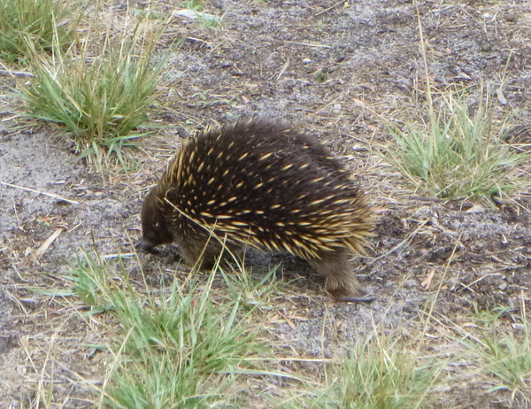
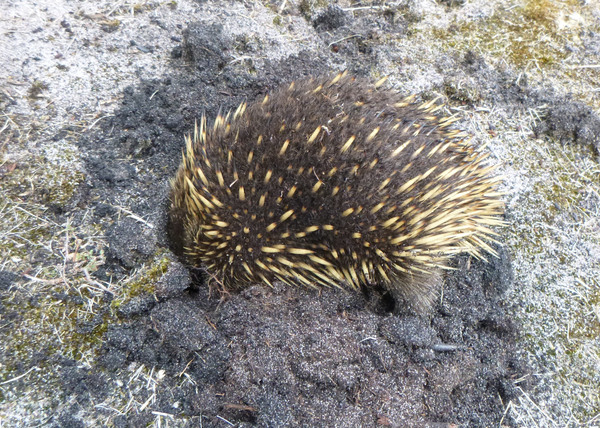
I saw an echidna foraging around the camp-site. It did a big loop around my tent and then headed off towards the beach, I assume to its nest.
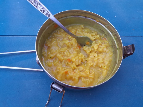
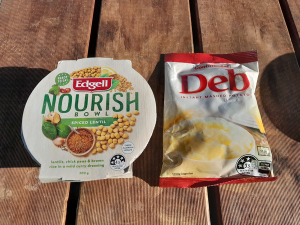
As evening approached I had a hearty evening meal of curried & spiced lentils and chickpeas with Deb instant mashed potato.
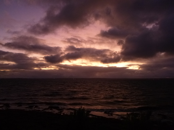
Then I went to the nearby beach to watch the sunset. By about 8pm I was in the tent and bedded down for the night.
30th March 2023
Due to the cold temperatures and blustery winds, I seemed to have developed what I thought was a bit of a head cold. This is not that unusual for me as I seem to be somewhat susceptible to head colds if exposed to cold wind for too long. When deciding on what clothes to take on this adventure I opted for 2 flannelette shirts, a pair of shorts (in case it was warm), long pants, 2 sleeveless vests and a waterproof raincoat. This meant that I had a full change of clothes if one got wet. But in retrospect it might have been better to take one ‘hoodie‘ instead of the 2 sleeveless vests as a hoodie would have been warmer and the raincoat would still have kept the rain off what I was wearing. We live and learn!
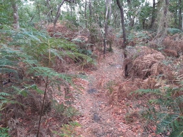
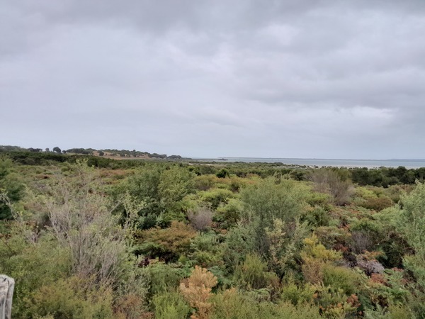
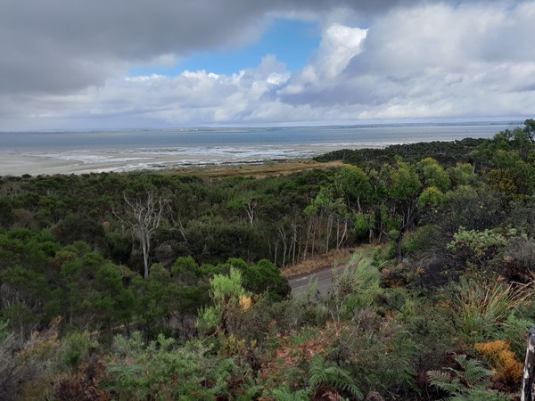
I decided I would do the West Coast Wetlands walk today, which traversed an area where there are a number of swamps, coastal vegetation, and the Pinnacles which is one of the highest elevations on the island. From it there were good views of the island and across Westernport Bay.
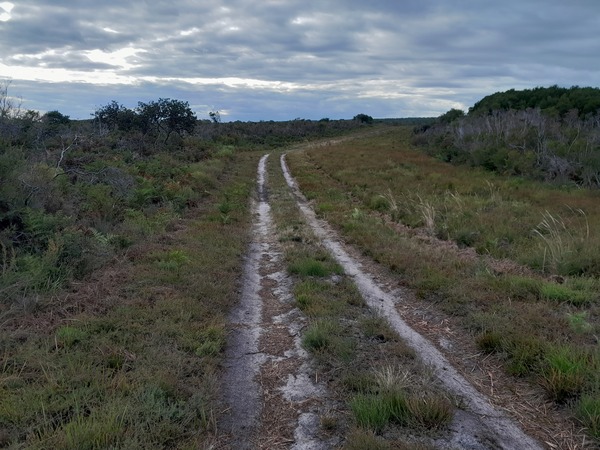
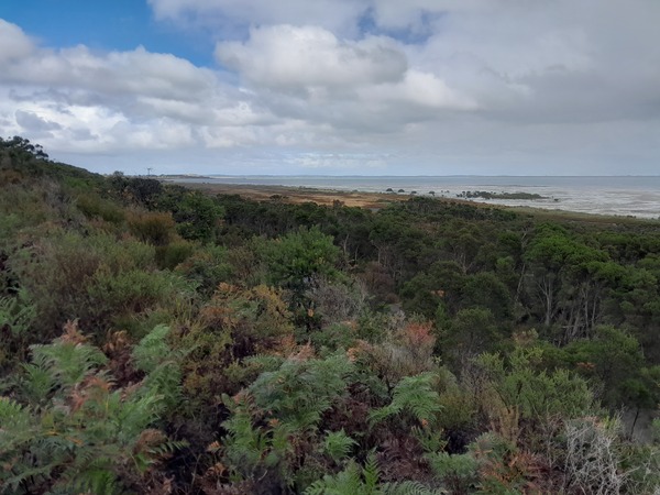
During the walk there were intermittent showers, so I would have my raincoat while it was raining then after the rain stopped I would have to take it off as it was too warm. This helped keep me dry when it rained and not too warm when it wasn’t. I took a detour to try and find Heifer Swamp, but without success. About half of the walk was fairly exposed to the wind, the vegetation being quite short, but there were other sections where the trees were tall providing some protection from the wind and rain. Overall, it was a pleasant walk, through interesting types of scenery that I don’t often get to explore.
In the afternoon I walked north along the beach from the campground. It didn’t rain, but the wind was vicious. It was cold and strong and so I had to rug myself up as best I could to try and keep it off my face and body. This meant I had to wear a raincoat, and as much clothing underneath that I could. But because the hood of the raincoat was really only designed to keep rain out rather than cold winds, my head was somewhat exposed to the elements. This meant the “head cold” was progressively getting worse.
31st March 2023
I slept terribly last night! The “head cold” and especially the associated sore throat was getting worse.
So I made a decision: I would break camp and head over to Stony Point Caravan Park to stay there the weekend then head home on Sunday or Monday. So I booked passage on the ferry for late in the afternoon, then packed up camp.
I hiked to Tankerton jetty and managed to get a much earlier ferry, and so I decided to try to get home by that night instead of staying at Stony Point over the weekend. But there was no practical way to do that so I booked a ticket on a bus from Southern Cross to Kyabram, Victoria to stay with Zoe, our oldest daughter. The plan was to stay there over weekend then travel the rest of the way home on Monday. Once I got to Zoe’s, she insisted I take a COVID RAT test as she is a nurse and needed to know whether she needed to test herself and take other precautions as well, as the symptoms of what I thought was a head cold could also mean I had COVID. And sure enough, it returned a positive result! For COVID that is.
QUARANTINE
1st – 9th April 2023
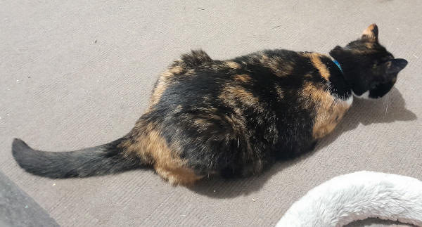
From 31st March to 6th April I was under quarantine at Zoe’s house, nursing a sore throat, a runny nose, and mostly watching TV when I wasn’t sleeping. Zoe’s cat, who I began to call ‘el gato’ (Spanish for “The Cat”), seemed to get somewhat used to me over those days or quarantine even sitting next to me on the couch.
After a few days the sore throat and runny nose started to lessen and by the end of the quarantine period I was feeling ok again, albeit with lower than usual energy levels. On the 7th April, after my quarantine had ended, Rebecca arrived on her way to Adelaide for a few days to attend the graduation of her ‘study-buddies’, which was the next portion of my annual leave. This meant a long journey (6+ hours) from Kyabram, Victoria, to Adelaide, South Australia. But at least we were able to stay with some friends a few hours from Kyabram, which broke the journey into two shorter sections. We arrived in Adelaide the afternoon of the 10th.
ADELAIDE
11th – 14th April
The main reason why we went to Adelaide was to attend the graduation of Rebecca’s study buddies, but that didn’t mean we didn’t do other things. The caravan park we stayed at was right next to the Torrens River Linear Park, which is a 30km linear park following the Torrens River between West Beach past Adelaide CBD to Athelstone and has various shared trails along it’s length. So a few of the mornings we were staying there I went for a walk in the morning before breakfast. One morning I walked in a north easterly direction, and the other in a south westerly direction towards Adelaide CBD.
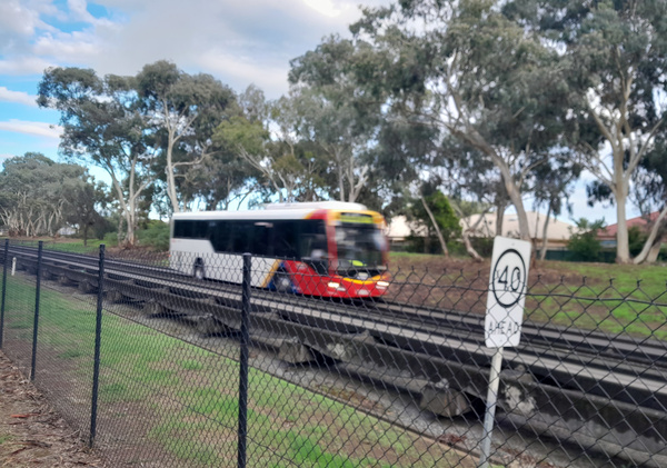
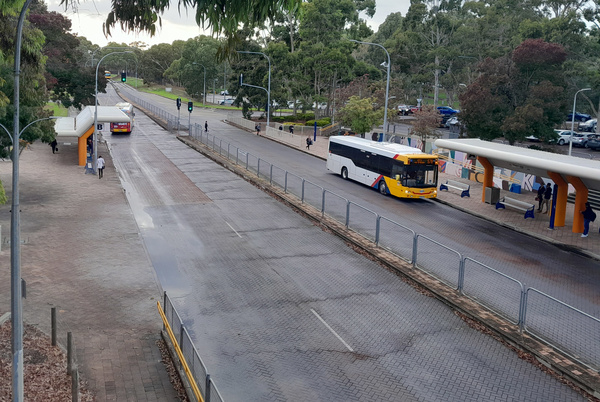
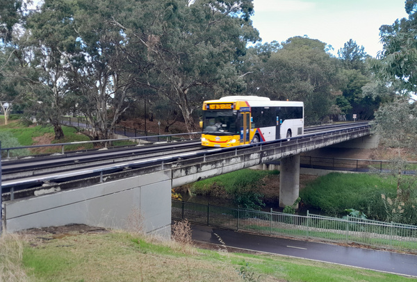
While on one of those walks I saw the O-Bahn, a bus-based mass transit system whose buses operate mostly on a dedicated roadway for most of their route distance. I had heard of this system before, but had never seen it in person or in operation. One thing that impressed me was how frequent the buses were (it was in peak hour when I saw it) – a bus or two in each direction approximately every minute. And it was quiet! Apart from a little engine noise from the buses themselves, there was not much other sound eminating from it. This is probably because the dedicated roadway used by the buses was of raised concrete road sections resting on what could be best described as concrete “sleepers” or pylons. There were apparently environmental reasons why this O-Bahn system was chosen instead of a railway along that route.
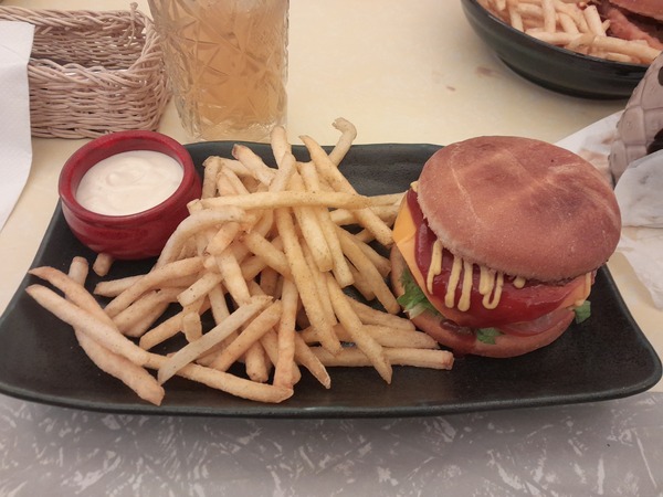
Over the few days we were in Adelaide, we spend some time in central Adelaide. At Rundle Mall, a mall designed for walking rather than vehicle traffic in the CBD, we explored the mall including some book shops. I’m a bit of a sucker for buying books (whether new or second hand), and I purchased two that particularly took my interest: one called “New Rome” (a history of the Roman Empire in the east between AD 395 and 700) and “Aelfreds Britain” (about war and peace in the Viking age). We also had a meal with Rebecca’s “study-buddies” at a cafe called “Two-Bit Villians” where vegan meals seem to be a bit of speciality. I had a “Macken Sleeze” burger which is described in their menu as “a crumbed patty of our famous Mac and Cheese, sliced cheese, lettuce, tomato, tomato sauce, mustard and pickles”.
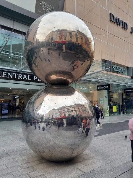
Apparently the Rundle Mall has balls, apparently somewhat affectionately referred to as “Mall’s Balls” by some! Don’t ask me to explain that, except by the photo below.
We also visited the Adelaide Public Gallery, wandering around the various art exhibits. Overall, a very pleasant way to spend a few hours.
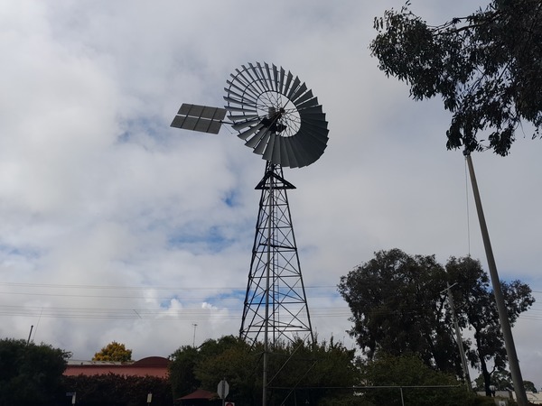
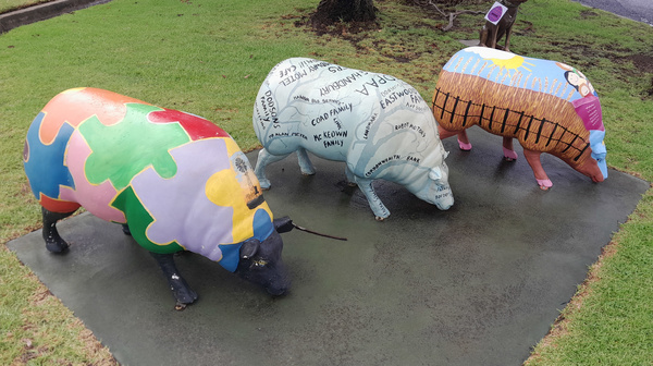
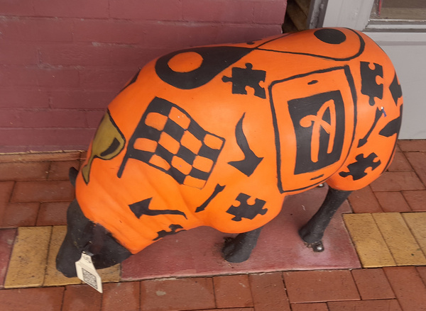
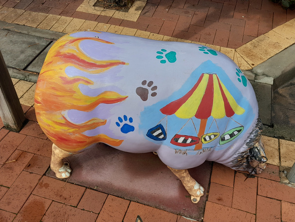
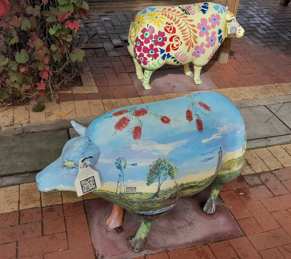
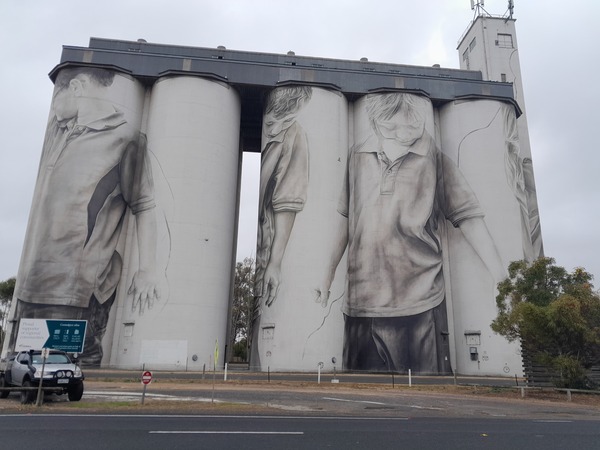
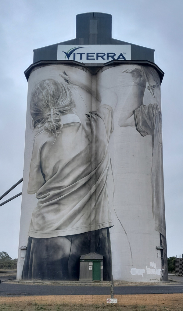
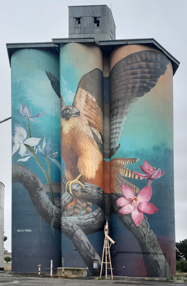
On the 13th April, very early in the morning (about 6am), we left Adelaide and headed towards home, driving up into the Adelaide Hills on the freeway towards Murray Bridge and Tailem Bend, then towards Kyabram. Along the way we stopped at Coonalpyn, South Australia and Kaniva, Victoria to have a rest from traveling, for a toilet stop, to visit acquaintances and / or to look at a tourist attraction. The attractions we saw in those towns included painted silos, painted sheep statues, and a very large windmill. We stayed overnight at Kyabram, then the next morning we travelled the rest of the way home, arriving mid-morning.
By this time my annual leave was effectively over. Two weeks of exploring and a week of COVID-induced quarantine being the best way to summarise it.
You May Also Like
2 Comments
Mum
Another very interesting write-up, James.
Sandra Glew
Hi James,
Your trip to Sydney & Adelaide sounded interesting, I can’t get over th OBahn, looks like a good idea that Vic could use.
Is the French Island Prision still there or has it been pulled down? Lovely photos of the Echidnas.
Good that you didn’t get any blisters this time, good idea to have the bandaids under your feet, they should have helped a lot.
Bye for now
Sandy