Merimbula Marital Moments
As parents, Rebecca and I haven’t had more than a few days at a time away together from our children that were still young enough to be living at home with us. Now that Eliana is 16 years old, and thinks we have “parent germs”, and no longer wants to go on holidays with us, we had the opportunity to spent a full week away, just the two of us, on a “second honeymoon”. It’s been 26 years since the first one, so we were well and truly due for the 2nd one. With the Covid-19 virus still being a concern, and the possibility of snap lockdowns and border closures always possible, we decided to stay within New South Wales, the state where we live. Originally, the plan was to do an outback New South Wales loop through Nyngan, Broken Hill and Wentworth. But Rebecca chose to go to Merimbula, on the south coast, instead. As it turned out, that was a better idea as there were potential Covid-19 exposure sites where we were originally planning to go!
14th June.
After saying farewell to Eliana at home, we commenced our journey to Merimbula. We were booked into the Country Inn at Murrumbateman for 14th to 15 June. After an uneventful journey to Murrumbateman, checking in, and an evening meal of a Veggie Burger and chips for me and a Vegetarian Rissotto for Bec at the restaurant next to our accommodation, we spent some time relaxing watching the TV in our room.
15th June
After a really nice sleep in with my Beloved, I went for a morning walk around Murrumbateman. Not a particularly spectacular walk as it was foggy and so the views of the surrounding area were well and truly hidden. At one point in the walk on the way back to our accommodation I was a bit disorientated (maybe because of the fog?) and started walking away from the township, but after a quick look at Google Maps I realised my mistake and headed in the right direction.
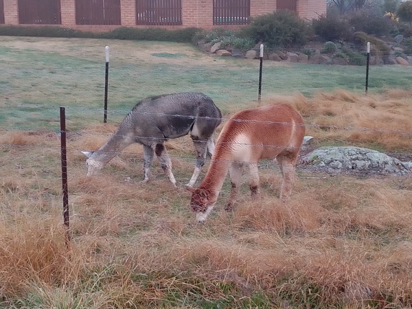
A pair of alpacas on the outskirts of Murrumbateman 
Fog at Murrumbateman
After 2 cups of home blended muesli soaked in almond milk eaten with a teaspoon, because there was no bowls or large spoons in the room, we commenced our second day’s journey. Today the plan was to get to Merimbula, via Bungendore, Braidwood and Batemans Bay.
Braidwood
Braidwood is a town in the Southern Tablelands area of New South Wales. It is located on the Kings Highway which links Canberra with Batemans Bay on the coast. It is approximately 200 kilometres south west of Sydney, 60 kilometres inland from the coast, and 55km from Canberra. The town is a service town for the surrounding agricultural district which is mostly comprised of sheep and cattle grazing, and forestry operations. European explorers reached the district in 1822 and the town was surveyed in 1839. The town is located near the headwaters of the Shoalhaven River which winds it way through the mountains to eventually flow into the Tasman Sea at Shoalhaven Heads near Nowra. The Braidwood settlement was built with convict labour, and many of the buildings they built in the region are still standing today.

Historic building, Braidwood 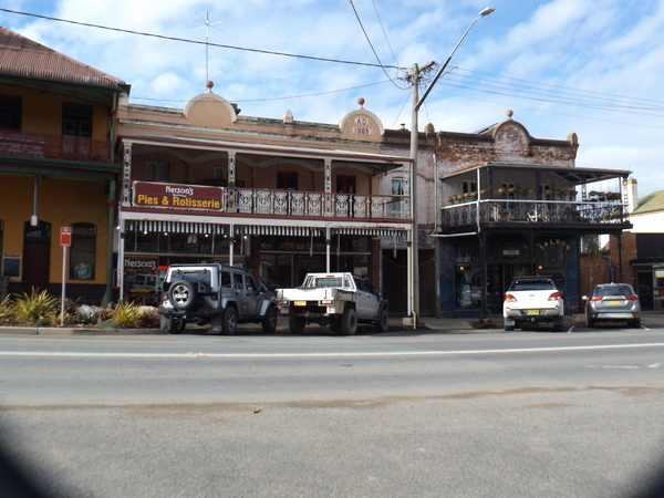
Historic building. Braidwood 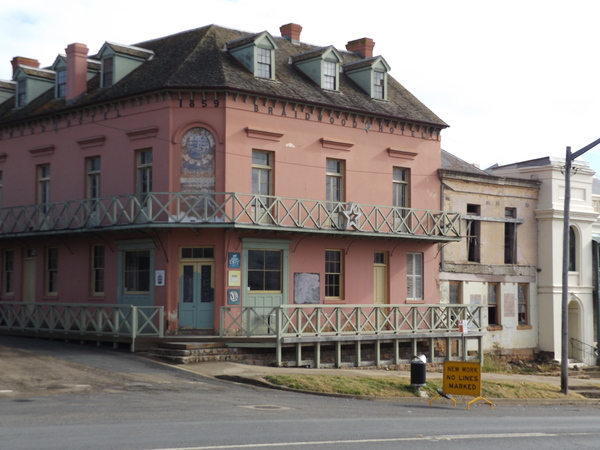
A historic hotel, Braidwood 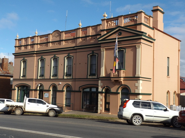
Literary Institute, Braidwood 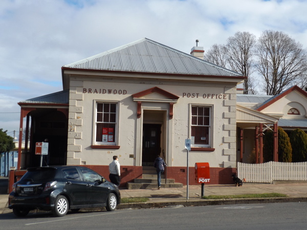
Historic Post Office, Braidwood
The town was named after Dr Thomas Braidwood Wilson who had been a surgeon-superintendent of ships taking convicts to New South Wales and Van Diemen’s Land (now Tasmania). He was first granted land in Van Diemen’s Land in 1824, which he exchanged for land near Lake George in 1825. He became a community leader and was involved in the building of Braidwood’s first courthouse in 1837-38. In 1840 he petitioned the government to build a road from Braidwood to Jervis Bay to enable faster and cheaper shipping of the wool clip to Sydney and, with Col. John Mackenzie, supplied the materials and labour for the Braidwood to Nerriga section. Wilson was sent bankrupt due to a drought in the late 1830s and the following depression, and he died in November 1843. He was buried on a block of land to the north of the town, high on the hill overlooking the town.
Gold was discovered in the Braidwood area in 1851, and for the next two decades the population of the district increased to about 10,000. Supplies and produce to support those on the Braidwood gold fields came from as far away as what would later be the Canberra region. The prosperity of the gold rush lasted for several years, during which time some substantial commercial buildings including banks and hotels were constructed.
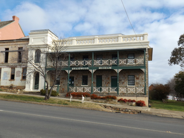
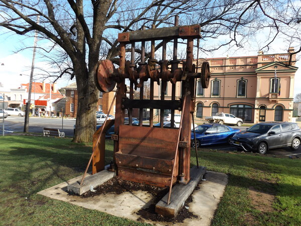
Museum, Braidwood 
Albion Hotel, Braidwood 
Commercial Bank, Braidwood
Through much of the 20th century, Braidwood was essentially in rural recession. Very little building work was carried out, and because of this the town entered the 21st century with much of its original streetscape and historic architecture intact. Following a period of unpleasant dispute between the historically minded who wished to preserve the town’s history and charm and those wishing to develop it, in March 2006 the town and its setting were listed on the NSW State Heritage Register. Braidwood is located equal distance (approximately 40km) from Bungendore and Tarago railway stations on the Goulburn – Canberra railway line.
Clyde Mountain & Nelligen
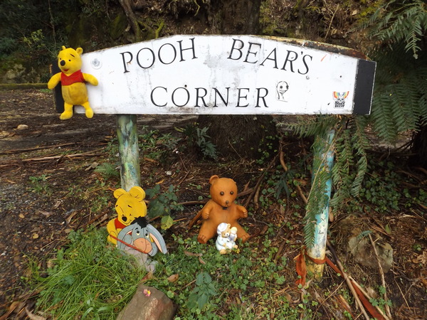
A while out of Braidwood, near Clyde Mountain, we happened upon Pooh Bears Corner. And what did we behold there but Pooh bear and his friends, and a few ring-ins. Whether that was the name of the corner before the Pooh bear and friends were deposited there I don’t know. But it was an interesting place to stop for a few minutes. The question has to be asked “what came first, the name ‘Pooh Bears Corner’ or the Pooh bear”.

Nelligen
Nelligen is a small town nestled in the Clyde River valley about 10 minutes from Bateman’s Bay. When we drove through it seemed a somewhat sleepy and pleasantly quiet small town, as many small country towns are. The town is the location of the “Bushranger Tree”, a large tree that the Clarke Gang, a group of bushrangers who terrorised the area between Braidwood and the coast, were reportedly chained to while the police awaited them being moved to Sydney for execution.

Clyde River, Nelligen 
Bushranger’s Tree, Nelligen 
Nelligen Mechanics Institute
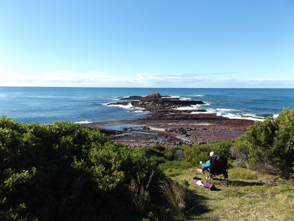
Batemans Bay
At Batemans Bay we stopped for a while so Rebecca could acquire some midday sustenance (ie, lunch). Since the last time we travelled through Batemans Bay (when we lived at Nowra) the old steel bridge with a raising section in the middle to allow ships to pass up stream has been replaced with a new higher all-concrete bridge. Some remnants of the old raising bridge still remained, but I’m guessing it won’t be long and those old sections will be entirely removed from the river.
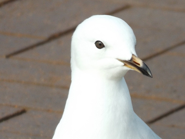
Seagul close-up 
Islands at the entrance to the inlet at Batemans Bay 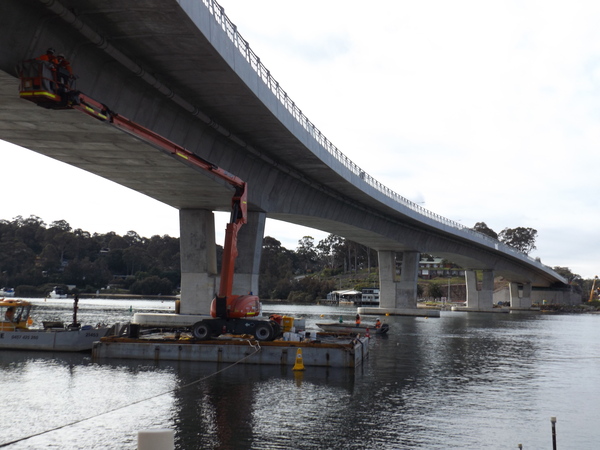
New bridge, Batemans Bay 
Old bridge, Batemans Bay
We arrived at Merimbula mid to late afternoon, and proceeded to the Information Centre to get some ideas of what there is to do in the area. Then it was time to book into our accommodation, and some time to relax.
16th June
The weather forecast for the rest of the week was for patches of wet weather so we decided we would get in as much ‘fair weather’ activities in the today and the next few days as possible so that if the weather turned too wet we would at least have visited some of the outdoor sights. After my morning walk and our breakfast, we headed west into the mountain ranges towards Bombala. The plan was to do the the Goodenia Rainforest Walk, visit the Myanba Creek and Gorge, and then travel to Eden before heading back to Merimbula.
Goodenia Rainforest Walk
This is a short somewhat steep but pleasant walk, in part of the cool temperate rainforest in the South East Forests National Park between Bombala and the coast. Apparently, cool temperate rainforest is unique to the area, not being found anywhere else in the state. The rainforest is the home of the Superb Lyrebird and the Eastern Whipbird. I don’t think we heard any of those two types of birds, but we heard a lot of what I called “Bell Birds” (I don’t know if that’s their actual name) with their characteristic bell-like call. On the walk, we came across what I think is probably the biggest fungus I’ve ever seen.

Goodenia Rainforest – Moss 
Goodenia Rainforest 
Goodenia Rainforest – Track 
Goodenia Rainforest – looking through canopy 
Goodenia Rainforest 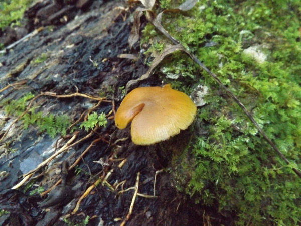
Goodenia Rainforest – Fungus 
Goodenia Rainforest – Fungus 
Goodenia Rainforest – Very Large Fungus 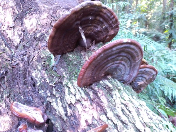
Goodenia Rainforest – Very Large Fungus 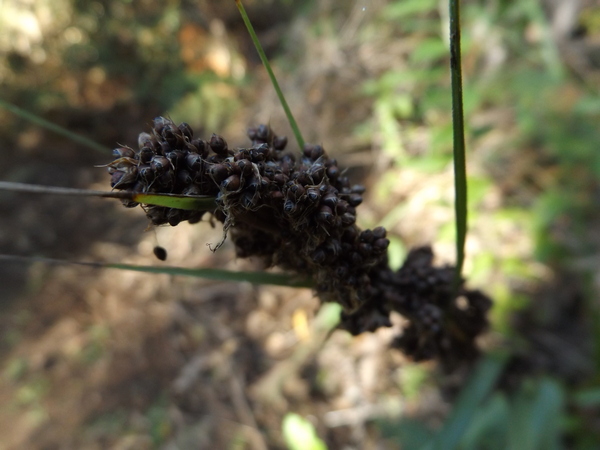
Goodenia Rainforest – Seeds
After we finished there, we headed towards the Myanba Creek & Gorge. We got to within 1km of there and we encountered a ‘road closed’ sign. Well, that was a disappointment! The NPWS website said it was open, but the sign across the road said otherwise. So we turned around and started heading back towards Merimbula. When we got back to the Mt Darragh road (effectively the ‘main’ road between Merimbula and Bombala, we consulted the coloured cartigraph, and noticed Myrtle Mountain Lookout and Wolumla Peak and decided we would try to reach one or both of those.
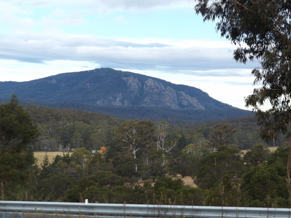
We passed through Wyndham, turning left onto Myrtle Mountain Road soon after, and soon we arrived at Myrtle Mountain. The view from the lookout was rather good, although it was a somewhat narrow view, the cleared area for the lookout being framed by tall trees. But a view is a view, and it was worth the detour. While there we noticed a station wagon, in a very disorganised state. It looked like they had camped there, which is forbidden. Maybe the ‘security camera’ advertised at the entrance to the lookout will be consulted by the authorities and the occupants of the station wagon chided for their disobedience. But then, maybe not.
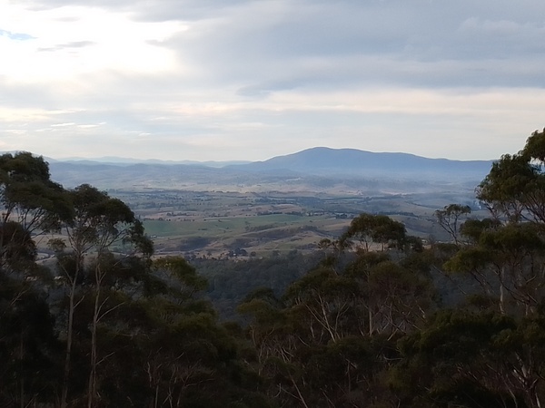
Myrtle Mountain View 
Myrtle Mountain View
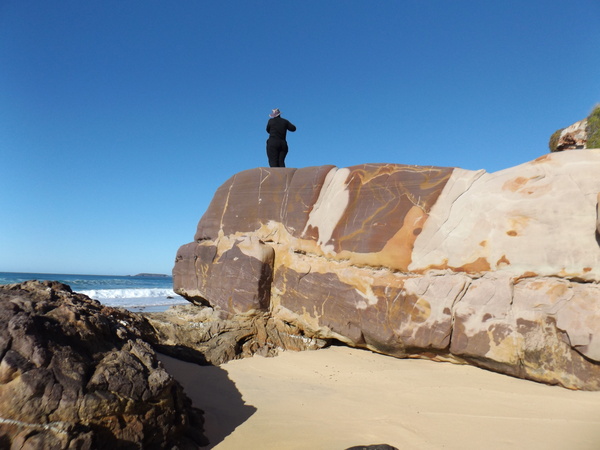
Due to the length of walk to the Wolumla Peak, we decided not to visit there but instead go to Pambula Beach and have a look around the Pambula River inlet for a while.
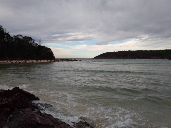
Pambula River looking towards the sea 
Red rocks, Pambula River 
Yellow speckled rocks, Pambula River 
Pock marked rocks, Pambula River 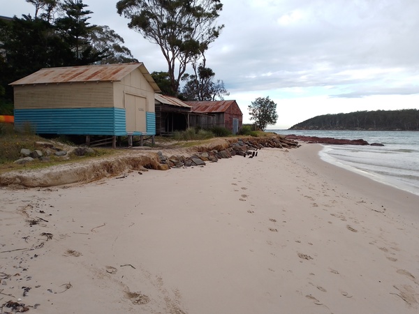
Boat(?) sheds, Pambula River
As it turned out, we would also visit this part of Pambula Beach again later in our holiday (see 20th June section) when we did the Pambula River Walk. After a look around there, Rebecca got a phone call from Zoe our oldest daughter, and so while they had a chin-wag I decided to walk from Pambula Beach township to our accommodation at Merimbula along the Merimbula Beach, a distance of about 6km. I figured by the time I got there Rebecca and Zoe would have finished their phone call and Rebecca would be back at our accommodation waiting patiently for me.

Beach looking towards Long Point 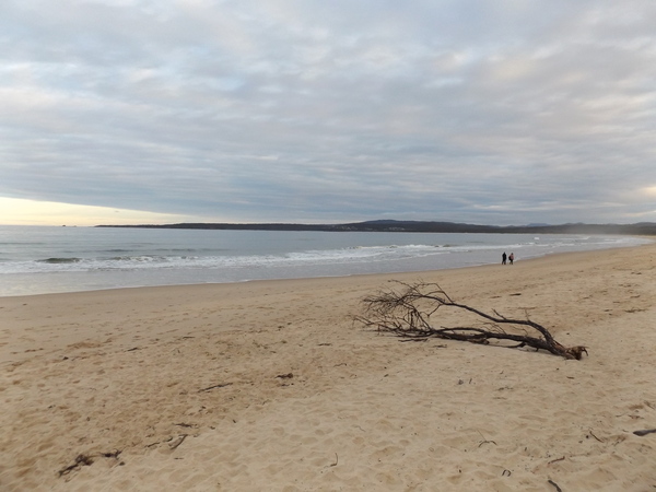
Merimbula Beach 
Beach looking towards Pambula
17th June
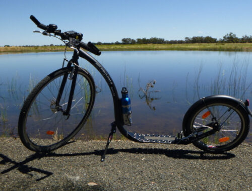
Today I got up earlier than my Beloved, and went for an almost 20km Kickbike ride to Pambula Beach and Panboola Wetlands. The wetlands certainly lived up to it’s name. In one place the trail was covered in water. I thought “oh, it doesn’t look that deep, I could probably get through without getting wet.” The water over the trail was deeper than I thought, and I couldn’t get through the water without putting my foot down to kick further. Seeing how my feet were getting wet, I decided to stop (yes, in the middle of the water, more or less) so I could turn around. That meant my feet got even wetter! By the time I got back to the dryer section of trail, my feet were soaked. Mental note to self: don’t try riding through long puddles across trails on a Kickbike – feet will get wet!

Kickbike at Panboola Wetlands, Pambula
I got back to our accommodation ok, albeit with wet feet, and removed my soaking shoes and placed them under the heater to try to dry them out.
After some breakfast, we decided to visit the Potoroo Palace, a small but friendly animal sanctuary about 10km out of Merimbula heading towards Bega. Some of the animals in the Potoroo Palace seemed to be ‘wild’ (that is, having free reign of the place), while others were housed in enclosures. The bird life in and out of the enclosures was very colourful.

Parrot 
Cape Barren Goose 
Eclectus Parrot (Male) 
Eclectus Parrot (Female) 
Gang Gang Cockatoo 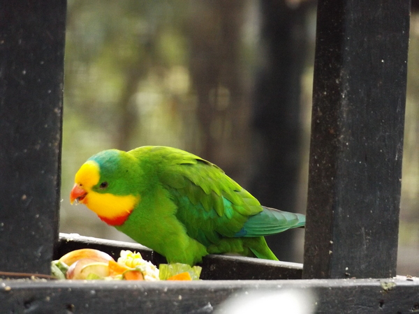
Parrot
One highlight for me was the quolls and potoroos, as I don’t think I have ever seen those up close before except in videos or photos.

Agile Wallaby 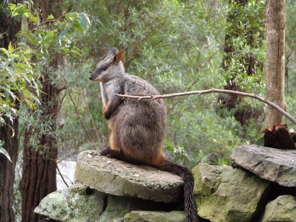
Brush-tailed RockWallaby 
Dingo 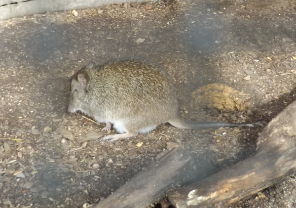
Long-nosed Potoroo 
Tiger Quoll
From there, we continued north to Bega, then east to Tathra. At Tathra we explored the Tathra Headland Memorial Gardens and Tathra Pier.
Tathra headlands walk 
Tathra headlands walk 
Tathra headlands 
Tathra Wharf 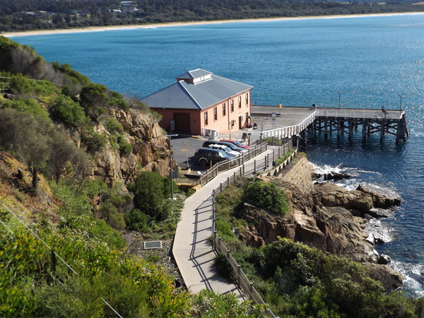
Tathra Wharf
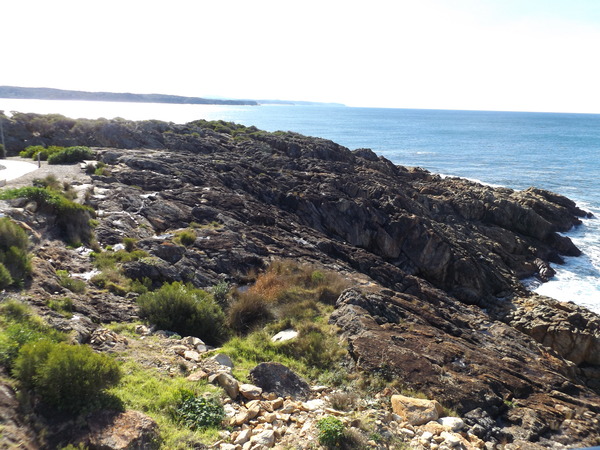
From Tathra, we headed north hoping to visit the Mimosa Rocks. As we drove towards there, we saw ‘road closed’ signs to some other features within the Mimosa Rocks National Park. That didn’t seem to bode well. Maybe we would get to Mimosa Rocks and discover it was closed like the Myanba Gorge was yesterday. We got to the Arugunna Beach Road, and turned into it. There was no ‘road closed’ signs, thankfully. We found the car park for the Mimosa Rocks, and proceeded along the boardwalk, exploring the various features there.

Mimosa Rocks 
Island, Mimosa Rocks 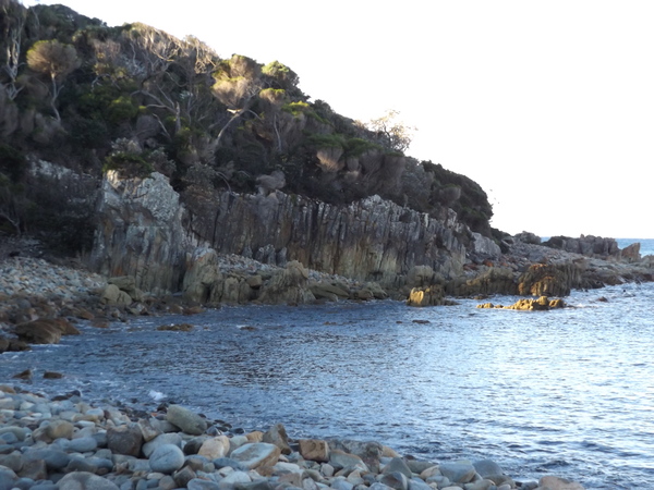
Mimosa Rocks 
Vertical rocks, Mimosa Rocks 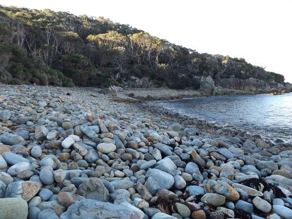
Rocky ‘beach’, Mimosa Rocks 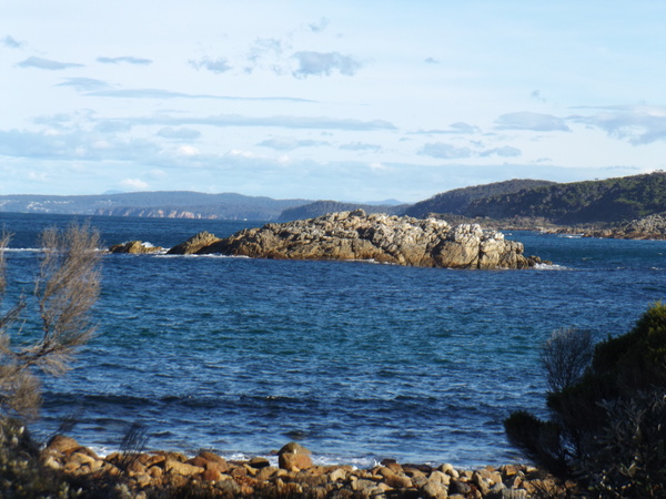
Rocks in the bay, Mimosa Rocks 
Aboriginal shell midden, Mimosa Rocks
The Mimosa Rocks and the larger National Park in which the rocks are located is named after the steamer the SS Mimosa which struck rocks north of Aragunnu Beach.

Arugunna Beach, Mimosa Rocks National Park
The Wreck of the SS Mimosa
Having 38 passengers aboard, the SS Mimosa left Merimbula, mid-afternoon on 18 September 1863 heading for Sydney. The steamer struck unchartered rocks 17 Km north of Tathra and one mile offshore. After striking the rocks the Mimosa floated free. However, the vessel was in trouble and began to settle in the water at the bow end. A few minutes later the captain, Captain Keft, abandoned ship and most of the passengers evacuated to the life boats. The steamer quickly settled in the water and sank as the boats pulled away. Two of the steerage passengers, Mr and Mrs Ivell, were unaccounted for. Their bodies were recovered a few weeks later. The Illawarra Steamers Navigation Company, which owned the ship, attempted to raise her but with little success. The hole in the rear was too large and since sinking sand had entered the hull which made recovery impossible. The SS Mimosa is one of the earliest paddle steam shipwrecks on the NSW south coast. it and other vessels like it played an important role in the development of trade along the NSW south coast. The Mimosa’s engine is an early example of a marine trunk engine.
Mogareeka Inlet (Bega River), near Tathra
After we had finished exploring there, we drove back towards Merimbula. We decided that we would stop at Tura Beach, and have our evening meal on the beach. So we went to the supermarket there and got a few groceries, then to the Kebab take away in the same shopping centre, and headed to the beach. After depositing ourselves on the beach, we ate our meal while watching the the sunset reflecting as pastel pinks and reds in the clouds out at sea to the east.

Turra beach at Sunset 
Turra Beach at Sunset 
Turra beach at Sunset
18th June
After I went for a nice 7km walk and we had finished our breakfast, we decided we would visit the Merimbula Aquarium. At the time we visited there, the rain hadn’t really arrived, except for the occasional ‘spit’ from the sky. After we had finished there, the temperature had warmed up a bit and it was quite pleasant outside, except for a blustery wind.

Merimbula Aquarium 
Merimbula Aquarium 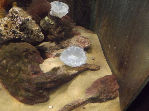
Merimbula Aquarium 
Merimbula Aquarium 
Merimbula Aquarium 
Merimbula Aquarium 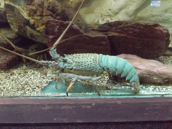
Merimbula Aquarium 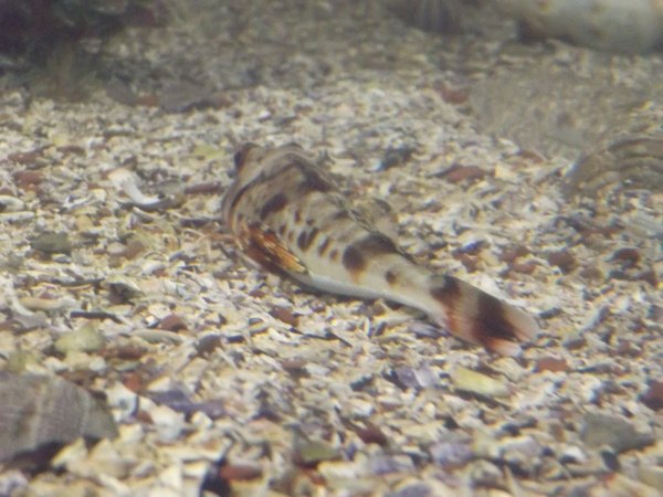
Merimbula Aquarium 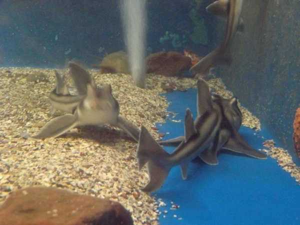
Merimbula Aquarium 
Merimbula Aquarium 
Merimbula Aquarium
When we visited the Information Centre on Tuesday upon arrival at Merimbula, one of the staff there said that if the weather was windy or stormy buying it was nice to buy some hot chips and sit in the car watching the waves at Short Point on the north east edge of the township. When the rains looked like they were going to set in, Rebecca wanted some hot chips so we could go to Short Point and eat hot chips while watching the waves. So we purchased said chips, after a quick visit to a craft shop and second hand book store, and then headed to Short Point. And we watched the waves, in the car while rain lashed the car.
Then we headed back to our accommodation.
19th June
After a late breakfast, and a time of Bible study with Rebecca, I decided I wanted to explore some of the natural features around Merimbula that I hadn’t already seen. Over the course of a few hours, I walked 13km, visiting Long Point, Middle Beach and Short Point. Most of the time I was on the walk there was a fairly strong wind, and it was particularly evident on the 3 places mentioned, where the surf was strong with large waves and lots of salt spray, some it reaching me a considerable distance from the water.
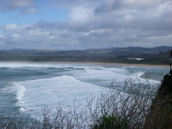
Waves south of Long Point, Merimbula 
Long Point, Merimbula 
Waves at Middle beach, Merimbula 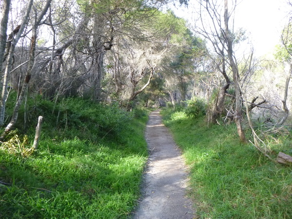
Long Point walking track, Merimbula
There was a strong wind and damaging surf warning in effect for NSW coasts between Newcastle and south of Merimbula. The ferocity of the waves at Short Point was very noticable compared with our visit there yesterday.

Waves, Short Point, Merimbula 
Waves, Short Point, Merimbula 
Waves, Short Point, Merimbula 
Back Lagoon, Merimbula / Tura Beach
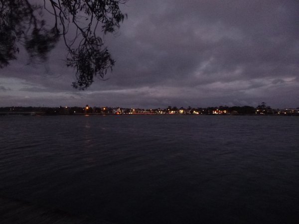
Later, as sunset approached, we went for a walk along the Boardwalk that follows the north side of Lake Merimbula. The tide was in, and the boardwalk had the feel of floating above the water.
Fish Pen area lights at Sunset 
Boardwalk, Merimbula Lake 
Merimbula Lake 
Rebecca 
Merimbula Lake reflections
20th June
After me spending an hour or so kickbiking, exploring some of the forest trails between Merimbula and Pambula Beach, we went to a Sunday market that was just up the road near our accommodation near the Merimbula Beach. We spent a good hour or so there, looking at the various stalls. Rebecca purchased a organic vegan face mask, and a medicinal Tumeric based powder to try to combat the inflammation and muscle pain she has.

A sandy track I explored on the Kickbike in the bush between Merimbula and Pambula 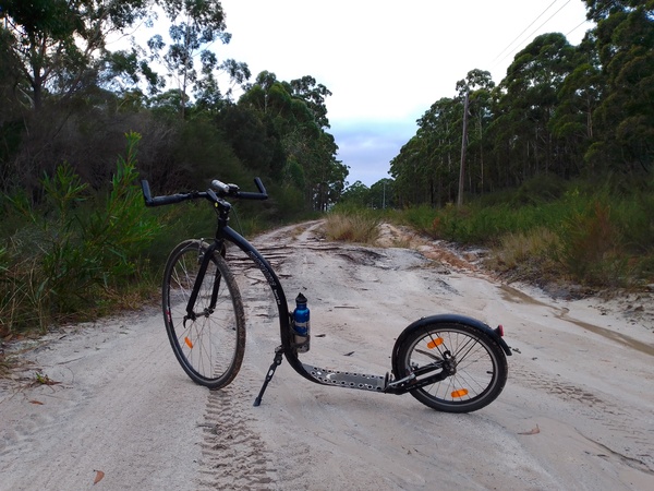
Kicking in the bush between Merimbula and Pambula
The museum in the old school house opened at 1:30pm, so between the time it opened and us finishing at the market we spent some time at one of the many small beaches. While there, we got up close to some pelicans. As we got quite close to one of them it was the first time I had seem how tall they actually are, being not much shorter than me. We watched as more of them arrived, forming an increasingly large pod (thats what a group of pelicans is apparently called, but they are also called a squadron, a pouch, a scoop, or a fleet) of those very large birds.

Spenser Beach, Merimbula 
Pelican, Spenser Beach, Merimbula
When it was time for the museum to open, we made our way there and spent a good hour or two there reading up on the history of the Merimbula area, and viewing the various historic artifacts on display. The displays included a boat listed with the national trust, history of the extraction of gold from Pambula, and various shipping and maritime related displays. It was interesting to read about attempts to grow wheat, which didn’t go too well due to the soil conditions. Later maize was tried and it was so successful that a factory was set up to process the maize locally.

Oyster Catchers Plate, Merimbula Schoolhouse Museum 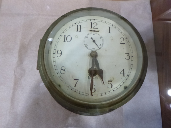
Clock from the ship Empire Gladstone 
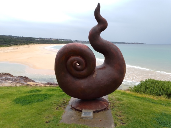
Tibor Szery Sculpture, Schoolhouse Museum, Merimbula 
Tibor Szery Sculpture, Schoolhouse Museum, Merimbula 
Oyster Punt, Schoolhouse Museum, Merimbula 
Historic machinery, Schoolhouse Museum, Merimbula 
Old schoolhouse, now museum, Merimbula.
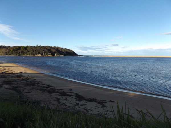
After we had finished at the museum, we decided we would go and have a look at the Yellow Pinch Dam, which apparently is the main water supply for the area, but alas the access road to the dam was closed. so we went to Pambula Beach instead and walked the Pambula River Walk, which is about 1km long and ends with a viewing platform overlooking the Pambula River.

Pambula River walking track, Lookout 
Pambula River walking track, Lookout 
Pambula River walking track, Rebecca 
Pambula River walking track, Inlet 
Pambula River walking track, Flowers 
Pambula River walking track, Fungus
Then we went to another lookout on the same walk at the Pambula River mouth, overlooking the Ben Boyd National Park on the opposite bank, and with views towards Pambula beach and Merimbula.

Pambula River mouth, and Ben Boyd National park on the other side of the river 
Looking towards Merimbula from Pambula River Mouth Lookout
As it was about time for our evening meal, we then went to Tura Beach shopping centre where we knew we could buy gluten free vegan pizzas. After purchasing said items, we went back to our accommodation and enjoyed our acquisitions.
21st June
No bike ride, or morning walk, today even though the weather was glorious with sunny skies and few clouds.
Today we visited Ben Boyd National Park north and south of Eden. This National Park is quite large and has lot to see and do, although a number of the things to see involve some physical exertion. The Pinnacles and Quondola beach walks start from the same car park, so we did both of them as one walk. The Pinnacles formation is a spectacular erosion feature that is made up of cliffs of soft white sands compressed and capped with a layer of red clay. I remember similar formations south of Adelaide (South Australia) when we visited there a few years ago.

Very lumpy tree, The Pinnacles walk, Ben Boyd National Park 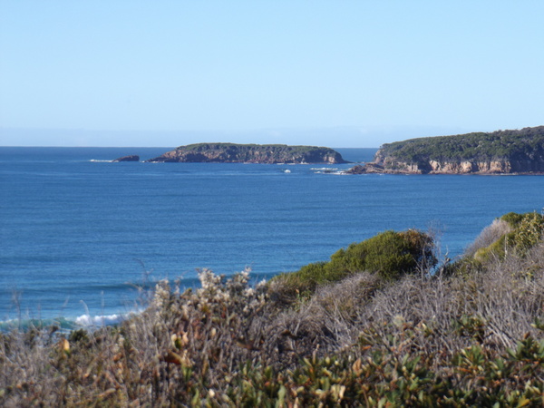
Looking south on the Pinnacles walk, Ben Boyd National Park 
Native flower, Ben Boyd National Park 
The Pinnacles formation, Ben Boyd National Park
Quoundola Beach is not far from the Pinnacles, and is accessed by a trail that is gently downhill for a way, then a steep section to access the beach. As the trail gets closer to the beach, the trees give way to low shrubs which allows a great view of the beach. On the beach itself there are some interesting rocks formations.
Rocks, Quoundola Beach, Ben Boyd National Park 
Rocks, Quoundola Beach, Ben Boyd National Park 
Rocks, Quoundola Beach, Ben Boyd National Park 
Snail, Quoundola Beach, Ben Boyd National Park 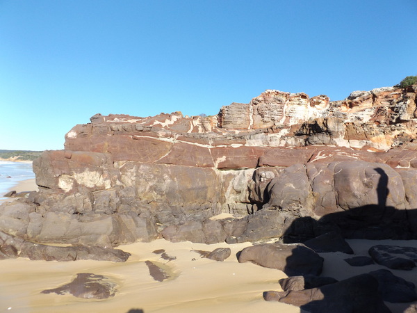
Rocks, Quoundola Beach, Ben Boyd National Park 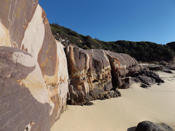
Rocks, Quoundola Beach, Ben Boyd National Park
Severs Beach, on the south bank of the Pambula River, is accessed by a short track from an access road that was somewhat bumpy with ruts – not ideal for our not-all-wheel-drive-low-clearance car. But we managed to get to the trackhead without any damage to the car. The walk itself is through a lovely forested area, with various types of vegetation. Near the beach tehre are what looks like Aboriginal shell middens, somewhat similar but seemingly more extensive than those at Mimosa Rocks. The track traverses the middens via an elevated walkway. The beach itself looks out over the same section of Pambula River that we explored on it’s north bank yesterday. While at Severs Beach, we tried to spot the lookout we walked to when we did the Pambula River Walk, but to no avail.

A shell encrusted rock, Severs Beach, Ben Boyd National Park 
Fern, Severs Beach walk, Ben Boyd National Park 
Pambula River, Severs Beach, Ben Boyd National Park 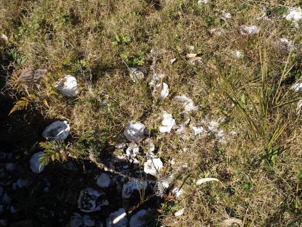
Shell midden, Severs Beach, Ben Boyd National Park 
Shell midden, Severs Beach, Ben Boyd National Park 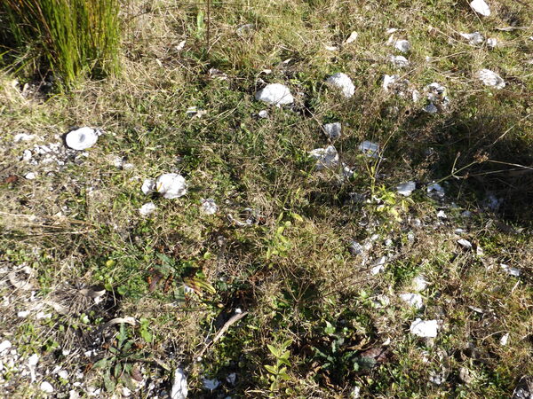
Shell midden, Severs Beach, Ben Boyd National Park
From Severs Beach, we went to Haycocks Point, which is at the northern end of the Quoundola Beach. The point is a short walk from the nearby car park and picnic area and offers some great views.
Haycocks Point, Ben Boyd National Park 
Haycocks Point, Ben Boyd National Park 
Haycocks Point, Ben Boyd National Park 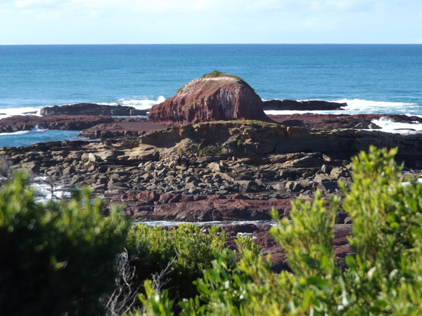
Haycocks Point, Ben Boyd National Park 
Kangaroos, Haycocks Point, Ben Boyd National Park
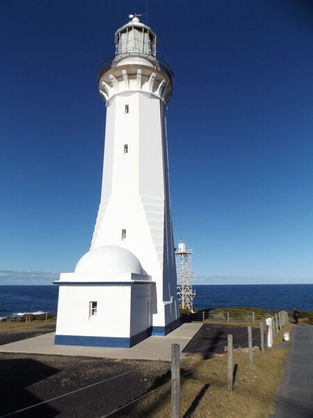
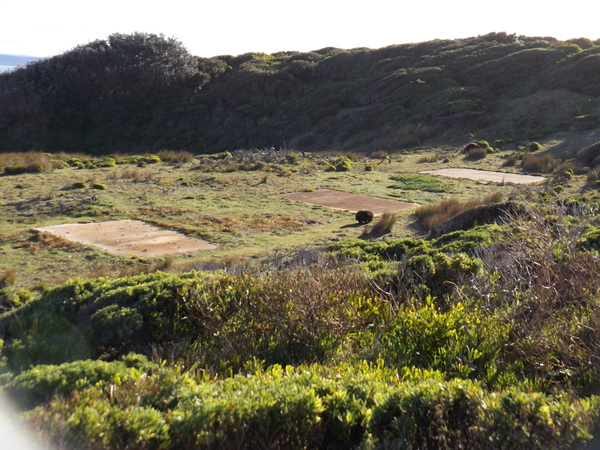
The next place we visited was Green Cape lighthouse. This involved a fairly long drive from Haycocks Point through Eden to the section of Ben Boyd National Park that is south of Eden. But there were other things we wanted to see in that section of the national park as well, so the longer drive was worth it. Green Cape Lighthouse is about 45 minutes drive south of Eden and is the southernmost lighthouse in NSW. Green Cape Lighthouse is steeped in seafaring history and has heritage architecture and spectacular ocean views of the wild and windy Green Cape.

Signal Flag Locker, Green Cape Lighthouse 
Signal Flag Pole, Green Cape Lighthouse 
Telegraph Station, Green Cape Lighthouse
The rugged coastline is a great whale watching spot in spring, but we did not spot any whales while we were there. The Green Cape Lighthouse was the largest mass concrete structure in Australia at the time it was completed. Materials for the building of the lighthouse were shipped to Bittangabee Bay, 7km to the north, and then hauled to Green Cape by a horse drawn wooden railed tramway. While the area would have been seen as being remote and inhospitable by early Europeans, many of the headlands in the Ben Boyd National park that surrounds Green Cape have Aboriginal shell middens, camping sites, stone artefacts and quarries – evidence that the area was extensively used by Aborigines for possibly thousands of years.
Building remains, Green Cape Lighthouse 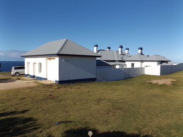
Residences, Green Cape Lighthouse 
Residences, Green Cape Lighthouse 
Rocks near Green Cape Lighthouse 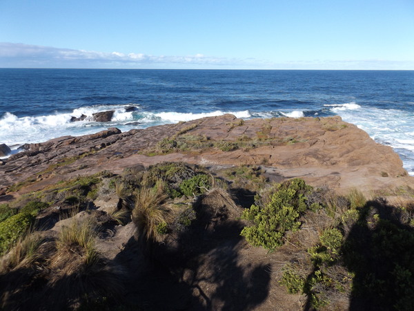
Rocks near Green Cape Lighthouse 
Wombat, Green Cape Lighthouse
Lighthouse keepers jobs could be particularly gruelling at times. All night, every night, in four hour shifts the Green Cape lighthouse keepers had to ensure their light flashed out to sea. This involved making sure the clockwork mechanism that rotated the light was properly ‘wound’ by raising 345kg weights that powered the clockwork mechanism. During the day the keepers had a constant ‘todo’ list as well:
- Dust the prisms and clean the lamp of the lighthouse.
- Clean the lighthouse windows, to stop the build up of salt.
- Oil and service the cables and weights that moved the light.
- Take weather recordings.
- Fill fuel tanks and maintain generator power supply.
- Polish and paint metal work to prevent salt corrosion.
- Paint all the buildings and repair equipment.
- Keep records.
I read a book recently called “The Last Lighthouse Keeper”, and the writer of that book painted an interesting picture of the joys and tribulations of being a lighthouse keeper. One thing in particular stood out to me, for some reason, was that each morning the light room at the top of the light house had to have curtains drawn around it. The reason for this was because the prisms of the lighthouse act as a huge magnifying class. Think of those times you might have tried to ignite a piece of paper with only a magnifying glass and you might get the idea of why the curtains were needed. The sunlight streaming into the light room if the curtains weren’t drawn would ignite the oil or other combustibles in the room and cause a fire in the lighthouse.

Green Cape was the site of the Ly-ee Moon shipwreck, a reminder of why lighthouses were so important especially in the days before GPS navigation. The Ly-ee Moon was travelling from Melbourne to Sydney and struck a reef off the cape on 30th May 1886, around 9:30pm. The heavy seas pounding the wrecked ship split the ship in two, and prevented rescue of those occupants on the stern section. With the aid of the lighthouse keepers 86 people on board were rescued. Tombstones of those shipwrecked lie among the rolling green hills at the foot of the lighthouse.

Davidsons Whaling Station historic site and Boyd’s Tower were the next places we visited and were not far from each other but were a fairly long drive from Green Cape Lighthouse.
Whaling and the export of whale by-products such as whale oil was one of Australia’s first primary industries. Davidson Whaling Station located at Kiah Inlet near Eden was one of the first commercial whaling operations in Australia, was the longest running shore-based whaling station in Australia and the last of its type to cease operation. Numerous other coastal whaling stations were established around Australia in the late 1820s to 1830s. The Davidson family was the only group of whalers that resided in Eden all year.
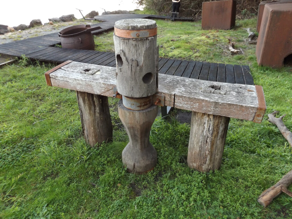
Whale processing equipment remains, Davidson Whaling Station 
Whale processing equipment remains, Davidson Whaling Station 
Whale processing equipment remains, Davidson Whaling Station
They employed Indigenous Australian whalers that were highly skilled due to their long family history of whaling and the years of experience, in addition to the help of the killer whales. Oral history indicates that the killer whales, who seemed to have some sort of mutually beneficial ‘arrangement’ with the whalers where the killer whales would help the whalers catch other whales in exchange for food, preferred Indigenous Australian whalers over the white whalers because they allowed the the first spoils of the catch to the killer whales (known as Law of the Tongue). The Davidson Whaling Station used traditional whaling techniques, such as row boats and hand harpoons that did not disturb or put stress on the killer whales with loud noise, while also reducing operating costs. Today Davidson Whaling Station is protected as an historic site, and gives an insight into the lives and industry of the 19th century whalers in the area.
Boyds Tower was originally designed as a lighthouse by Benjamin Boyd, and was built in 1847. Benjamin Boyd was a well known entrepreneur of the time who also built nearby Boydtown. He had interests in whaling and shipping, as well as owning vast grazing properties in the Monaro district and in the Riverina, NSW. But his success wasn’t to last. After his financial empire failed, Boyd’s tower was taken over by the Davidson family who used it to spot whales for their whaling operations at Kiah Inlet. During the whaling season the tower was manned daily and when a whale was observed, boat crews were alerted with a gunshot. Twenty metres tall, the tower is surrounded by the sea on three sides giving it constant exposure to the elements which has resulted in erosion of the tower, particularly the mortar. It has the unique look (for Australia) of a part of an English castle, with it’s serrated crest, and has the name “BOYD” engraved in it. Today part of the crest of the tower is missing, due to a lightning strike. Boyd wanted his tower to be an impressive landmark by day, and a lighthouse at night, but he was denied official approval to operate the tower as a lighthouse so today it is impressive by day and not easily seen at night!
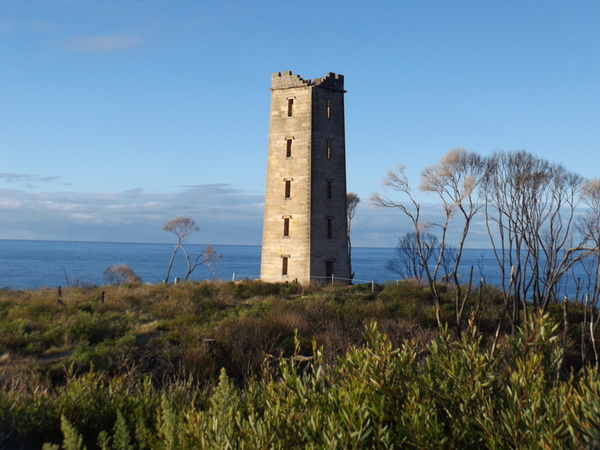
Panorama of Boyd Tower 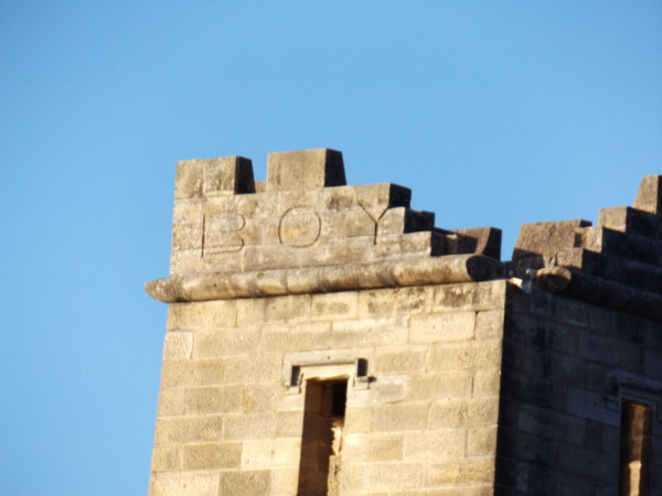
Missing crest section, Boyd Tower 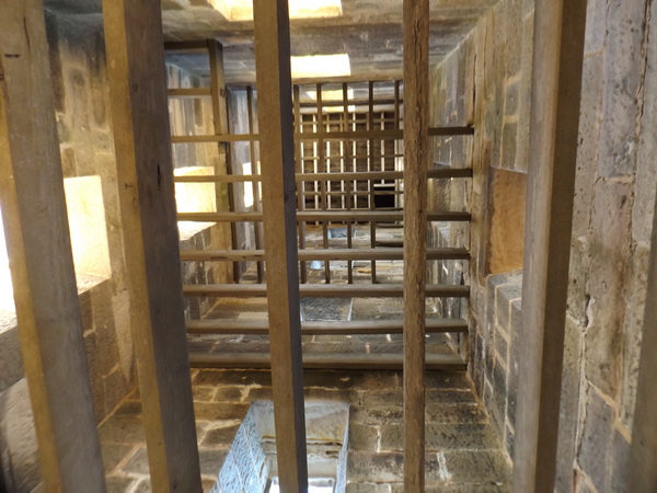
Inside Boyd Tower 
View from Boyd Tower 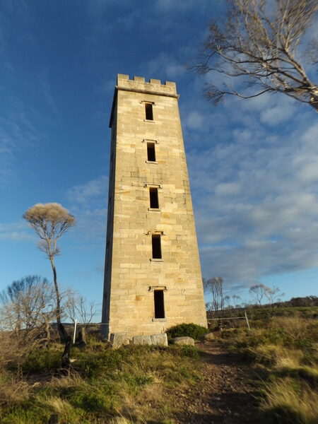
Boyd Tower, Ben Boyd National Park 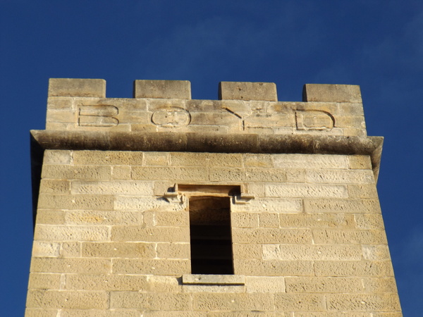
“BOYD” on crest of Boyd Tower
We were back at our accommodation by about 5pm – a full day of outdoor activities. This was our last full day staying at Merimbula. The next day we would be driving home. I don’t know how other people feel when they leave a place they have been staying on holidays, but always feel a tinge of sadness, knowing that I will soon be going home. I really enjoyed staying at Merimbula with Rebecca, and seeing and experiencing lots of interesting things.
22nd June
Today we travelled home via Cooma, Canberra, and Yass. We left fairly early, a few hours before breakfast, and planned to buy breakfast at somewhere along the way. When we left Merimbula, the weather was mild. We drove through Brown Mountain, where we stopped for a toilet break at the Fred Piper Memorial Lookout. When we got out of the car there it was cooold! Way colder than when we left Merimbula. At least the toilet had no resident Red-backs, I suppose. But washing our hands in the freezing cold water from the taps was a bit of an ordeal!

Fred Piper Memorial Lookout, Brown Mountain 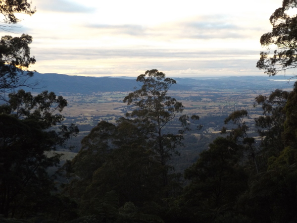
Fred Piper Memorial Lookout view
We continued our travels, and as we got up and voer Brown Mountain we entered what I suppose if part of the Monaro Plains. It was very foggy on that section of road, more less all the way into Cooma where the fog still persisted. There, we found ourselves a cafe that was open, and sat down to a good hearty hot breakfast.
By this stage, the fog had started to lift, so we continued on our way through Canberra, then onto Yass. We stopped at Yass for another toilet break, and when we started the car the ‘engine’ light was on. That normally isn’t a good sign. But last time that happened, it was a matter of finding a mechanic to check and then reset the car’s computer. We found a mechanic but he wasn’t able to look at the car for a few hours as he had an urgent job to do. So we walked into the shopping area, where Rebecca purchased some lunch and we sat in the park until it was time to walk back to pick up the car. Thankfully, there was no actual problem with the car – it’s had just has just detected a misfire and so the engine light came on. After a computer reset it was ready to go. From Yass we joined the Hume Freeway for most of the rest of our journey home. By late afternoon we had arrived home.
You May Also Like
One Comment
Mum
WOW! That was a very descriptive history lesson. Well done!